
Ride legally: stay on designated routes, follow the rules of the USDA Forest Service, carry the required registration and OHV permits, and check current conditions before you go.
Wolf Pen Gap is closed for the season. The USFS reopens it for the Thanksgiving window (three days before through two days after Thanksgiving, so Nov. 23–28, 2026) and again Dec. 22, 2026 – Jan. 2, 2027, weather permitting. The regular season starts the first Friday of March.
checked 2026-11-11Closure details
At a glance
Vehicle types
- ATV
- Motorized trail bike
Trail type
Distance
Difficulty
Season
Hours
Fees
Permits
- No USFS permit or fee is required.
- Follow Arkansas off-road vehicle laws; tracked vehicles are prohibited by forest order.
Registration sticker
Width limits
Staging area
Land manager
Overview
Wolf Pen Gap is a free OHV trail complex in the Ouachita National Forest, south of Mena. Visit Mena counts 41 miles of looping trails connected so riders can vary the length of a trip, from easy to most difficult. The area was designated for ATV use in 1991.
- 41 mi of connected loops (Visit Mena)
- No fee or permit
- Gap Creek, Board Camp Creek and high mountain vistas
- Holiday openings at Thanksgiving and Christmas
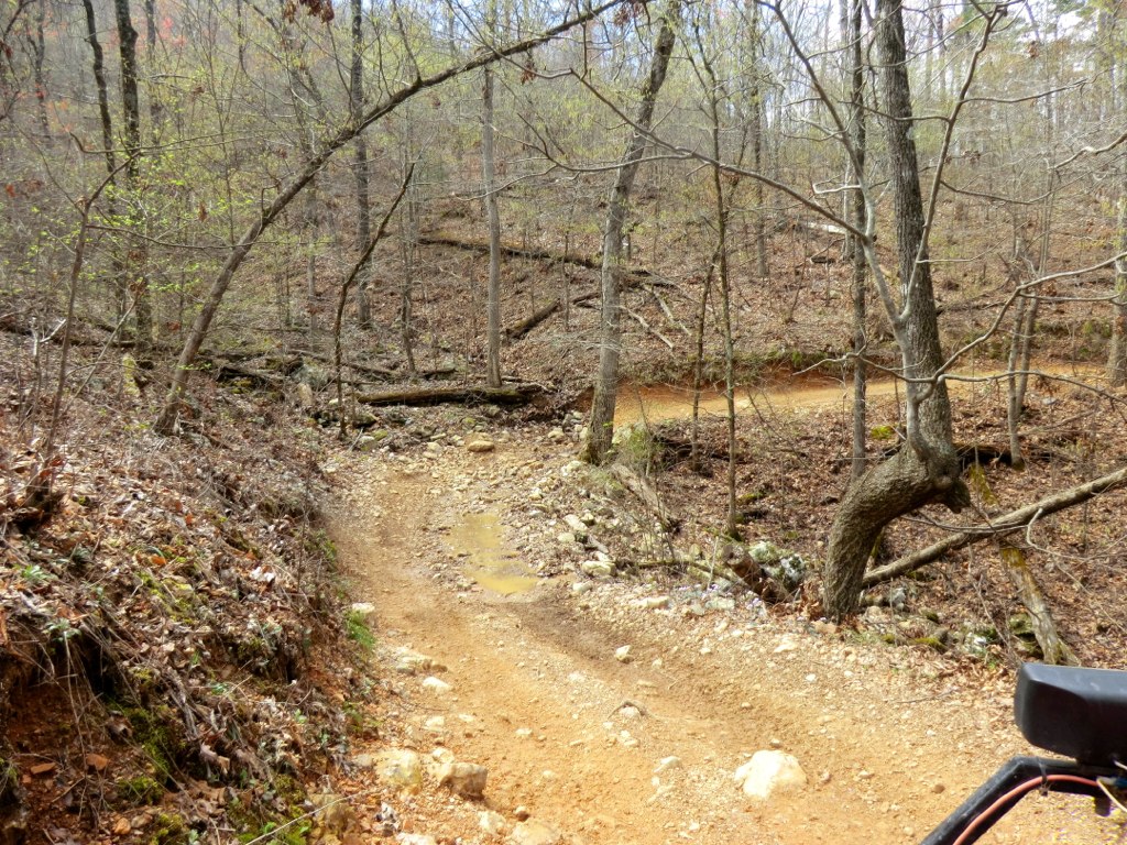
The USFS says the trail passes scenic Gap Creek and Board Camp Creek, runs through big pines and hardwoods, and passes the unusual two-footed oak tree and an abandoned mine shaft. Visit Mena says the trails mix old logging roads and newer built trail, marked with fiberglass posts and reflective stickers.
Plan your visit
Getting there
From Mena, take AR 8 east for 1 mile to Arkansas 375, then go south 8 miles to the trailhead near County Road 277. For the North Trailhead, take AR 8 east 10 miles to Polk County Road 61, go 3.5 miles, turn right at the sign and go half a mile. For the East Trailhead, take AR 8 east about 20 miles (about 1 mile past Big Fork), turn right on Polk County Road 83 (Forest Road 38) and go 5 miles.
Parking
Park at the main trailhead on Arkansas 375, or at the North or East trailhead. There's no drinking water at the site.
When to go
Ride the regular season from the first Friday of March to Oct. 31, or during the Thanksgiving and Dec. 22 – Jan. 2 windows. Openings depend on weather, and the trails can close when heavy rain occurs or is forecast.
Good to know
There's no fee. Horses aren't allowed, camping is limited to designated sites, and there's no potable water. For conditions, call the Mena-Oden Ranger District at 479-394-2382.
Where to stay near Wolf Pen Gap Trail Complex
Nearest town: Mena, AR
Find hotels and rentals near Wolf Pen Gap Trail Complex
We may earn a commission if you book a stay through these links, at no extra cost to you. Prices and availability come from booking partners and can change. We never rank trails by commission.
The trail system
- 1Main trailhead (AR 375): the most direct access from Mena.
- 2North Trailhead (Polk County Road 61) and East Trailhead (Polk County Road 83 / FR 38).
- 3Loops: about 41 connected miles, easy to most difficult (Visit Mena).
- 4Landmarks: Gap Creek, Board Camp Creek, the two-footed oak and an abandoned mine shaft.
Safety
- Wear a helmet; the USFS recommends it.
- No riding after sundown or before sunrise.
- Stay off the trails when they are seasonally closed or closed for wet weather.
- Tracked vehicles are prohibited.
Tips
- Plan around the Nov. 23–28 and Dec. 22 – Jan. 2 holiday openings this winter.
- Call 479-394-2382 before driving out after rain.
- Bring all your water.
- Download the Avenza trail map linked from the USFS page.
What to bring & gear
- DOT-approved helmet
- Goggles or eye protection
- Gloves, over-the-ankle boots and long sleeves
- Plenty of water and snacks
- First-aid kit
- Tire plug kit and a portable air compressor
- Tow strap and basic tools
- The official trail map, downloaded for offline use
Photos
Places to eat (nearest is 14 mi away)
Few options nearby. Pack food and water.
Little Italy
Italian14 mi away Directions
La Villa Mexican Restaurant
Mexican14 mi away Directions
Sonic
Fast food14 mi away Directions
Ratings & Comments
—
No ratings yet
Sign in to rate this route and leave a comment.
No comments yet. Share what the trail was like for you.
Nearby
More trails
Frequently asked questions
Is Wolf Pen Gap open now?
No. It is closed for the season and reopens Nov. 23–28, 2026 for Thanksgiving and Dec. 22 – Jan. 2 for the holidays, weather permitting.
Is there a fee at Wolf Pen Gap?
No. The USFS says no fees are required.
How many miles of trail are at Wolf Pen Gap?
Visit Mena lists 41 miles of connected loop trails.
Can I ride at night?
No. Riding after sundown or before sunrise is prohibited.
How do I get to Wolf Pen Gap?
From Mena, take AR 8 east 1 mile to Arkansas 375, then go south 8 miles to the trailhead near County Road 277.
Sources
- fs.usda.gov — https://www.fs.usda.gov/r08/ouachita/recreation/wolf-pen-gap
- visitmena.com — https://visitmena.com/attractions/wolf-pen-gap/
- flickr.com — https://www.flickr.com/photos/27976441@N03/8320376912
- openstreetmap.org — https://www.openstreetmap.org
- littleitalymena.com — https://www.littleitalymena.com/
- visitmena.com — https://visitmena.com/food/la-villa-mexican-restaurant/
- locations.sonicdrivein.com — https://locations.sonicdrivein.com/ar/mena/1001-highway-71-n.html