

Current alert
Open (NPS alerts checked Oct 21, 2026: a flash flood warning has closed the Narrows and slot canyons, which doesn't affect this trail). Oversize vehicles face tunnel restrictions on the Zion–Mt. Carmel Highway.
At a glance
Distance
Elevation gain
Difficulty
Route type
Time
Permit required
Fees
Dogs
Best season
Official park info: Zion National Park
Zion's best short hike: ledges and stairs to a fenced view down the main canyon.
Canyon Overlook packs a big Zion view into a half-mile walk on the park's quieter east side. Sandstone steps with a metal handrail lead you along ledges above a dark slot canyon. Then the rock opens into red and cream slickrock and ends at a fenced cliff edge looking straight down lower Zion Canyon toward the Towers of the Virgin.
Overview
- A fenced overlook of lower Zion Canyon
- Views of the Towers of the Virgin
- Cliff-side ledges with handrails above a slot canyon
- A chance to spot bighorn sheep
The NPS rates the trail moderate. Most of it is hard rock, with stairs and boulders. There's a stretch under overhanging rock, where clearance drops to about 4 feet.
Plan your visit
Getting there
The trail starts at the Canyon Overlook Trailhead on SR 9, just east of the Zion–Mount Carmel Tunnel.
Parking
Very small lot east of the tunnel; be ready to try several times. Pit toilets.
Permits & fees
No permit is needed. Park entrance fee: $35 per private vehicle; non-U.S. residents 16+ also pay $100 per person in 2026 (waived with a qualifying annual pass).
When to go
This is one of Zion's best winter walks, because the trail is short and rarely closes. Early morning or late afternoon gives you the best chance at a parking space. The canyon is in shadow early and glows late in the day.
Trailhead map
Trailhead at 37.2135, -112.9406. Confirm current trail conditions before you go.
Where to stay near Canyon Overlook Trail
Find hotels and rentals near Canyon Overlook Trail
We may earn a commission if you book a stay through these links, at no extra cost to you. Prices and availability come from booking partners and can change. We never rank trails by commission.
Route, step by step
1. The trailhead. Park in the small lot on the east side of the Zion–Mount Carmel Tunnel and cross to the trail.
2. Steps and ledges. Climb the first sandstone steps with a handrail, then follow ledges above the slot canyon.
Show full route
3. The overhang. Duck under the overhanging rock section and continue over open slickrock.
4. The overlook. Finish at the fenced viewpoint and return the same way.
Tips
- Parking is extremely limited. Arrive early or late in the day.
- Pets aren't allowed on this trail.
- Keep a hand on the rail on the exposed ledges.
- Check the park's large-vehicle tunnel limits if you're driving an RV.
Tips
- Parking is extremely limited. Arrive early or late in the day. Pets aren't allowed on this trail. Keep a hand on the rail on the exposed ledges. Check the park's large-vehicle tunnel limits if you're driving an RV.
What to bring & gear
- Sturdy hiking shoes or boots
- 2–3 liters of water per person
- Sun protection: hat, sunscreen, sunglasses
- Trail snacks or a packed lunch
- Electrolyte tablets
Picks sized for a 1-mile, 1–2 hour hike.
Our gear picks
Our picks for this hike. Compare current prices at Amazon.
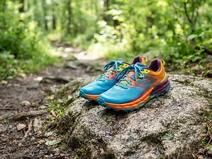
Trail Runners
Our pickClassic out-of-the-box comfort for easy miles.
Merrell Moab 3

Daypack
Our pickCompact, well-built daypack that packs down small.
Osprey Daylite Plus
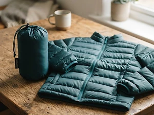
Insulation
Our pickWarmth that compresses into its own pocket.
Packable Puffer Jacket
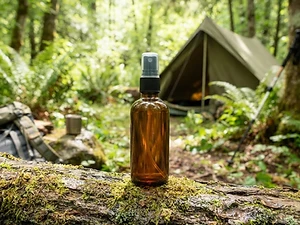
Insect Repellent
Budget pickLong-lasting protection without the DEET smell.
Sawyer 20% Picaridin Insect Repellent Spray
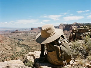
Sun Hat
Our pickFull coverage with a long neck cape.
Sunday Afternoons Adventure Hat

Traction
Our pickGrip for icy or early-season snowy trail sections.
Kahtoola MICROspikes
As an Amazon Associate, Love Hiking Trails earns from qualifying purchases.
Photos


Featured in: The Best Hikes in Utah, The Best Hikes Near St. George, Utah
Places to eat nearby
Ratings & Comments
—
No ratings yet
Sign in to rate this trail and leave a comment.
No comments yet. Share what the trail was like for you.
Nearby
Nearby bike trails
Trails nearby
 ChallengingHike
Observation Point (East Mesa)
Zion National Park, Utah
With the canyon route closed by rockfall, Observation Point is now reached by a nearly flat forest walk across the East Mesa. Reaching the trailhead means a high-clearance or 4WD dirt road.
Distance
6.8 mi
Difficulty
Challenging
Type
Out and back (East Mesa route)
 ChallengingHike
The Narrows
Zion National Park, Utah
Wade up the Virgin River between towering slot-canyon walls that close to just 20 feet apart — one of the world's best hikes.
Distance
5 mi
Difficulty
Challenging
Type
Out and back (river hike)
 StrenuousHike
Angels Landing
Zion National Park, Utah
A narrow sandstone spine with chain-assisted scrambling and thousand-foot drop-offs — Zion's most famous thrill hike.
Distance
5.4 mi
Difficulty
Strenuous
Type
Out and back
More trails to explore
More hikes nearby
Frequently asked questions
How long is the Canyon Overlook Trail?
1 mile round trip, rated moderate by the NPS.
Where do I park for Canyon Overlook?
In the small lot on State Route 9 just east of the Zion–Mount Carmel Tunnel. It fills quickly.
Are dogs allowed?
No. Pets aren't allowed on the Canyon Overlook Trail.