

At a glance
Distance
Elevation gain
Difficulty
Route type
Time
Permit required
Fees
Dogs
Best season
Official park info: Clark Creek Natural Area
Waterfalls in loess bluffs near Woodville.
Clark Creek Natural Area near Woodville in southwest Mississippi hides one of the state's greatest surprises: dozens of waterfalls tumbling through steep loess ravines in the Tunica Hills, just north of the Louisiana line. Managed by the Mississippi Department of Wildlife, Fisheries, and Parks, the 700-acre area has an improved trail with stairs and a rugged primitive trail that follows the creek beds.
Overview
- Dozens of waterfalls, some around 30 feet tall
- Deep loess ravines with beech and magnolia forest
- Rare plants typical of the Appalachians
October through April is best, with cooler weather and more water. Summer is hot and humid. Falls are strongest after rain.
Plan your visit
Trailhead map
Trailhead at 31.0718, -91.5115. Confirm current trail conditions before you go.
Where to stay near Clark Creek Natural Area
Find hotels and rentals near Clark Creek Natural Area
We may earn a commission if you book a stay through these links, at no extra cost to you. Prices and availability come from booking partners and can change. We never rank trails by commission.
Route, step by step
From the parking area, the improved trail follows the ridge with wooden stairs descending to several of the larger falls. The primitive trail drops into the ravines and follows the creek beds, requiring scrambling, wading and route-finding. Many hikers combine the two to make a loop that takes in the most waterfalls. The improved trail is about 1.5 miles one way to the farthest of its large falls; the primitive trail is shorter on paper but slower because of the scrambling and creek crossings. Expect steep stairs, mud and roots. Water levels vary greatly; after heavy rain the creek can be impassable.
Tips
Show full route
- A small per-person entry fee is charged at the entrance.
- The area is open daily, generally 8 a.m. to 5 p.m.
- Wear shoes you don't mind getting wet.
- The primitive trail is steep and slippery; take care.
Tips
- A small per-person entry fee is charged at the entrance.
What to bring & gear
- Sturdy hiking shoes or boots
- 2–3 liters of water per person
- Sun protection: hat, sunscreen, sunglasses
- Trail snacks or a packed lunch
- Rain shell
- Insect repellent
Picks sized to this trail's difficulty rating.
Our gear picks
Our picks for this hike. Compare current prices at Amazon.

Hiking Boots
Our pickSupport and grip for rocky, rooty miles.
Merrell Moab 3 Mid Waterproof

Daypack
Our pickCarries water, layers, and snacks comfortably.
Osprey Talon 22

Hydration Reservoir
Our pickWide-opening reservoir that's easy to fill and clean.
Platypus Big Zip EVO 3L Reservoir

Trekking Poles
Our pickSaves your knees on steep descents.
Cascade Mountain Tech Carbon Fiber Trekking Poles

Rain Jacket
Our pickBlocks sudden mountain storms and wind.
Columbia Watertight II Rain Jacket
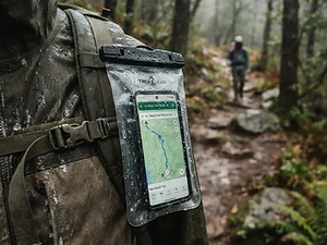
Phone Case
Budget pickKeeps your phone dry and usable in a wet pack or on the water.
Waterproof Phone Pouch
As an Amazon Associate, Love Hiking Trails earns from qualifying purchases.
Photos

Ratings & Comments
—
No ratings yet
Sign in to rate this trail and leave a comment.
No comments yet. Share what the trail was like for you.
Nearby
More in Mississippi
Trails nearby
 ChallengingHike
Tunica Hills Trails
Tunica Hills Wildlife Management Area, Louisiana
Rugged loess bluffs and creek beds in Louisiana's hill country.
Difficulty
Challenging
Type
Out & Back
 ChallengingHike
Lakeshore Trail
Chicot State Park, Louisiana
A long loop around Lake Chicot through hardwood forest and cypress.
Difficulty
Challenging
Type
Loop
Wild Azalea Trail
Kisatchie National Forest, Louisiana
Louisiana's longest hiking trail, famous for spring azalea blooms.
Difficulty
Challenging
Type
Point to Point
More trails to explore
More trails in Mississippi
Frequently asked questions
How many waterfalls are at Clark Creek?
There are dozens, varying in height and flow.
Is there a fee?
Yes, MDWFP charges a $2 per-person entry fee; children 5 and under are free.
Are dogs allowed?
Yes, leashed dogs are allowed.
What are the hours?
Generally 8 a.m. to 5 p.m., closed Thanksgiving and Christmas.
How long is the Clark Creek Natural Area hike?
Clark Creek Natural Area is 1.5 miles. Most hikers complete it in Varies.
How difficult is Clark Creek Natural Area?
We rate it Challenging (3 out of 5) for Clark Creek Natural Area. That reflects its distance and terrain.
When is the best time to hike Clark Creek Natural Area?
The best window is October-April. Always check current conditions and weather before you go.
Do I need a permit or reservation for Clark Creek Natural Area?
No special trail permit is required. $2 per person entry fee.