

Current alert
Open. NPS alert (checked Oct 21, 2026): Kennesaw Mountain Drive is closed to private vehicles; free shuttle service to the top runs daily.
At a glance
Distance
Elevation gain
Difficulty
Route type
Time
Permit required
Fees
Dogs
Best season
Official park info: Kennesaw Mountain National Battlefield Park
Atlanta's favorite Civil War summit climb, with skyline views from the top.
The climb up Big Kennesaw is one of the busiest day hikes in metro Atlanta. In 1.1 miles it mixes city views, Civil War history and a real workout. Switchbacks soften the roughly 700 feet of climbing, benches sit at key points, and the path passes earthworks left from the 1864 battle.
Overview
- Civil War earthworks and artillery positions beside the trail
- A south-facing view of Atlanta from the upper parking area
- A stone viewing station near the true summit
- Benches and mile markers the whole way up
The NPS calls the trail moderately difficult: steep and rocky in places, but easy to follow. Trails are open in all seasons. In winter the hours are 6:30 a.m.–6:30 p.m. (November–March), and in summer 6:30 a.m.–8 p.m.
Plan your visit
Parking
Visitor Center lot (fee enforced). The mountain road is closed to private vehicles; a free shuttle runs to the top 7 days a week (parking fees still apply).
When to go
Weekday mornings are calmest. Fall and winter bring the clearest skyline views and cooler climbing. On hot summer days, start early and carry extra water for yourself and your dog.
Trailhead map
Trailhead at 33.9830, -84.5780. Confirm current trail conditions before you go.
Where to stay near Kennesaw Mountain Trail (Big Kennesaw Summit)
Find hotels and rentals near Kennesaw Mountain Trail (Big Kennesaw Summit)
We may earn a commission if you book a stay through these links, at no extra cost to you. Prices and availability come from booking partners and can change. We never rank trails by commission.
Route, step by step
1. Visitor Center start. Leave the Visitor Center, turn left on the wide sidewalk and walk up the gentle hill to the crosswalk at the mountain road.
2. Cross to the trailhead. Cross to the trailhead and follow the signs and mile markers uphill. Switchbacks ease the grade.
Show full route
3. The upper parking lot. The trail reaches the upper parking lot, which has a broad view south toward Atlanta.
4. The summit and return. Continue past the stone viewing station to the true summit, then return the same way (or ride the free shuttle down).
Tips
- Restrooms are only at the Visitor Center.
- Stay on the trail and off the earthworks.
- Wear closed-toe shoes and carry plenty of water in summer.
- In winter, parts of the trail can be icy.
Tips
- Restrooms are only at the Visitor Center. Stay on the trail and off the earthworks. Wear closed-toe shoes and carry plenty of water in summer. In winter, parts of the trail can be icy.
What to bring & gear
- Sturdy hiking shoes or boots
- 2–3 liters of water per person
- Sun protection: hat, sunscreen, sunglasses
- Trail snacks or a packed lunch
- Rain shell
- Insect repellent
Picks sized for a 2.2-mile, 45–90 minutes up; allow 1.5–2.5 hours round trip hike.
Our gear picks
Our picks for this hike. Compare current prices at Amazon.

Trail Runners
Our pickClassic out-of-the-box comfort for easy miles.
Merrell Moab 3

Daypack
Our pickCompact, well-built daypack that packs down small.
Osprey Daylite Plus
Water Bottle
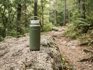
Budget pickSimple, tough bottle for casual day hikes.
Nalgene 32 oz Wide Mouth Bottle

Insect Repellent
Budget pickLong-lasting protection without the DEET smell.
Sawyer 20% Picaridin Insect Repellent Spray
Sun Hat
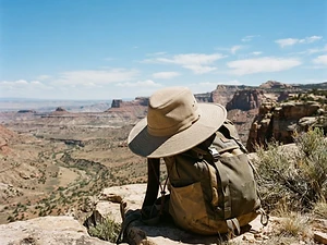
Our pickFull coverage with a long neck cape.
Sunday Afternoons Adventure Hat

Trail Snacks
Budget pickDense energy bars for sustained effort.
CLIF Bar Variety Pack
As an Amazon Associate, Love Hiking Trails earns from qualifying purchases.
Photos


Featured in: The Best Hikes Near Atlanta, Georgia, The Best Hikes in Georgia
Places to eat nearby
Ratings & Comments
—
No ratings yet
Sign in to rate this trail and leave a comment.
No comments yet. Share what the trail was like for you.
Nearby
Nearby bike trails
Nearby off-road
Trails nearby
 ChallengingHike
Stone Mountain Walk-Up Trail
Stone Mountain Park, Georgia
A short, steep climb up the bare granite dome of Stone Mountain to a summit with views of the Atlanta skyline.
Distance
2.2 mi
Difficulty
Challenging
Type
Out & Back
 ExpertHike
Amicalola Falls
Amicalola Falls State Park, Georgia
For thousands of Appalachian Trail thru-hikers, the journey to Maine starts with a walk under a stone archway at Amicalola Falls State Park. From there, the blue-blazed Approach Trail climbs past a 729-foot waterfall, one of the tallest in the eastern U.S., and on to Springer Mountain, the A.T.'s southern terminus.
Distance
8.5 mi
Difficulty
Expert
Type
Point-to-point (Approach Trail) or out-and-back
 StrenuousHike
Blood Mountain via Byron Reece Trail
Chattahoochee National Forest, Georgia
The most popular route to Blood Mountain, the highest point on Georgia's Appalachian Trail, with a historic stone shelter and sweeping summit views.
Distance
4.3 mi
Difficulty
Strenuous
Type
Out & Back
More trails to explore
More trails in Georgia
More hikes nearby
Frequently asked questions
How long is the hike up Kennesaw Mountain?
1.1 miles each way from the Visitor Center trailhead, about 2.2 miles round trip, with roughly 700 feet of gain.
Can I drive to the top of Kennesaw Mountain?
Not in a private vehicle. The road is closed to private cars, and a free shuttle runs to the top daily. Parking fees still apply.
Are dogs allowed?
Yes, on a leash of 6 feet or shorter. Waste stations are provided.