

At a glance
Distance
Elevation gain
Difficulty
Route type
Time
Permit required
Fees
Dogs
Best season
Official park info: Inyo National Forest
The Mount Whitney Trail climbs more than 6,000 ft in 11 miles from Whitney Portal. It's a non-technical route when snow-free, but its length and altitude make it a serious undertaking, and it needs a permit all year.
Mount Whitney is the high point of the Sierra Nevada and the southern end of the John Muir Trail. The Mount Whitney Trail starts at Whitney Portal at 8,300 ft and climbs more than 6,000 ft over 11 miles. Inyo National Forest calls it strenuous but non-technical when snow-free. The summit itself sits in Sequoia National Park.
Most people attempt it either as a pre-dawn-to-dark day hike or as a two- or three-day backpack with a night at a designated camping area. Either way, the altitude is the hard part. Love Hiking Trails recommends spending a night or two at elevation first and setting a firm turnaround time.
Overview
- Bear-resistant food containers are required.
- Pack out all human waste.
- No campfires.
- Treat all water.
- Camping isn't allowed at Mirror Lake or Trailside Meadow.
- Watch yourself and your partners for altitude sickness, and descend if symptoms worsen.
Plan your visit
Getting there
Whitney Portal is about 13 miles west of Lone Pine on Whitney Portal Road. The Eastern Sierra Interagency Visitor Center (US-395 and SR-136, Lone Pine; 760-876-6200; open daily 8:30 am–4:30 pm) is where you can check conditions and pick up information.
Parking
Parking at Whitney Portal is limited, so carpool if you can. Bear activity at the trailhead is high. Store all food and scented items in the bear lockers, never in your car.
Permits & fees
You need a permit all year for both day and overnight trips into the Mt. Whitney Zone.
- Lottery: apply February 1 to March 1 on recreation.gov (permit 445860). Results come out March 15. Winners pay $15 per person by April 21 at 9 pm PT. Remaining dates open first-come, first-served on April 22 at 7 am PT.
- Quota season (May 1–November 1): 100 day-use and 60 overnight permits per day.
- Off-season (November 2–April 30): permits are unlimited and can be booked online up to 2 weeks ahead.
- Groups are limited to 15. Permits can't be transferred, and day-use and overnight permits aren't interchangeable.
When to go
The trail is usually relatively snow-free from late June to mid-October. Ice and snow can linger into early July, and storms can return at any time. For mid-October and beyond, expect winter conditions. That calls for ice axe and crampon skills and an unlimited off-season permit, but only with mountaineering experience.
Trailhead map
Trailhead at 36.5785, -118.2923. Confirm current trail conditions before you go.
Where to stay near Mount Whitney
Find hotels and rentals near Mount Whitney
We may earn a commission if you book a stay through these links, at no extra cost to you. Prices and availability come from booking partners and can change. We never rank trails by commission.
Route, step by step
1. Whitney Portal (8,300 ft). Start in the dark for a day hike, climbing switchbacks above the Portal.
2. Lakes and meadows. The trail passes Mirror Lake and Trailside Meadow, where camping isn't allowed, then continues into the high country.
Show full route
3. The switchbacks to Trail Crest. A long series of switchbacks climbs the headwall to the crest and the Sequoia National Park boundary.
4. The John Muir Trail junction. From the junction, the route runs along the ridge behind the pinnacles to the summit plateau.
5. Summit. Descend the same way. Save energy for the 11 miles back.
Tips
- Turn around by early afternoon if you're not close to the top.
- Carry a way to treat water, plus layers for wind and cold at the top.
- WAG bags or another human-waste kit are part of the required plan.
Nearby trails we recommend
- Half Dome, another permit-lottery Sierra classic in Yosemite
- Cathedral Lakes Trail, in Yosemite's Tuolumne high country
Tips
- Permit required. Acclimate a day before. Start at 2–3am to avoid afternoon thunderstorms above the crest.
What to bring & gear
- Sturdy hiking shoes or boots
- 2–3 liters of water per person
- Sun protection: hat, sunscreen, sunglasses
- Trail snacks or a packed lunch
- Trekking poles for the steep sections
- Headlamp and extra batteries
- Map or offline GPS route
- Emergency layers and a small first-aid kit
- Microspikes for early-season snow
Picks sized for a 22-mile, 12–16 hour hike.
Our gear picks
Our picks for this hike. Compare current prices at Amazon.

Hiking Boots
Our pickBurly support for heavy loads and long climbs.
Salomon Quest 4 GTX

Water Filter
Budget pickReliable squeeze filter with a long service life.
Sawyer Squeeze Water Filter
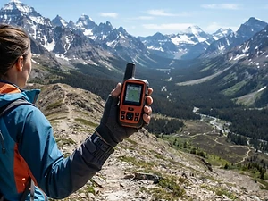
Satellite Messenger
Premium pickTwo-way messaging and SOS far from cell signal.
Garmin inReach Mini 2

Trekking Poles
Our pickSaves your knees on steep descents.
Cascade Mountain Tech Carbon Fiber Trekking Poles

Rain Jacket
Premium pickStorm-proof shell built for serious weather.
Arc'teryx Beta AR
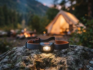
Headlamp
Our pickBright, weatherproof light with a red night mode.
Black Diamond Spot 450 Headlamp
As an Amazon Associate, Love Hiking Trails earns from qualifying purchases.
Photos

Featured in: The Best Hikes in California
Ratings & Comments
—
No ratings yet
Sign in to rate this trail and leave a comment.
No comments yet. Share what the trail was like for you.
Nearby
Trails nearby
 ExpertHike
Half Dome
Yosemite National Park, California
Yosemite's icon — a 16-mile round trip ending in a cable climb up a 45° granite dome.
Distance
16 mi
Difficulty
Expert
Type
Out and back
 ModerateHike
Cathedral Lakes Trail
Yosemite National Park, California
Granite spires mirrored in two high Sierra lakes off Tuolumne Meadows.
Distance
7 mi
Difficulty
Moderate
Type
Out and back (Upper and Lower lakes)
 ChallengingHike
Bristlecone Trail
Spring Mountains National Recreation Area, Nevada
A loop through ancient bristlecone pines in Lee Canyon.
Difficulty
Challenging
Type
Loop
More trails to explore
More trails in California
More hikes nearby
Frequently asked questions
Do I need a permit to day hike Mount Whitney?
Yes. A permit is required all year for day and overnight use in the Mt. Whitney Zone.
When is the Mount Whitney lottery?
February 1 to March 1, with results on March 15.
How long is the Mount Whitney Trail?
11 miles one way (22 round trip), gaining more than 6,000 ft from Whitney Portal.
Is Mount Whitney a technical climb?
Not when it's snow-free. With snow and ice, it requires mountaineering skills and gear.
How many day-use permits are issued?
100 per day from May 1 to November 1.