

At a glance
Distance
Elevation gain
Difficulty
Route type
Time
Permit required
Fees
Dogs
Best season
Official park info: Monongahela National Forest
A switchback climb to an overlook platform on Seneca Rocks.
Seneca Rocks is a knife-edged fin of Tuscarora quartzite rising about 900 feet above the North Fork of the South Branch Potomac River in Monongahela National Forest. It's one of the most famous landmarks in West Virginia and a legendary rock-climbing destination. The Seneca Rocks Trail lets hikers reach an observation platform near the top without climbing gear.
Overview
- Observation platform with valley views
- Towering quartzite fins
- Climbers on the rock faces
The trail is good year-round. Fall color is outstanding. Winter can be icy.
Plan your visit
Getting there
Seneca Rocks is at the junction of U.S. Route 33 and West Virginia Route 28 in Pendleton County. The Discovery Center has exhibits on geology and history. During World War II, the Army trained mountain troops on Seneca Rocks. The rock is part of the Spruce Knob-Seneca Rocks National Recreation Area.
Trailhead map
Trailhead at 38.8338, -79.3744. Confirm current trail conditions before you go.
Where to stay near Seneca Rocks Trail
Find hotels and rentals near Seneca Rocks Trail
We may earn a commission if you book a stay through these links, at no extra cost to you. Prices and availability come from booking partners and can change. We never rank trails by commission.
Route, step by step
From the Seneca Rocks Discovery Center, cross the river on a footbridge and follow the trail as it switchbacks up the forested slope. The trail is well-built, with steps and switchbacks, and climbs steadily to a wooden observation platform just below the summit fin. Views stretch over the river valley and surrounding ridges. Return the same way. The round trip is about 2.6 miles. The trail climbs about 700 feet over 1.3 miles, with switchbacks and stone steps. The platform is just below the summit fin, and the views over the North Fork valley are outstanding.
Tips
Show full route
- Do not climb beyond the platform without technical gear; falls here have been fatal.
- Visit the Discovery Center for exhibits.
- Carry water.
- There is no fee.
Tips
- Do not climb beyond the platform without technical gear; falls here have been fatal.
What to bring & gear
- Sturdy hiking shoes or boots
- 2–3 liters of water per person
- Sun protection: hat, sunscreen, sunglasses
- Trail snacks or a packed lunch
- Warm insulating layers for the summit
Picks sized for a 2.6-mile, 1.5 hour hike.
Our gear picks
Our picks for this hike. Compare current prices at Amazon.

Trail Runners
Our pickClassic out-of-the-box comfort for easy miles.
Merrell Moab 3

Daypack
Our pickCompact, well-built daypack that packs down small.
Osprey Daylite Plus

Insulation
Our pickWarmth that compresses into its own pocket.
Packable Puffer Jacket
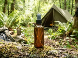
Insect Repellent
Budget pickLong-lasting protection without the DEET smell.
Sawyer 20% Picaridin Insect Repellent Spray

Trekking Poles
Our pickSaves your knees on steep descents.
Cascade Mountain Tech Carbon Fiber Trekking Poles

Traction
Our pickGrip for icy or early-season snowy trail sections.
Kahtoola MICROspikes
As an Amazon Associate, Love Hiking Trails earns from qualifying purchases.
Photos

Featured in: The Best Hikes Near Charlottesville, Virginia
Ratings & Comments
—
No ratings yet
Sign in to rate this trail and leave a comment.
No comments yet. Share what the trail was like for you.
Nearby
More in West Virginia
Nearby bike trails
Trails nearby
 ChallengingHike
Bear Rocks Trail
Dolly Sods Wilderness, West Virginia
Open heath and rock formations on the Allegheny Front.
Difficulty
Challenging
Type
Out & Back
 EasyHike
Lindy Point Overlook
Blackwater Falls State Park, West Virginia
A short boardwalk to a platform over Blackwater Canyon.
Distance
0.6 mi
Difficulty
Easy
Type
Out & Back
 ModerateHike
Swallow Falls Canyon Trail
Swallow Falls State Park, Maryland
A loop past Muddy Creek Falls, Maryland's tallest free-falling waterfall.
Distance
1.25 mi
Difficulty
Moderate
Type
Loop
More trails to explore
More trails in West Virginia
More hikes nearby
Frequently asked questions
How long is the Seneca Rocks Trail?
It is about 2.6 miles round trip.
Is there a fee?
No, there is no fee.
Are dogs allowed?
Yes, leashed dogs are allowed.
Can I climb to the summit?
Only with technical climbing gear and experience.
How difficult is Seneca Rocks Trail?
We rate it Challenging (3 out of 5) for Monongahela National Forest. That reflects its distance, 700 ft of climbing, and terrain.
When is the best time to hike Seneca Rocks Trail?
The best window is Year-round. Always check current conditions and weather before you go.
Do I need a permit or reservation for Seneca Rocks Trail?
No special trail permit is required. Free.