

At a glance
Distance
Elevation gain
Difficulty
Route type
Time
Permit required
Fees
Dogs
Best season
Official park info: Bridger-Teton National Forest
A classic Wind River Range backpacking trip from Elkhart Park past Island Lake to the Titcomb Lakes, in a long granite basin ringed by 13,000-foot peaks.
Titcomb Basin, in Wyoming's Wind River Range, sits in the Bridger Wilderness of the Bridger-Teton National Forest, rimmed by 12,000- and 13,000-foot peaks. Its head is a cirque of jagged summits, including Mount Woodrow Wilson (13,502 ft) and the Sphinx (13,258 ft). Gannett Peak (13,804 ft), Wyoming's highest point, shows in the gap between them. The Forest Service doesn't publish route distances, so those here come from HikingWalking.com.
Plan your visit
Getting there
The hike starts at the Elkhart–Pole Creek Trailhead at the end of Skyline Drive in Elkhart Park. From Pinedale, head east on Highway 191 (East Pine Street) and turn left onto Fremont Lake Road. After about 3 miles it becomes Skyline Drive (FS-370740). Continue about 9.7 miles, then turn right onto FS-370740B for 1.5 miles. The trailhead is on the right just beyond the visitor center. It's about 14 miles.
Parking
The trailhead has a large parking area, vault toilets and a visitor information center, and it's open 24 hours. There's no drinking water. The Pine Creek Trailhead, 200 yards north, has extra parking and stock corrals. Trails End Campground next door is first-come, first-served at $12 a night, and proper food storage is required in this bear country.
Permits & fees
Individual hikers need no permit, and the trailhead is free. The Forest Service does require free permits for organized groups and for overnight campers with pack or saddle stock. Call the Pinedale Ranger District at 307-367-4326 with questions.
When to go
The Forest Service doesn't publish a season for this route. Call the Pinedale Ranger District about conditions before you go.
Good to know
Bridger Wilderness rules are strict. Don't camp within 200 feet of any lake or designated trail, or within 100 feet of streams, creeks or springs. Open fires are banned above timberline and within those same distances of water and trails. Groups are capped at 15 people. Pack out all waste, and don't shortcut switchbacks. HikingWalking.com notes that Titcomb Basin has few trees for hanging food, so carry a bear container or find a large boulder to hang it from.
Trailhead map
Trailhead at 43.0200, -109.7200. Confirm current trail conditions before you go.
Where to stay near Titcomb Basin
Find hotels and rentals near Titcomb Basin
We may earn a commission if you book a stay through these links, at no extra cost to you. Prices and availability come from booking partners and can change. We never rank trails by commission.
Route, step by step
1. Elkhart–Pole Creek Trailhead (about 9,340 ft). Take the Pole Creek Trail and climb through mostly forested terrain.
2. Photographers Point (4.6 mi). A panorama of the high peaks.
Show full route
3. Seneca Lake Trail (5.6 mi). Turn left near Eklund Lake. It roller-coasters 5.1 miles past Barbara, Hobbs, Seneca and Little Seneca lakes.
4. Highline/Continental Divide trails. Go left for 0.4 mile over a ridge, then continue straight on the Indian Pass Trail.
5. Island Lake (12.1 mi). Many parties camp here or on the way.
6. Into Titcomb Basin. From the junction at Island Lake's southeast end, follow the Indian Pass Trail. At 1.2 miles from the lake, keep straight on the Titcomb Basin Trail, and reach the foot of the basin at 1.6 miles.
7. Titcomb Lakes. Pass Lake 10,548 and Lower Titcomb Lake to reach Upper Titcomb Lake, 3.6 miles from Island Lake. Return the same way.
Tips
- Plan a multi-day trip. HikingWalking.com calls a one-day push to Island Lake tiring and strenuous.
- Camp at least 200 feet from lakes and trails. HikingWalking.com says the best Titcomb campsites are south of Lower Titcomb Lake.
- Fill water bottles before you arrive. The trailhead has no potable water.
Nearby trails we recommend
- Paintbrush–Cascade Canyon Loop, in Grand Teton National Park
- Mount Washburn Trail, in Yellowstone National Park
- Fairy Falls Trail, in Yellowstone National Park
Tips
- Plan a multi-day trip. HikingWalking.com calls a one-day push to Island Lake tiring and strenuous. Camp at least 200 feet from lakes and trails. HikingWalking.com says the best Titcomb campsites are south of Lower Titcomb Lake. Fill water bottles before you arrive. The trailhead has no potable water.
What to bring & gear
- Sturdy hiking shoes or boots
- 2–3 liters of water per person
- Sun protection: hat, sunscreen, sunglasses
- Trail snacks or a packed lunch
- Trekking poles for the steep sections
- Headlamp and extra batteries
- Warm insulating layers for the summit
- Microspikes for early-season snow
Picks sized for a 31.4-mile, 2–3 day hike.
Our gear picks
Our picks for this hike. Compare current prices at Amazon.

Hiking Boots
Our pickBurly support for heavy loads and long climbs.
Salomon Quest 4 GTX

Water Filter
Budget pickReliable squeeze filter with a long service life.
Sawyer Squeeze Water Filter
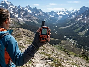
Satellite Messenger
Premium pickTwo-way messaging and SOS far from cell signal.
Garmin inReach Mini 2

Trekking Poles
Our pickSaves your knees on steep descents.
Cascade Mountain Tech Carbon Fiber Trekking Poles

Traction
Our pickGrip for icy or early-season snowy trail sections.
Kahtoola MICROspikes
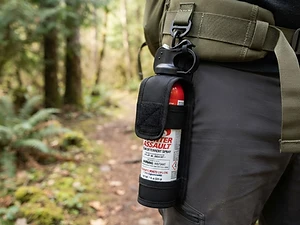
Bear Safety
Our pickCarried where it's reachable — a last-resort deterrent.
Bear Spray with Holster
As an Amazon Associate, Love Hiking Trails earns from qualifying purchases.
Photos

Featured in: The Best Hikes in Wyoming
Places to eat (nearest is 13 mi away)
Few options nearby. Pack food and water.
Wind River Brewing Company
Pinedale, WY13 mi awayWebsite
Heart & Soul Bakery & Cafe
Pinedale, WY13 mi away
Stockman's Saloon & Steakhouse
Pinedale, WY13 mi away
Ratings & Comments
—
No ratings yet
Sign in to rate this trail and leave a comment.
No comments yet. Share what the trail was like for you.
Nearby
Trails nearby
 StrenuousHike
Paintbrush–Cascade Canyon Loop
Grand Teton National Park, Wyoming
A grand tour of the Tetons' wild side — through two canyons and over Paintbrush Divide.
Distance
19.2 mi
Difficulty
Strenuous
Type
Loop (boat shortcut available)
 ModerateHike
Fairy Falls Trail
Yellowstone National Park, Wyoming
A flat hike to 200-foot Fairy Falls, with an overlook of Grand Prismatic Spring.
Distance
5 mi
Difficulty
Moderate
Type
Out & Back
 ChallengingHike
Mount Washburn Trail
Yellowstone National Park, Wyoming
A wildflower-lined climb to a fire lookout atop Mount Washburn with views across Yellowstone.
Distance
6.2 mi
Difficulty
Challenging
Type
Out & Back
More trails to explore
More trails in Wyoming
More hikes nearby
Frequently asked questions
How long is the hike to Titcomb Basin?
HikingWalking.com puts Island Lake 12.1 miles from Elkhart Park and Upper Titcomb Lake another 3.6 miles on, for about 31.4 miles round trip. The Forest Service doesn't publish an official distance.
Do I need a permit for Titcomb Basin?
Not as an individual. Organized groups and overnight stock users need free Bridger Wilderness permits.
Is there a fee at the Elkhart Park trailhead?
No. The Elkhart–Pole Creek Trailhead is free and open 24 hours.
Where can I camp?
In the wilderness, at least 200 feet from lakes and trails and 100 feet from streams. Trails End Campground at the trailhead costs $12 a night.
Can I have a campfire?
Not above timberline, and not within 200 feet of a lake or trail or 100 feet of a stream.
What's the maximum group size?
15 people in the Bridger Wilderness.
Sources (checked October 22, 2026)
- https://www.fs.usda.gov/r04/bridger-teton/recreation/elkhart-pole-creek-trailhead
- https://www.fs.usda.gov/r04/bridger-teton/recreation/trails-end-campground
- https://www.fs.usda.gov/r04/bridger-teton/alerts/bridger-wilderness-pinedale-ranger-district
- https://www.fs.usda.gov/r04/bridger-teton/alerts/wilderness-restrictions-bridger-gros-ventre-teton-wilderness
- https://www.fs.usda.gov/r04/bridger-teton/permits/bridger-wilderness-area-permits
- https://www.fs.usda.gov/r04/bridger-teton/alerts
- https://www.hikingwalking.com/destinations/wy/wy_ww/elkhart_park/bp_islandlake
- https://www.hikingwalking.com/destinations/wy/wy_ww/elkhart_park/bp_islandlake/titcomb_basin