

At a glance
Distance
Elevation gain
Difficulty
Route type
Time
Permit required
Fees
Dogs
Best season
Official park info: White Mountain National Forest
The classic, steep climb up the Northeast's highest peak through a glacial cirque, starting from Pinkham Notch.
Mount Washington (6,288 ft) is notorious for some of the world's worst weather, and the Tuckerman Ravine Trail is the most popular route to its summit. From Pinkham Notch the trail climbs a wide path to Hermit Lake, then ascends the steep headwall of the glacial cirque and continues over boulders to the summit.
Overview
Mount Washington (6,288 ft) is notorious for some of the world's worst weather. The Tuckerman Ravine Trail is the most popular route to its summit. The classic, steep climb up the Northeast's highest peak through a glacial cirque, starting from Pinkham Notch.
Expect 8.4 miles, 4,300 ft of climbing, out & back, typically 7-9 hours. The best time to go is June-September.
Plan your visit
Trailhead map
Trailhead at 44.2575, -71.2531. Confirm current trail conditions before you go.
Where to stay near Mount Washington via Tuckerman Ravine
Find hotels and rentals near Mount Washington via Tuckerman Ravine
We may earn a commission if you book a stay through these links, at no extra cost to you. Prices and availability come from booking partners and can change. We never rank trails by commission.
Route, step by step
From Pinkham Notch, climb a wide trail to Hermit Lake, then ascend the steep headwall of the ravine and continue over boulders to the summit.
Tips
Show full route
- Check the Mount Washington Observatory higher summits forecast.
- The headwall may close for snow and ice into early summer.
- Bring layers even in July.
- Fees: Free.
- Dogs: Allowed on leash.
Tips
- Check the Mount Washington Observatory higher summits forecast before you go. The headwall may close for snow and ice into early summer. Bring layers even in July.
What to bring & gear
- Shoes with sticky rubber soles for the rocky or wet sections
- Rain shell and a warm layer for fast-changing weather
- Trekking poles for the steep descent
- Water and snacks sized to the hike
- Sun protection: hat, sunscreen, sunglasses
- Headlamp and extra batteries
- Map or offline GPS route
- Microspikes for early-season snow
Picks sized for a 8.4-mile, 7–9 hour hike.
Our gear picks
Our picks for this hike. Compare current prices at Amazon.

Hiking Boots
Our pickBurly support for heavy loads and long climbs.
Salomon Quest 4 GTX

Water Filter
Budget pickReliable squeeze filter with a long service life.
Sawyer Squeeze Water Filter
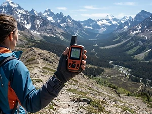
Satellite Messenger
Premium pickTwo-way messaging and SOS far from cell signal.
Garmin inReach Mini 2

Trekking Poles
Our pickSaves your knees on steep descents.
Cascade Mountain Tech Carbon Fiber Trekking Poles

Rain Jacket
Our pickBreathable storm shell with pit zips for climbs.
Outdoor Research Foray II

Traction
Our pickGrip for icy or early-season snowy trail sections.
Kahtoola MICROspikes
As an Amazon Associate, Love Hiking Trails earns from qualifying purchases.
Photos

Featured in: The Best Hikes in New Hampshire
Ratings & Comments
—
No ratings yet
Sign in to rate this trail and leave a comment.
No comments yet. Share what the trail was like for you.
Nearby
More in New Hampshire
Nearby bike trails
Nearby off-road
Trails nearby
 ModerateHike
Arethusa Falls Trail
Crawford Notch State Park, New Hampshire
A rocky, steady climb off Route 302 to Arethusa Falls, which NH State Parks calls the highest falls in New Hampshire at nearly 200 feet.
Distance
2.8 mi
Difficulty
Moderate
Type
Out and back (or a 4-mile loop past Frankenstein Cliff)
 StrenuousHike
Franconia Ridge Loop
White Mountain National Forest, New Hampshire
An exposed alpine ridge over three 4,000-foot peaks — a National Geographic dream trail.
Distance
8.9 mi
Difficulty
Strenuous
Type
Loop
 ChallengingHike
Welch-Dickey Loop
White Mountain National Forest, New Hampshire
The White Mountains' classic day loop — two open granite domes with 360° southern-range views.
Distance
4.4 mi
Difficulty
Challenging
Type
Loop
More trails to explore
More trails in New Hampshire
More hikes nearby
Frequently asked questions
How hard is it?
Very strenuous, with over 4,000 feet of gain.
Is the headwall open?
It can be closed in spring; check the forest service.
Dogs?
Allowed on leash but the headwall is hard for dogs.
Can I ride down?
The auto road and Cog Railway may offer descents; check availability.
How long is the Mount Washington via Tuckerman Ravine hike?
Mount Washington via Tuckerman Ravine is 8.4 miles with 4,300 feet of elevation gain. Most hikers complete it in 7–9 hours.
How difficult is Mount Washington via Tuckerman Ravine?
We rate it Expert (5 out of 5) for White Mountain National Forest. That reflects its distance, 4,300 ft of climbing, and terrain.
When is the best time to hike Mount Washington via Tuckerman Ravine?
The best window is Jun–Sep. Always check current conditions and weather before you go.
Do I need a permit or reservation for Mount Washington via Tuckerman Ravine?
No special trail permit is required. Free.