
At a glance
Distance
Elevation gain
Difficulty
Trail style
Permit
Fees
Dogs
Hours
Season
E-bike policy
Overview
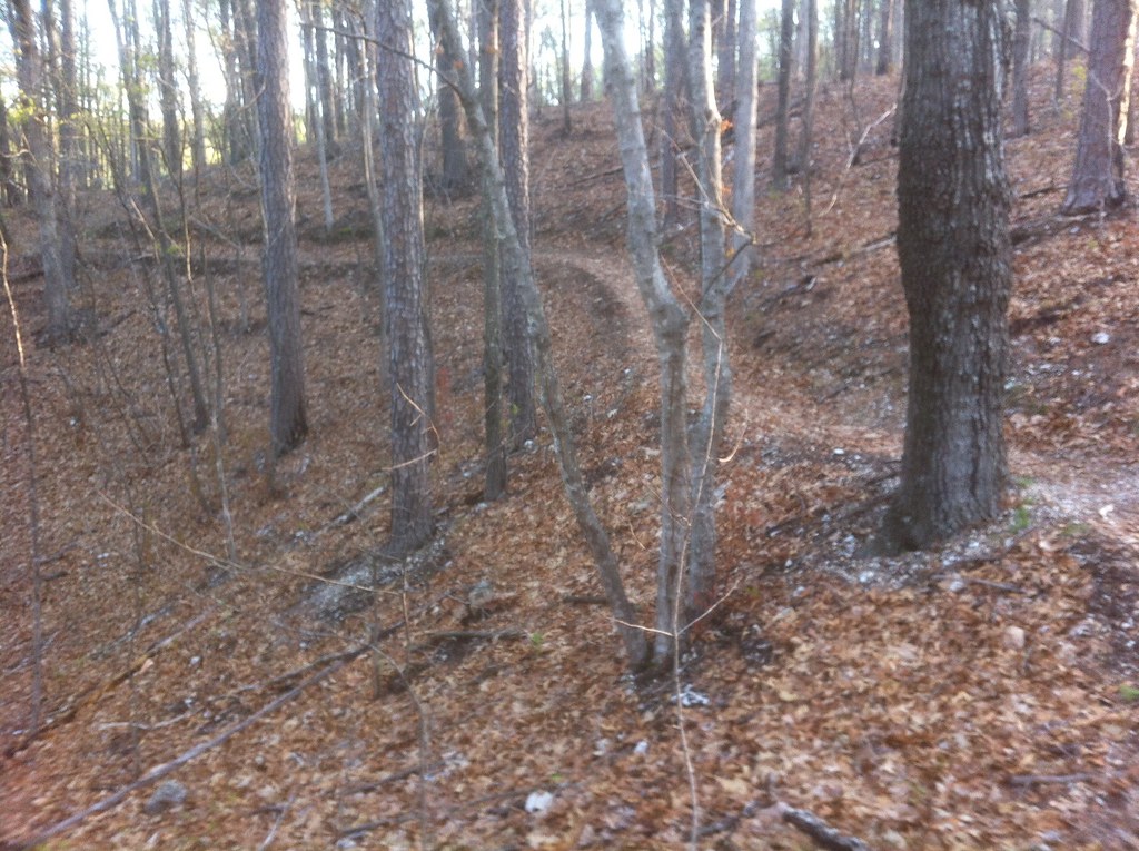
The Berryman Trail is a 24-mile loop in the Mark Twain National Forest west of Potosi. It winds through oak and shortleaf pine, climbing switchback fashion from low bottoms to high cherty ridges. The USFS rates it Moderate, with several long, sustained climbs and rocky descents, and its western half doubles as part of the Ozark Trail's Courtois Section.
- 24-mile Ozark loop through oak and shortleaf pine
- Shares about 10 miles with the Ozark Trail
- Trailhead at a 1930s CCC camp site
The trail is marked with white rectangular Ozark Trail blazes, and every intersection is signed. Elevation runs from 842 to 1,195 feet, with average grades of 10–12%. The loop starts at Berryman Campground, the site of a 1930s Civilian Conservation Corps camp, and the Highway 8 (Berryman) Trailhead is another way on.
Plan your visit
Getting there
From St. Louis, take Highway 21 south 60 miles to Potosi, turn right (west) onto Highway 8, go 16 miles to FR 2266, and follow FR 2266 to the Berryman Campground.
Parking
The campground trailhead has parking for 15 vehicles. The USFS lists a $5 per vehicle day-use fee at Berryman Campground, paid in cash or check at the fee tube. No permit is needed for the trail.
When to go
The USFS lists the best seasons as fall, winter and spring. Campground day use runs 6 a.m.–10 p.m.; be aware of hunting seasons.
Good to know
There's no potable water at any trailhead or campground on the loop, so carry what you need or treat water. Dogs are allowed on the trail (a 6-ft leash is required in day-use areas). We couldn't find an e-bike policy from the USFS; no motorized vehicles are allowed on the trail.
Where to stay near Berryman Trail
Nearest town: Potosi, MO
Find hotels and rentals near Berryman Trail
We may earn a commission if you book a stay through these links, at no extra cost to you. Prices and availability come from booking partners and can change. We never rank trails by commission.
The loop
- 1The loop: 24 miles of unsurfaced, native-material trail, rocky in places, marked with white rectangular Ozark Trail blazes; all intersections are signed.
- 2Ozark Trail overlap: the western half doubles as part of the Courtois Section of the Ozark Trail (the Courtois Section follows the Berryman Trail for around 10 miles).
- 3Spurs: Brazil Creek Spur (0.1 mi) and Harmon Spring Trail Camp Spur (0.2 mi).
- 4Terrain: several long, sustained climbs and rocky descents; stream crossings are not bridged.
- 5The USFS doesn't publish a turn-by-turn ride description, so we don't list one.
Tips
- Carry all your water, or a filter. There's no potable water at the trailheads.
- Expect wet feet. Stream crossings aren't bridged.
- Bring a map and compass; the USFS strongly suggests both.
- Be aware of hunting seasons.
- Bring cash or a check for the $5 day-use fee at Berryman Campground.
What to bring & gear
- Helmet
- Full-finger gloves and eye protection
- Water: a hydration pack or two bottles (no potable water at any trailhead)
- Spare tube, tire levers and a pump or CO2
- Multi-tool with a chain breaker
- Small first-aid kit
- Phone with an offline map
- Sun protection and insect repellent
- Water filter or treatment
- Map and compass
Photos
Places to eat (nearest is 14 mi away)
Few options nearby. Pack food and water.
Cheri's Sweets & Eats
restaurant14 mi away Directions
Rich's Famous Burgers
restaurant15 mi away Directions
Art & Joe
cafe15 mi away Directions
Mr. Tequila Mexican Restaurant
restaurant15 mi away Directions
Ratings & Comments
—
No ratings yet
Sign in to rate this trail and leave a comment.
No comments yet. Share what the trail was like for you.
Nearby
Nearby off-road
More trails
Frequently asked questions
How long is the Berryman Trail?
The USFS describes a 24-mile loop. Its trail-sections table lists the Berryman Trail at 26.5 miles.
How hard is the Berryman Trail?
The USFS rates it Moderate, with several long, sustained climbs, rocky descents and average grades of 10–12%.
Is there a fee to ride the Berryman Trail?
No permit is needed for the trail; the USFS lists a $5 per vehicle day-use fee at Berryman Campground.
Is there water on the Berryman Trail?
No. No trailheads or campgrounds on the trail have potable water.
Where does the Berryman Trail start?
At Berryman Campground off FR 2266, 16 miles west of Potosi via Highway 8; the Highway 8 (Berryman) Trailhead is another access.
Sources
- fs.usda.gov — https://www.fs.usda.gov/r09/marktwain/recreation/trails/berryman-trail
- fs.usda.gov — https://www.fs.usda.gov/sites/nfs/files/r09/marktwain/publication/Mark%20Twain%20NF%20-%20Berryman%20Trail%20Map.pdf
- fs.usda.gov — https://www.fs.usda.gov/r09/marktwain/recreation/berryman-campground
- openstreetmap.org — https://www.openstreetmap.org