


Hike
Cantwell Cliffs Trail
Hocking Hills State Park, Ohio
2 mi450 ftChallenging
Hocking Hills' quietest gorge — rim trails, the Fat Woman's Squeeze, and a towering rock shelter.
View hike guide
Photo: aparlette, CC BY 2.0, via Wikimedia Commons
An interactive atlas of America's best hikes, mountain-bike routes and off-road trails — explore them on the map, then let the trail finder match a route to your ambition.
531
Mapped Routes
50
States
14,505′
Highest Peak
Pick your sport
300 hikes, 160 bike trails and 71 off-road areas across 50 states — on foot, on a bike, or behind the wheel. Pick a sport and start exploring.
Tuesday, November 17, 2026
One hike, one bike trail and one off-road route, picked fresh at midnight Central and the same for everyone all day.
Hocking Hills State Park, Ohio
Hocking Hills' quietest gorge — rim trails, the Fat Woman's Squeeze, and a towering rock shelter.
View hike guideGreenbrier River Trail State Park, West Virginia
West Virginia's longest rail trail: 78 miles and 35 bridges along the Greenbrier River.
View bike trail guideCanyonlands National Park (Island in the Sky), Utah
A 100-mile high-clearance four-wheel-drive loop in Canyonlands, open to street-legal 4x4s and motorbikes — not ATVs or UTVs — with a required day-use permit.
View off-road guideThe Continental Scale
Every hike, bike trail and off-road route in one map. Colors show the activity: green for hiking, orange for biking, brown for off-road. Use the region buttons to jump coast to coast.
Showing 160 bike trails
The Full Atlas
300 hikes, 160 bike trails and 71 off-road areas across 50 states.
 IntermediateBike
Oak Mountain State Park, Alabama
About 50 miles of IMBA Epic singletrack in Alabama's largest state park, just south of Birmingham.
Distance
50 mi
Difficulty
Intermediate
Type
Mountain bike
 Bike
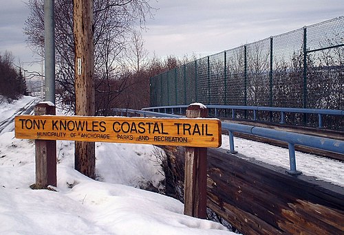
Anchorage Parks and Recreation, Alaska
Anchorage's 11-mile coastal path, reaching Kincaid Park's trail hub.
Distance
11 mi
Type
Paved multi-use path
 BeginnerBike
Coconino National Forest (Red Rock Ranger District), Arizona
A wide, mostly hard-surfaced 3.6-mile ride past Bell Rock and Courthouse Butte, with links toward Cathedral Rock.
Distance
3.6 mi
Difficulty
Beginner
Type
Mountain bike
 Bike
Arkansas River Trail System, Arkansas
Loop the Arkansas River over the Big Dam Bridge, the longest bridge in North America built for walkers and cyclists.
Distance
16 mi
Type
Greenway
 Bike
American River Parkway, California
Sacramento's 32-mile paved river trail, from Discovery Park up the American River.
Distance
32 mi
Type
Greenway
 BeginnerBike
Cherry Creek Trail, Colorado
Follow Cherry Creek from downtown Denver past the shopping district and through Cherry Creek State Park toward Franktown.
Distance
45 mi
Difficulty
Beginner
Type
Greenway
 Bike
Air Line State Park Trail, Connecticut
Fifty miles of the old 'Ghost Train' line across eastern Connecticut, free to ride.
Distance
50 mi
Type
Rail trail (gravel or hybrid)
 BeginnerBike
Cape Henlopen State Park, Delaware
An easy five miles on crushed stone between Lewes and Rehoboth Beach, across coastal marshes.
Distance
5 mi
Difficulty
Beginner
Type
Crushed-stone rail trail
 Bike
Fred Marquis Pinellas Trail, Florida
Pinellas County's rail-trail spine, from St. Petersburg through Dunedin to Tarpon Springs.
Type
Greenway
Regional guides that rank the best hikes around each city and across each state, with drive times, distances and fees.
The Visual Sifter
Set your difficulty, your vibe, and how far or high you want to go. Matches update live.
Trail Finder
Filter by difficulty, vibe, distance, and elevation gain.
Tees and hats from Love Hiking Trails
Printed on demand and shipped by our print partner.
We use cookies for analytics, advertising (including third-party ad cookies) and affiliate tracking. You can accept all, reject non-essential cookies, or choose. See our Privacy Policy.


