

At a glance
Distance
Elevation gain
Difficulty
Route type
Time
Permit required
Fees
Dogs
Best season
Official park info: White River National Forest
A 27-mile circuit over four 12,500-foot passes beneath the Maroon Bells — Colorado's most famous backpack.
The Four Pass Loop threads beneath the Maroon Bells and over Buckskin, Trail Rider, Frigid, and West Maroon passes, each above 12,400 feet. Alpine flower meadows, waterfall-choked valleys, and the mirror of Crater Lake bookend the circuit. The passes are steep and exposed; snow lingers into July and afternoon storms are the rule.
Plan your visit
Parking
Maroon Bells-Snowmass overnight permit; Maroon Lake parking reservation or shuttle
Permits & fees
A permit, reservation, or entry ticket may be required. Maroon Bells-Snowmass overnight permit; Maroon Lake parking reservation or shuttle
When to go
The best window is Jul–Sep. Check the local forecast (not the regional one — mountains, coasts, and canyons all make their own weather), and always confirm current trail conditions, closures, and fees with the managing agency before you head out.
Overnight permits required (congestion quota). Start from either Maroon Lake or Snowmass trailhead. Never summit the Bells themselves — the rock is deadly.
Trailhead map
Trailhead at 39.1157, -106.9549. Confirm current trail conditions before you go.
Where to stay near Four Pass Loop (Maroon Bells)
Find hotels and rentals near Four Pass Loop (Maroon Bells)
We may earn a commission if you book a stay through these links, at no extra cost to you. Prices and availability come from booking partners and can change. We never rank trails by commission.
Tips
- Overnight permits required (congestion quota). Start from either Maroon Lake or Snowmass trailhead. Never summit the Bells themselves — the rock is deadly.
What to bring & gear
- Sturdy hiking shoes or boots
- 2–3 liters of water per person
- Sun protection: hat, sunscreen, sunglasses
- Trail snacks or a packed lunch
- Trekking poles for the steep sections
- Headlamp and extra batteries
- Map or offline GPS route
- Emergency layers and a small first-aid kit
- Microspikes for early-season snow
Picks sized for a 26.6-mile, 2–3 day hike.
Our gear picks
Our picks for this hike. Compare current prices at Amazon.

Hiking Boots
Our pickBurly support for heavy loads and long climbs.
Salomon Quest 4 GTX

Water Filter
Budget pickReliable squeeze filter with a long service life.
Sawyer Squeeze Water Filter
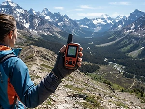
Satellite Messenger
Premium pickTwo-way messaging and SOS far from cell signal.
Garmin inReach Mini 2

Trekking Poles
Our pickSaves your knees on steep descents.
Cascade Mountain Tech Carbon Fiber Trekking Poles

Rain Jacket
Our pickBreathable storm shell with pit zips for climbs.
Outdoor Research Foray II

Traction
Our pickGrip for icy or early-season snowy trail sections.
Kahtoola MICROspikes
As an Amazon Associate, Love Hiking Trails earns from qualifying purchases.
Photos

Featured in: The Best Hikes in Colorado
Ratings & Comments
—
No ratings yet
Sign in to rate this trail and leave a comment.
No comments yet. Share what the trail was like for you.
Nearby
Nearby bike trails
Trails nearby
 ChallengingHike
Hanging Lake
White River National Forest, Colorado
A turquoise hanging lake and waterfall tucked into Glenwood Canyon.
Distance
3.2 mi
Difficulty
Challenging
Type
Out and back
 StrenuousHike
Ice Lakes Basin
San Juan National Forest, Colorado
A steep, wildly popular climb on Ice Lake Trail #505 near Silverton, rising from 9,840 to 12,260 feet into a wildflower-filled basin ringed by Grant, Fuller and Beatie peaks.
Distance
7 mi
Difficulty
Strenuous
Type
Out and back
 ExpertHike
Longs Peak (Keyhole Route)
Rocky Mountain National Park, Colorado
At 14,259 ft, Longs Peak is the highest summit in Rocky Mountain National Park. NPS is blunt about the Keyhole Route: "not a hike." It's a 15-mile, 10–15 hour climb across ledges and steep rock where an unroped fall would likely be fatal.
Distance
15 mi
Difficulty
Expert
Type
Out and back
More trails to explore
More trails in Colorado
More hikes nearby
Frequently asked questions
How long is the Four Pass Loop (Maroon Bells) hike?
Four Pass Loop (Maroon Bells) is 26.6 miles with 7,800 feet of elevation gain. Most hikers complete it in 2–3 days.
How difficult is Four Pass Loop (Maroon Bells)?
We rate it Expert (5 out of 5) for White River National Forest. That reflects its distance, 7,800 ft of climbing, and terrain.
When is the best time to hike Four Pass Loop (Maroon Bells)?
The best window is Jul–Sep. Always check current conditions and weather before you go.
Do I need a permit or reservation for Four Pass Loop (Maroon Bells)?
Yes — access is managed. Maroon Bells-Snowmass overnight permit; Maroon Lake parking reservation or shuttle. Check the official White River National Forest page before you go.
Are dogs allowed on the Four Pass Loop (Maroon Bells) trail?
Allowed on leash. Bring water for your dog and follow the area's pet rules.