

At a glance
Distance
Elevation gain
Difficulty
Route type
Time
Permit required
Fees
Dogs
Best season
Official park info: Rocky Mountain National Park
At 14,259 ft, Longs Peak is the highest summit in Rocky Mountain National Park. NPS is blunt about the Keyhole Route: "not a hike." It's a 15-mile, 10–15 hour climb across ledges and steep rock where an unroped fall would likely be fatal.
Longs Peak dominates the skyline of northern Colorado's Front Range, and summiting it is a rite of passage for many Colorado hikers. NPS asks you to think of it as a climb. The standard Keyhole Route runs 7.5 miles from the trailhead to the summit (15 miles round trip) and averages 10 to 15 hours. The maintained trail ends at the Boulder Field, about 5 miles in. Beyond that, the route crosses narrow ledges, loose rock and steep slabs marked by red-and-yellow bull's-eyes. NPS warns that an unroped fall there would likely be fatal, that conditions are wintry for most of the year, and that many accidents happen on the descent.
Love Hiking Trails suggests treating the Keyhole as your assessment point. NPS describes it as a good place to decide whether to continue.
Overview
There's no water on the Keyhole Route, so carry 3–4 quarts. Altitude sickness is a real risk. Solo climbing isn't recommended. Follow the bull's-eyes and don't take shortcuts. NPS no longer assigns technical ratings to the route, but it's serious scrambling with major exposure.
Plan your visit
Getting there
The climb starts at the Longs Peak Trailhead on the park's southeast side. That's outside the Bear Lake Road corridor, so the park-wide timed-entry rules apply rather than the Bear Lake ones.
Parking
Park at the Longs Peak Trailhead. NPS recommends starting before sunrise, so plan to arrive well before dawn.
Permits & fees
A day climb needs no wilderness permit. In 2026, Rocky Mountain's park-wide timed-entry permit was required from 9 am to 2 pm, May 22 to October 12 ($2 recreation.gov fee). Entering before 9 am needed no reservation. The Bear Lake Road corridor required permits from 5 am to 6 pm through October 18. Park entrance costs $30 for a 1-day vehicle pass or $35 for 7 days.
When to go
The route is most likely to be snow- and ice-free from mid-July to mid-September. Afternoon thunderstorms are common from June to August, so start before sunrise and turn back if clouds build. Outside that window, expect snow and ice that call for mountaineering skills.
Trailhead map
Trailhead at 40.2549, -105.6151. Confirm current trail conditions before you go.
Where to stay near Longs Peak (Keyhole Route)
Find hotels and rentals near Longs Peak (Keyhole Route)
We may earn a commission if you book a stay through these links, at no extra cost to you. Prices and availability come from booking partners and can change. We never rank trails by commission.
Route, step by step
1. Longs Peak Trailhead. Climb through forest and out above treeline in the dark.
2. Boulder Field (about 5 mi). The maintained trail ends here.
Show full route
3. The Keyhole (about 6 mi). A notch in the ridge and NPS's recommended assessment point. Turn back here if the weather, the clock or the conditions are wrong.
4. The final 1.5 miles. The hardest part: the Ledges, the Trough, the Narrows and the Homestretch, following red-and-yellow bull's-eyes.
5. Summit (14,259 ft). Then descend the same way with full attention. NPS reports that many accidents happen on the way down.
Tips
- Set a hard turnaround time before you start.
- Wear a helmet for rockfall in the Trough and the Homestretch.
- Acclimatize for a few days at elevation first.
Nearby trails we recommend
- Sky Pond via Glacier Gorge, a classic in Rocky Mountain National Park
- Hanging Lake, in Glenwood Canyon
- Four Pass Loop (Maroon Bells), near Aspen
Tips
- Start by 1–2am. Be off the upper route by noon to avoid lightning. Do not attempt in snow or ice without gear.
What to bring & gear
- Sturdy hiking shoes or boots
- 2–3 liters of water per person
- Sun protection: hat, sunscreen, sunglasses
- Trail snacks or a packed lunch
- Trekking poles for the steep sections
- Headlamp and extra batteries
- Map or offline GPS route
- Emergency layers and a small first-aid kit
- Microspikes for early-season snow
Picks sized for a 15-mile, 10–14 hour hike.
Our gear picks
Our picks for this hike. Compare current prices at Amazon.

Hiking Boots
Our pickBurly support for heavy loads and long climbs.
Salomon Quest 4 GTX

Water Filter
Budget pickReliable squeeze filter with a long service life.
Sawyer Squeeze Water Filter
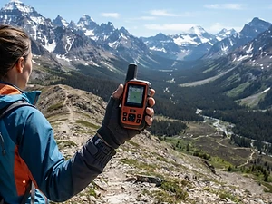
Satellite Messenger
Premium pickTwo-way messaging and SOS far from cell signal.
Garmin inReach Mini 2

Trekking Poles
Our pickSaves your knees on steep descents.
Cascade Mountain Tech Carbon Fiber Trekking Poles

Rain Jacket
Premium pickStorm-proof shell built for serious weather.
Arc'teryx Beta AR

Traction
Our pickGrip for icy or early-season snowy trail sections.
Kahtoola MICROspikes
As an Amazon Associate, Love Hiking Trails earns from qualifying purchases.
Photos


Featured in: The Best Hikes in Colorado
Ratings & Comments
—
No ratings yet
Sign in to rate this trail and leave a comment.
No comments yet. Share what the trail was like for you.
Nearby
Nearby bike trails
Trails nearby
 StrenuousHike
Sky Pond via Glacier Gorge
Rocky Mountain National Park, Colorado
A 9.8-mile round trip from the Glacier Gorge Trailhead past Alberta Falls and The Loch, then up beside Timberline Falls and past Lake of Glass to Sky Pond.
Distance
9 mi
Difficulty
Strenuous
Type
Out and back
 ModerateHike
Emerald Lake Trail
Rocky Mountain National Park, Colorado
Three alpine lakes in under two miles, ending under Hallett Peak.
Distance
3.4 mi
Difficulty
Moderate
Type
Out and back
 ChallengingHike
Royal Arch Trail
City of Boulder Open Space and Mountain Parks (Chautauqua), Colorado
A lung-busting climb past the Flatirons to a sandstone arch above Boulder.
Distance
3.3 mi
Difficulty
Challenging
Type
Out and back
More trails to explore
More trails in Colorado
More hikes nearby
Frequently asked questions
How long does it take to climb Longs Peak?
NPS says the round trip averages 10 to 15 hours over 15 miles.
Is Longs Peak a hike?
No. NPS describes the Keyhole Route as a climb with exposure, scrambling and fall risk.
When is the best time to climb Longs Peak?
Usually mid-July to mid-September, when the route is most likely free of snow and ice.
Do I need a permit to climb Longs Peak?
Not for a day climb. You may need the park's timed-entry permit, depending on when you enter during the summer season.
How tall is Longs Peak?
14,259 feet.