

At a glance
Distance
Elevation gain
Difficulty
Route type
Time
Permit required
Fees
Dogs
Best season
Official park info: Humboldt-Toiyabe National Forest (Spring Mountains NRA)
A switchback climb to a seasonal waterfall in the Spring Mountains near Las Vegas.
Mary Jane Falls is a seasonal waterfall in Kyle Canyon in the Spring Mountains National Recreation Area, about an hour from Las Vegas. The trail climbs switchbacks through ponderosa pine and white fir to a cliff where water spills from springs above, and a small cave near the base of the falls makes a cool resting spot.
Overview
- The seasonal waterfall and cave
- Pine and fir forest
- Views of Kyle Canyon
May through October is the main season. The falls are strongest in late spring after snowmelt.
Plan your visit
Getting there
The trailhead is at the end of Echo Road off Kyle Canyon Road (State Route 157), about 45 minutes from Las Vegas. The trail climbs about 1,000 feet through a forest of ponderosa pine and white fir, and the cave at the base of the falls offers shade. Temperatures here are often 20 to 30 degrees cooler than in Las Vegas, but snow and ice can cover the trail well into spring, so microspikes are useful early in the season.
Trailhead map
Trailhead at 36.2669, -115.6618. Confirm current trail conditions before you go.
Where to stay near Mary Jane Falls Trail
Find hotels and rentals near Mary Jane Falls Trail
We may earn a commission if you book a stay through these links, at no extra cost to you. Prices and availability come from booking partners and can change. We never rank trails by commission.
Route, step by step
From the trailhead at the end of Echo Road, the trail climbs steadily up switchbacks to the falls. The final stretch is steep and rocky. Return the same way. The upper switchbacks are steep, rocky and exposed to sun, so pace yourself and take breaks in the shade of the pines. Near the top the trail traverses beneath limestone cliffs to the falls, where water seeps and pours from springs in the rock face. A shallow cave just beyond is a popular resting spot. On the descent, watch your footing on loose gravel.
Tips
Show full route
- Carry water; the climb is steep and dry.
- The trail can be snowy and icy in winter.
- Watch for loose rock near the falls.
- There is no fee at the trailhead.
Tips
- Carry water; the climb is steep and dry.
What to bring & gear
- Sturdy hiking shoes or boots
- 2–3 liters of water per person
- Sun protection: hat, sunscreen, sunglasses
- Trail snacks or a packed lunch
- Electrolyte tablets
Picks sized for a 3.2-mile, 2 hour hike.
Our gear picks
Our picks for this hike. Compare current prices at Amazon.

Hiking Boots
Our pickSupport and grip for rocky, rooty miles.
Merrell Moab 3 Mid Waterproof

Daypack
Our pickCarries water, layers, and snacks comfortably.
Osprey Talon 22

Hydration Reservoir
Our pickWide-opening reservoir that's easy to fill and clean.
Platypus Big Zip EVO 3L Reservoir

Trekking Poles
Our pickSaves your knees on steep descents.
Cascade Mountain Tech Carbon Fiber Trekking Poles

Rain Jacket
Our pickBlocks sudden mountain storms and wind.
Columbia Watertight II Rain Jacket
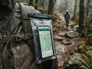
Phone Case
Budget pickKeeps your phone dry and usable in a wet pack or on the water.
Waterproof Phone Pouch
As an Amazon Associate, Love Hiking Trails earns from qualifying purchases.
Photos


Ratings & Comments
—
No ratings yet
Sign in to rate this trail and leave a comment.
No comments yet. Share what the trail was like for you.
Nearby
Nearby bike trails
Nearby off-road
Trails nearby
 ChallengingHike
Bristlecone Trail
Spring Mountains National Recreation Area, Nevada
A loop through ancient bristlecone pines in Lee Canyon.
Difficulty
Challenging
Type
Loop
 ChallengingHike
Calico Tanks Trail
Red Rock Canyon National Conservation Area, Nevada
A scramble up a sandstone canyon to a natural water tank with a view of Las Vegas.
Distance
2.5 mi
Difficulty
Challenging
Type
Out & Back
 ModerateHike
Fire Wave Trail
Valley of Fire State Park, Nevada
A short walk to swirling striped sandstone in Nevada's oldest state park.
Distance
1.5 mi
Difficulty
Moderate
Type
Out & Back
More trails to explore
More trails in Nevada
Frequently asked questions
How long is the Mary Jane Falls trail?
It is a short but steep out-and-back.
Is there a fee?
No, there is no fee.
Are dogs allowed?
Yes, leashed dogs are allowed.
When is the waterfall flowing?
Usually strongest in spring after snowmelt.
How difficult is Mary Jane Falls Trail?
We rate it Challenging (3 out of 5) for Spring Mountains National Recreation Area. That reflects its distance, 700 ft of climbing, and terrain.
When is the best time to hike Mary Jane Falls Trail?
The best window is May-October. Always check current conditions and weather before you go.
Do I need a permit or reservation for Mary Jane Falls Trail?
No special trail permit is required. Free.