

Current alert
Open. NPS road status (checked Oct 21, 2026): MP 298.5–305.1 open with sporadic short single-lane closures for a Great American Outdoors Act project. Linn Cove Visitor Center is temporarily closed.
At a glance
Distance
Elevation gain
Difficulty
Route type
Time
Permit required
Fees
Dogs
Best season
Official park info: Blue Ridge Parkway
A short, steep climb to a boardwalk above the Linn Cove Viaduct.
Rough Ridge is the most rewarding short walk on the Grandfather Mountain stretch of the Blue Ridge Parkway. A rocky section of the Tanawha Trail climbs sharply from the parking area to a 200-foot boardwalk. It crosses fragile low-growing mountain heather, and nothing blocks the view toward the Piedmont, the Linn Cove Viaduct and the surrounding peaks.
Overview
- A 200-foot boardwalk over a rare mountain-heather community
- A look back at the curving Linn Cove Viaduct
- Views of Grandmother Mountain, Hawksbill and Table Mountain
- The white-blazed Mountains-to-Sea Trail, which shares this path
The NPS calls the Rough Ridge section strenuous, even though the Tanawha Trail is mostly easy to moderate. The climb is short but steep and rocky.
Plan your visit
Parking
Small roadside lot at MP 302.8; fills on fall weekends.
When to go
Early morning is quietest, and the light on the viaduct is best. October brings the biggest crowds for fall color. Fog often settles on the ridge, so a clear forecast is worth waiting for.
Trailhead map
Trailhead at 36.0983, -81.7973. Confirm current trail conditions before you go.
Where to stay near Rough Ridge (Tanawha Trail)
Find hotels and rentals near Rough Ridge (Tanawha Trail)
We may earn a commission if you book a stay through these links, at no extra cost to you. Prices and availability come from booking partners and can change. We never rank trails by commission.
Route, step by step
1. Start at the MP 302.8 lot. Join the Tanawha Trail and head uphill toward Rough Ridge.
2. The climb. The trail climbs steeply over rock and roots to the start of the boardwalk.
Show full route
3. The boardwalk. Walk the 200-foot boardwalk. Stay on it, because the heather around it is easily damaged.
4. The high point and return. Continue to the rocky high point for the widest view, then return the same way.
Tips
- Stay on designated paths, bridges and boardwalks, as the NPS asks.
- The rock is slick in fog, rain and frost.
- Keep dogs on a leash of 6 feet or less, and clean up after them.
- Check the Parkway road status page before driving, especially in winter.
Tips
- Stay on designated paths, bridges and boardwalks, as the NPS asks. The rock is slick in fog, rain and frost. Keep dogs on a leash of 6 feet or less, and clean up after them. Check the Parkway road status page before driving, especially in winter.
What to bring & gear
- Sturdy hiking shoes or boots
- 2–3 liters of water per person
- Sun protection: hat, sunscreen, sunglasses
- Trail snacks or a packed lunch
- Rain shell
- Insect repellent
Picks sized for a 1.2-mile, 30–60 minute hike.
Our gear picks
Our picks for this hike. Compare current prices at Amazon.
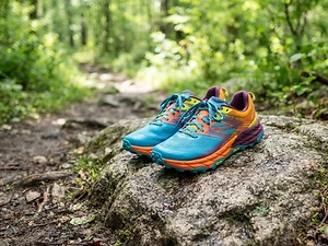
Trail Runners
Our pickClassic out-of-the-box comfort for easy miles.
Merrell Moab 3

Daypack
Our pickCompact, well-built daypack that packs down small.
Osprey Daylite Plus

Insulation
Our pickWarmth that compresses into its own pocket.
Packable Puffer Jacket
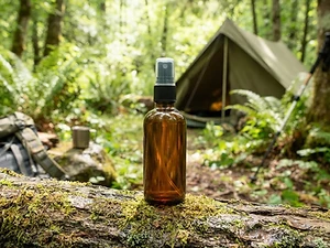
Insect Repellent
Budget pickLong-lasting protection without the DEET smell.
Sawyer 20% Picaridin Insect Repellent Spray
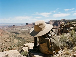
Sun Hat
Our pickFull coverage with a long neck cape.
Sunday Afternoons Adventure Hat

Traction
Our pickGrip for icy or early-season snowy trail sections.
Kahtoola MICROspikes
As an Amazon Associate, Love Hiking Trails earns from qualifying purchases.
Photos


Featured in: The Best Hikes in North Carolina, The Best Hikes Near Johnson City, Tennessee
Places to eat (nearest is 13 mi away)
Few options nearby. Pack food and water.
Famous Louise's Rock House
Linville Falls, NC13 mi awayWebsite
Ratings & Comments
—
No ratings yet
Sign in to rate this trail and leave a comment.
No comments yet. Share what the trail was like for you.
Nearby
More in North Carolina
Nearby bike trails
Nearby off-road
Trails nearby
 ChallengingHike
Linville Falls
Blue Ridge Parkway, North Carolina
Linville Falls is one of the most impressive waterfalls on the Blue Ridge Parkway. The Linville River pours over the Upper Falls, squeezes through a narrow canyon, and then plunges 45 feet over the Lower Falls into the head of Linville Gorge.
Distance
1.18 mi
Difficulty
Challenging
Type
Out-and-back
 ModerateHike
Roan Mountain Highlands
Pisgah National Forest, North Carolina
Grassy bald ridges along the Appalachian Trail — a rhododendron bloom and fall-color legend.
Distance
7 mi
Difficulty
Moderate
Type
Out and back along the balds
 ChallengingHike
Grayson Highlands & Mount Rogers
Grayson Highlands State Park / Jefferson NF, Virginia
Wild ponies on grassy balds beneath Virginia's highest peak — like Scotland, with rhododendrons.
Distance
8.5 mi
Difficulty
Challenging
Type
Out and back
More trails to explore
More in Blue Ridge Parkway
More trails in North Carolina
More hikes nearby
Frequently asked questions
How long is the Rough Ridge hike?
Most guides put it at about 1.2 miles round trip from the MP 302.8 parking area. The NPS doesn't give a separate length for this section.
Is there a fee for Rough Ridge?
No. The Blue Ridge Parkway has no entrance fee.
Are dogs allowed on Rough Ridge?
Yes, on a leash no longer than 6 feet.