

At a glance
Distance
Elevation gain
Difficulty
Route type
Time
Permit required
Fees
Dogs
Best season
Official park info: Great Smoky Mountains National Park
On the North Carolina side of the Smokies, just outside Bryson City, the Deep Creek area packs three waterfalls into one short loop: Juney Whank Falls, Tom Branch Falls, and Indian Creek Falls. It's an easy-to-moderate half-day outing with a lot of reward, and a great choice for families or anyone who wants a variety of waterfalls without a long climb.
Overview
Deep Creek is one of the park's most popular areas on the NC side, about 3 miles north of downtown Bryson City. The trails here are wide and well used, and the creek itself is a summer magnet. But NPS doesn't recommend water recreation anywhere in the park, because drowning is one of the leading causes of death in the Smokies.
The three falls:
- Juney Whank Falls: A tall, two-tiered falls you cross on a footbridge partway up
- Tom Branch Falls: A delicate falls that spills directly into Deep Creek, viewed from the trail with benches
- Indian Creek Falls: A broad, sliding falls on Indian Creek, just off Deep Creek Trail
Hurricane Helene note: Helene (2024) hit the North Carolina side of the park hard, especially Cataloochee, Big Creek, and Balsam Mountain. As of October 2026, the Deep Creek loop trails are not on the NPS closure list. Check the current closures page before you go.
Plan your visit
Getting there
From Bryson City, follow signs to Deep Creek and drive to the end of Deep Creek Road, past Deep Creek Campground, to the trailhead parking area. Buy a tag in advance online, at the Swain County Visitor Center in Bryson City, or at the Deep Creek Picnic Area machine.
Parking
No permit. Parking tag required ($5 daily, $15 weekly, $40 annual). There's a parking tag machine at Deep Creek Picnic Area.
When to go
Spring for flow and wildflowers; fall for color; year-round access
Spring brings peak flow and wildflowers. Summer is busy with picnickers and creek-goers, so go early. Fall color is beautiful along the creek. Winter is quiet; Deep Creek Campground closes seasonally, but the trailhead is reachable.
Trailhead map
Trailhead at 35.4614, -83.4368. Confirm current trail conditions before you go.
Where to stay near Deep Creek Waterfalls Loop
Find hotels and rentals near Deep Creek Waterfalls Loop
We may earn a commission if you book a stay through these links, at no extra cost to you. Prices and availability come from booking partners and can change. We never rank trails by commission.
Route, step by step
These directions follow the official NPS route. Bring a map, since the junctions come quickly.
1. Juney Whank Falls (0–0.3 mi). From the parking area at the end of Deep Creek Road, take the steep but short trail to Juney Whank Falls. Cross the falls on the footbridge, which puts you right in the middle of the falls.
Show full route
2. Over to Deep Creek (0.3–1 mi). Continue 300 feet past the falls to a trail junction. Turn right, then left, and follow the Deep Creek Horse Trail toward Deep Creek Trail.
3. Indian Creek junction (about 1 mi). At the junction with Deep Creek Trail, turn right and go 0.1 mile to the Indian Creek Trail.
4. Indian Creek Falls (about 1.1 mi). Follow Indian Creek Trail about 200 feet to the falls. A side path leads down to a viewing spot at the base. Be careful on wet rocks.
5. Back along Deep Creek (1.1–2.4 mi). Backtrack to Deep Creek Trail and turn left, following it downstream to the trailhead. About 0.5 mile from Indian Creek Falls you'll pass Tom Branch Falls, which tumbles into Deep Creek from the far bank. Benches make a nice break spot.
6. Trailhead. Deep Creek Trail returns you to the parking area.
Longer Option
For a longer day, continue up Indian Creek Trail and loop back via Sunkota Ridge or Loop Trail. Several local guides describe a loop of about 5 miles. Use a park map and confirm junctions before setting out.
Tips
- Start with Juney Whank while your legs are fresh; it's the steepest part.
- Weekday mornings are the calmest.
- Bikes are allowed on some Deep Creek trails, so stay alert and share the path.
- Make it a Bryson City day: lunch in town, then the loop.
- Respect the water: Stay out of Deep Creek's swift sections, especially after rain.
Tips
- No permit. Parking tag required ($5 daily, $15 weekly, $40 annual). There's a parking tag machine at Deep Creek Picnic Area.
What to bring & gear
- Trail shoes: waterproof trail shoes
- Day pack: 18L daypack
- Water: water bottle
- Rain jacket: rain jacket
- Waterproof phone pouch: phone dry pouch
- Smokies map: Great Smoky Mountains trail map
- Kids' hiking backpack: kids' hiking backpack
- Sun protection: hat, sunscreen, sunglasses
- Insect repellent
Picks sized for a 2.4-mile, 1.5–2.5 hour hike.
Our gear picks
Our picks for this hike. Compare current prices at Amazon.

Hiking Boots
Our pickSupport and grip for rocky, rooty miles.
Merrell Moab 3 Mid Waterproof

Daypack
Our pickCarries water, layers, and snacks comfortably.
Osprey Talon 22

Hydration Reservoir
Our pickWide-opening reservoir that's easy to fill and clean.
Platypus Big Zip EVO 3L Reservoir

Trekking Poles
Our pickSaves your knees on steep descents.
Cascade Mountain Tech Carbon Fiber Trekking Poles

Traction
Our pickGrip for icy or early-season snowy trail sections.
Kahtoola MICROspikes
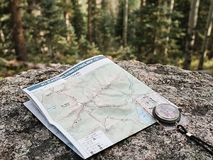
Map
Budget pickWaterproof topographic map of the park's trails.
Nat Geo Trails Illustrated Great Smoky Mountains Map #229
As an Amazon Associate, Love Hiking Trails earns from qualifying purchases.
Photos

Featured in: The Best Hikes Near Asheville, North Carolina, The Best Hikes in North Carolina
Ratings & Comments
—
No ratings yet
Sign in to rate this trail and leave a comment.
No comments yet. Share what the trail was like for you.
Nearby
More in North Carolina
Nearby bike trails
Nearby off-road
Trails nearby
 ChallengingHike
Kuwohi (Clingmans Dome)
Great Smoky Mountains National Park, North Carolina
At 6,643 feet, Kuwohi is the highest point in Great Smoky Mountains National Park and in Tennessee, and the third-highest summit east of the Mississippi River. A short, steep, paved path leads from the parking area to an observation tower with a 360-degree view over a sea of blue ridges.
Distance
1 mi
Difficulty
Challenging
Type
Out-and-back (optional bypass trail)
 ChallengingHike
Andrews Bald
Great Smoky Mountains National Park, North Carolina
Picture a high, open meadow ringed by spruce and fir, with blueberry bushes and blooming azaleas at your feet and blue ridgelines stacked to the horizon. That's Andrews Bald.
Distance
3.6 mi
Difficulty
Challenging
Type
Out-and-back (downhill first)
 ChallengingHike
Charlies Bunion
Great Smoky Mountains National Park, Tennessee
A rocky knuckle of the Appalachian Trail with a dizzying view over the Smokies.
Distance
8 mi
Difficulty
Challenging
Type
Out and back
More trails to explore
More in Great Smoky Mountains National Park
More trails in North Carolina
More hikes nearby
Frequently asked questions
How long is the Deep Creek waterfall loop?
2.4 miles (3.9 km), passing Juney Whank, Indian Creek, and Tom Branch falls.
Is Deep Creek open after Hurricane Helene?
As of October 2026, NPS does not list the Deep Creek waterfall loop trails as closed. Always check the park's closures page before you go.
Where do I park?
At the end of Deep Creek Road past the campground. Display a parking tag.
Are dogs allowed on the Deep Creek trails?
No. The nearby Oconaluftee River Trail is one of the park's two pet-friendly trails.
Can I swim or tube at Deep Creek?
NPS does not recommend water recreation in the park because of drowning and injury risk.
Which waterfall is the best?
Juney Whank is the most dramatic up close; Indian Creek Falls is the widest.
How long is the Deep Creek Waterfalls Loop hike?
Deep Creek Waterfalls Loop is 2.4 miles with 500 feet of elevation gain. Most hikers complete it in 1.5–2.5 hours.
How difficult is Deep Creek Waterfalls Loop?
We rate it Moderate (2 out of 5) for Great Smoky Mountains National Park. That reflects its distance, 500 ft of climbing, and terrain.
When is the best time to hike Deep Creek Waterfalls Loop?
The best window is Spring for flow and wildflowers; fall for color; year-round access. Always check current conditions and weather before you go.
Do I need a permit or reservation for Deep Creek Waterfalls Loop?
Yes — access is managed. No permit. Parking tag required ($5 daily, $15 weekly, $40 annual). There's a parking tag machine at Deep Creek Picnic Area.. Check the official Great Smoky Mountains National Park page before you go.