

Cookeville is the hub of Tennessee's waterfall country. The rivers of the Upper Cumberland cut down through the edge of the Cumberland Plateau, so within about an hour and a half you can see a 75-ft swimming-hole falls, the state's tallest waterfall and a falls that pours out of a cave. Every hike below is in a Tennessee State Park or state natural area, and all are free to enter.
Drive times are approximate, from downtown Cookeville. Waterfall flow on the plateau is strongest from late fall through spring and after rain, and it can drop sharply in late-summer dry spells. Several of these parks also have strict hours or permit rules, noted below.
The Best Hikes Near Cookeville

Photo: Ichabod, CC BY-SA 3.0, via Wikimedia Commons. Burgess Falls State Park, Tennessee
Drive
About 25 min (11 mi)
Distance
1.5-mile loop (River Trail out, service road back)
Difficulty
Moderately strenuous (park rating)
Best for
Four waterfalls in one short walk
The River Trail follows the Falling Water River past a series of four waterfalls and ends at an overlook above the biggest, Burgess Falls. There's no access to the base. Parking is extremely limited in 2026 because of visitor center construction: the upper lot is closed, and RVs and trailers can't park. Main trailhead hours change with the season.

Photo: Brian Stansberry, CC BY 3.0, via Wikimedia Commons. Cummins Falls State Park, Tennessee
Drive
About 25 min (12 mi)
Distance
About 0.4 mi each way to the overlook; a little over a mile each way to the base
Difficulty
Very strenuous to the base (park rating)
Best for
A 75-ft waterfall with a swimming hole
Cummins Falls drops 75 ft on the Blackburn Fork State Scenic River, about 9 miles north of Cookeville. To enter the gorge or reach the base, you need a Gorge Access Permit. Permits are limited, sold online in advance and non-refundable. The route to the base is rugged and wet, and the gorge can flash-flood within minutes. The park also has extra rules for young children.

Photo: Michael W. Neu, Public domain, via Wikimedia Commons. Rock Island State Park, Tennessee
Drive
About 50 min (34 mi)
Distance
The Twin Falls Overlook is a short walk from parking; the Downstream Trail is 1.55 mi one way
Difficulty
Moderate (Downstream Trail); difficult on the gorge trails
Best for
Gorge waterfalls with an easy overlook
Twin Falls is the tallest waterfall in the park, which also protects the horseshoe-shaped Great Falls and the gorge below it. TVA water releases can close the gorge trails and make the river dangerous without warning, so check the park's alert before you go. Swimming and wading below the powerhouse aren't allowed, and roadside parking is prohibited.

Photo: Brian Stansberry, CC BY 3.0, via Wikimedia Commons. Ozone Falls State Natural Area, Tennessee
Drive
About 1 hr (48 mi)
Distance
A short walk to the top of the falls; about 3/4 mi one way into the gorge
Difficulty
Easy above; rugged in the gorge
Best for
A 110-ft plunge right off US-70
Fall Creek drops 110 ft into a pool before disappearing underground. The small natural area is open sunrise to sunset, and rappelling isn't allowed. It's best after rain.

Photo: Ichabod, CC BY-SA 3.0, via Wikimedia Commons. Fall Creek Falls State Park, Tennessee
Drive
About 1 hr 5 min (43 mi)
Distance
0.7 mi round trip from the overlook lot to the base, or about 2.6 mi round trip from the Nature Center
Difficulty
Difficult (a very strenuous climb back out)
Best for
Tennessee's tallest waterfall (256 ft)
The Base of Falls Trail drops steeply to the base of Tennessee's highest waterfall. The rim overlook alone is worth the trip if you'd rather skip the climb. Some trails in the park have been closed since a 2023 tornado.

Photo: Silent melanie, Public domain, via Wikimedia Commons. Virgin Falls State Natural Area, Tennessee
Drive
About 1 hr 10 min (36 mi)
Distance
8.6 mi round trip
Difficulty
Strenuous (more than 1,000 ft lost and regained)
Best for
A full-day adventure to a falls that pours from a cave
At the end of the trail in Scott's Gulf, a 110-ft waterfall pours out of a cave. The park suggests allowing 5–8 hours. Hikers may not start after 2 pm, and you should carry a headlamp.
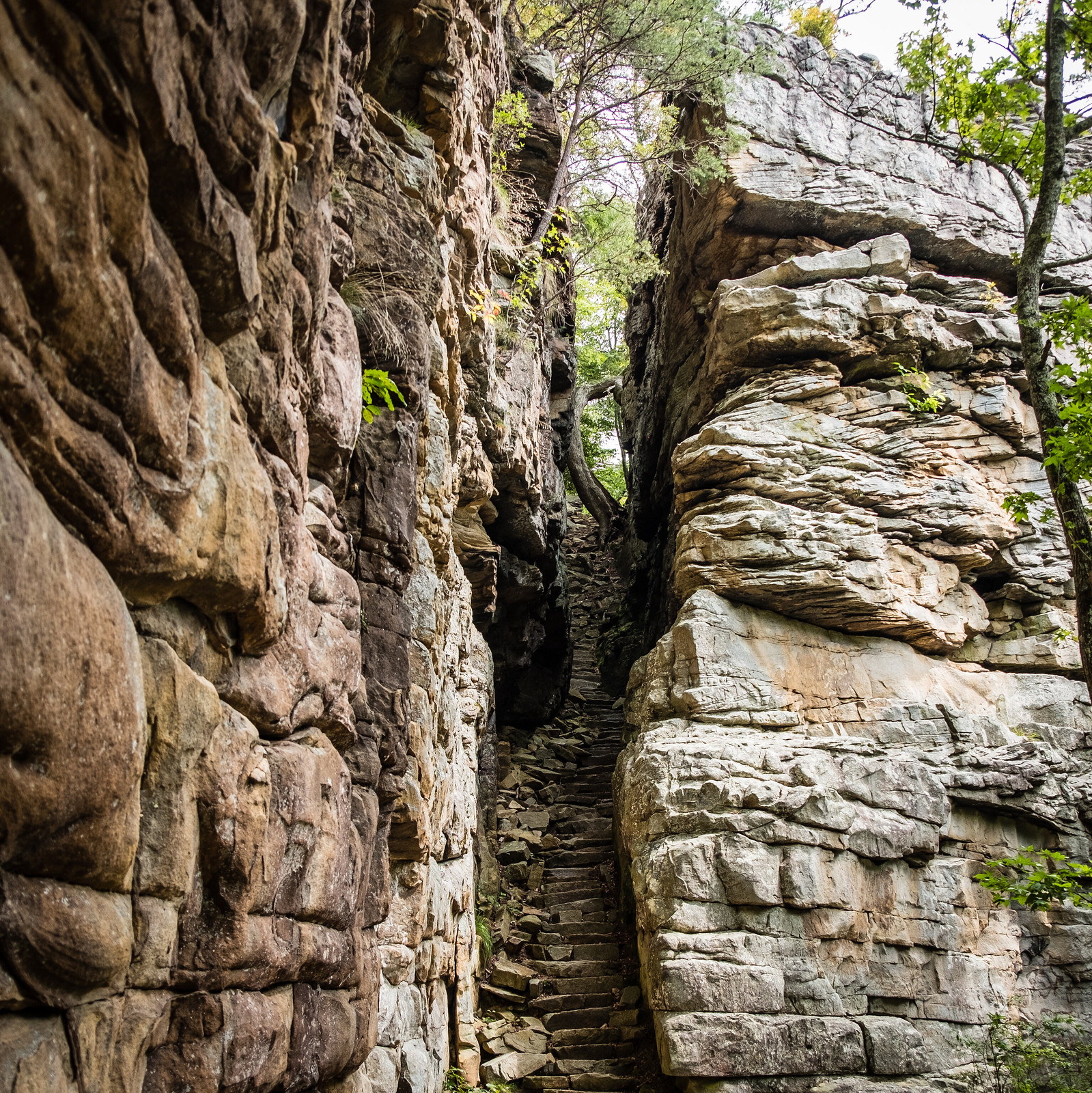
Photo: Sharon Mollerus, CC BY 2.0, via Flickr. Savage Gulf State Park, Tennessee
Drive
About 1 hr 35 min (66 mi)
Distance
0.9 mi one way
Difficulty
Easy
Best for
Big gorge views on an easy walk
A mostly level rim trail, paved for its first 0.2 mi to Laurel Gulf Overlook, leads to the Stone Door. That's where the Big Creek Gulf Trail drops steeply through the bluff into the gorge. The ranger station has accessible parking and restrooms.

Photo: Sharon Mollerus, CC BY 2.0, via Wikimedia Commons. Savage Gulf State Park, Tennessee
Drive
About 1 hr 35 min (approximate)
Distance
0.8 mi loop (park trail map)
Difficulty
Moderate
Best for
Three waterfalls in under a mile
Three waterfalls, a blue swimming hole and a spiral staircase at the Savage Gulf West Trailhead. The 45-space lot can fill on summer weekends.
Quick Tips for Hiking Near Cookeville
- Book Cummins Falls gorge permits early. Daily numbers are limited, and permits aren't refundable.
- Watch the clock: Burgess Falls and Cummins Falls have set hours, and Virgin Falls bars starts after 2 pm.
- Check TVA releases before you visit Rock Island's gorge.
- Parking is tight at Burgess Falls in 2026. Go on a weekday morning.
- Wear shoes with grip. Plateau sandstone and gorge rocks are slick when wet.
Frequently asked questions
Are the waterfall hikes near Cookeville free?
Yes. Tennessee State Parks don't charge entry. Cummins Falls requires a paid Gorge Access Permit only to enter the gorge or reach the base of the falls.
What's the easiest waterfall near Cookeville?
Twin Falls Overlook at Rock Island and the top of Ozone Falls are both short walks from parking. Stone Door is an easy 0.9-mile walk each way.
Can you swim at Cummins Falls?
Yes, in fair weather with a Gorge Access Permit. The park warns that the gorge can flood within minutes and closes it when conditions are unsafe.
What's the hardest hike near Cookeville?
Virgin Falls: 8.6 miles round trip, with more than 1,000 ft of descent you'll have to climb back out.
When is the best time to see the waterfalls?
Late fall through spring and after rain, when flow is strongest. October and early November add fall color.
Gear for Cookeville Waterfall Hikes
Water shoes for creek crossings
Water Hiking Shoes
Check price on AmazonWaterproof phone pouch
Waterproof Phone Pouch
Check price on AmazonBlack Diamond Spot headlamp
Black Diamond Spot 450 Headlamp
Check price on AmazonDarn Tough hiking socks
Darn Tough Hiker Micro Crew Cushion
Check price on Amazon
As an Amazon Associate, Love Hiking Trails earns from qualifying purchases.
Sources
Trail facts were checked against official park, forest and agency pages in October 2026. Conditions change, so check the official page before you go.
Drive times are approximate routing estimates from downtown, rounded to 5 minutes, and don't include traffic.
- tnstateparks.com/parks/burgess-falls
- tnstateparks.com/parks/cummins-falls
- reserve.tnstateparks.com/cummins-falls/permits
- tnstateparks.com/parks/rock-island
- tn.gov/environment/natural-areas/what-we-do/sna/cu/ozone-falls.html
- tnstateparks.com/parks/fall-creek-falls
- tnstateparks.com/parks/scotts-gulf
- tnstateparks.com/parks/savage-gulf
- tnstateparks.com/sites/default/files/2026-02/FallCreekFalls_faq_of_the_park.pdf