

At a glance
Distance
Elevation gain
Difficulty
Route type
Time
Permit required
Fees
Dogs
Best season
Official park info: Rock Island State Park
Rock Island is where three rivers (the Caney Fork, Collins, and Rocky) meet at the head of Center Hill Lake, cutting a slick limestone gorge full of waterfalls. The star is Twin Falls, the park's tallest waterfall, which pours out of the bluffs in dozens of ribbons.
Overview
TVA's Great Falls Dam and Powerhouse can release water on an irregular schedule that "may change day to day or even hour to hour." The park states:
- All river gorge areas downstream of the TVA dam are closed when the dam is in active spill mode or a discharge is likely that day.
- Gorge access depends on TVA approval based on hourly release predictions, and closures can happen without notice.
- Swimming or wading is not permitted downstream of the Powerhouse at any time, regardless of releases. That includes the Blue Hole.
- If you hear sirens or see water rising, get out immediately.
Before you go: Check TVA's Great Falls page (tva.gov/Environment/Lake-Levels/Great-Falls) and the park's alert banner.
The park covers more than 2,000 acres. Besides Twin Falls, you'll find Great Falls, a horseshoe-shaped waterfall below the historic Falls City Cotton Mill (operated 1892–1902), and swimming spots called the Cold Hole and Warm Hole when the gorge is open. Twin Falls flows from the Collins River out of limestone bluffs into the Caney Fork River, forming the headwaters of Center Hill Lake.
- Collins River Loop: 2.95 mi, moderate; wooded loop on the Collins River peninsula.
- Bluff Trail: 1.95-mi lollipop with a Center Hill Lake overlook spur (hikers and bikers).
- Eagle Trail: 0.75 mi; arboretum walk to a waterfall overlook.
- Moonshine Trail: 0.35 mi past an old still.
Plan your visit
Parking
Free. Large lot at the end of Powerhouse Road. Don't park on roadsides.
When to go
Spring for wildflowers and flow; summer for the Cold Hole (when the gorge is open); fall color
Spring has strong flow and wildflowers along the Downstream Trail. Summer is peak season. Arrive early, and check TVA releases the same morning. Fall brings color reflected in the gorge. Weekdays are much calmer.
Good to know
Leashed pets generally allowed in TN State Parks
Trailhead map
Trailhead at 35.8088, -85.6335. Confirm current trail conditions before you go.
Where to stay near Twin Falls
Find hotels and rentals near Twin Falls
We may earn a commission if you book a stay through these links, at no extra cost to you. Prices and availability come from booking partners and can change. We never rank trails by commission.
Route, step by step
1. Twin Falls Overlook. Park at the large lot at the end of Powerhouse Road. A short walk brings you to the Twin Falls Overlook, the park's iconic view. If the gorge is closed, this is still worth the trip.
2. Downstream Trail (1.55 mi one way, moderate). From the overlook, the Downstream Trail follows a very steep bluff line above the river, with views of the Blue Hole, Twin Falls, Little Falls, seeps, spring wildflowers, and rock formations. Turn around when you've had your fill.
Show full route
3. Blue Hole Trail (0.15 mi, difficult). A short, steep spur down to the Blue Hole, a popular fishing spot. No swimming here, since it's downstream of the powerhouse.
4. Upstream Trail (0.2 mi, difficult). Also starting at Twin Falls Overlook, this trail is the way down to Great Falls, the Warm Hole, and the Cold Hole. It's strenuous, but the park says it's less steep than the Old Mill climb. Only go when the gorge is open.
5. Old Mill Gorge Trail (0.1 mi, difficult). From the Old Mill picnic area, staircases lead into the gorge. The park warns it's "steep, wet, rocky, and may not be suitable for all hikers."
Tips
- Check TVA releases the morning of your visit and again before entering the gorge.
- Wear grippy shoes. The limestone is extremely slick. The park also encourages life jackets in gorge areas.
- Don't park on roadsides. If the park is full, the park suggests visiting another state park nearby.
- No alcohol in the gorge. The park lists avoiding alcohol among its safety tips.
Tips
- Free. Large lot at the end of Powerhouse Road. Don't park on roadsides.
What to bring & gear
- Grippy water shoes: water hiking shoes
- Life jacket for gorge swimming: PFD life jacket
- Dry bag: 10L dry bag
- Polarizing filter: circular polarizer filter
- Water bottle: water bottle
- Sun protection: hat, sunscreen, sunglasses
- Trail snacks or a packed lunch
- Insect repellent
Picks sized for a 1.6-mile, 30 minutes (overlook) to 2–3 hour hike.
Our gear picks
Our picks for this hike. Compare current prices at Amazon.
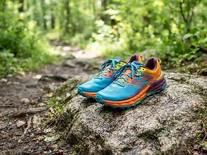
Trail Runners
Our pickClassic out-of-the-box comfort for easy miles.
Merrell Moab 3

Daypack
Our pickCompact, well-built daypack that packs down small.
Osprey Daylite Plus
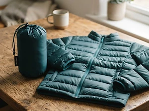
Insulation
Our pickWarmth that compresses into its own pocket.
Packable Puffer Jacket
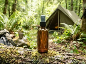
Insect Repellent
Budget pickLong-lasting protection without the DEET smell.
Sawyer 20% Picaridin Insect Repellent Spray

Trekking Poles
Our pickSaves your knees on steep descents.
Cascade Mountain Tech Carbon Fiber Trekking Poles

Traction
Our pickGrip for icy or early-season snowy trail sections.
Kahtoola MICROspikes
As an Amazon Associate, Love Hiking Trails earns from qualifying purchases.
Photos

Featured in: The Best Hikes Near Cookeville, Tennessee, The Best Hikes Near Nashville, Tennessee
Ratings & Comments
—
No ratings yet
Sign in to rate this trail and leave a comment.
No comments yet. Share what the trail was like for you.
Nearby
Nearby bike trails
Trails nearby
 ModerateHike
Burgess Falls
Burgess Falls State Park, Tennessee
Burgess Falls is one of the biggest waterfall payoffs in Middle Tennessee for the effort. A short trail along the Falling Water River passes four waterfalls in a little over half a mile, ending at an overlook of the main falls as it plunges into a deep gorge.
Distance
1.5 mi
Difficulty
Moderate
Type
Loop
 StrenuousHike
Fall Creek Falls
Fall Creek Falls State Park, Tennessee
At 256 feet, Fall Creek Falls is the highest waterfall in Tennessee and one of the tallest in the eastern United States. Standing at its base, watching the water fall in a long white ribbon into a huge rock amphitheater, is one of the great short hikes in the Southeast.
Distance
2.6 mi
Difficulty
Strenuous
Type
Out-and-back
 ExpertHike
Virgin Falls
Virgin Falls State Natural Area, Tennessee
A creek rushes out of a cave, falls about 110 feet over sculpted rock, and then disappears into another cave below. That's Virgin Falls, and there's nothing else quite like it in Tennessee.
Distance
8.6 mi
Difficulty
Expert
Type
Out-and-back (optional short loop near the falls via Sheep Cave Trail)
More trails to explore
More hikes nearby
Frequently asked questions
Can you swim at Twin Falls or the Blue Hole?
No. Swimming and wading aren't permitted downstream of the TVA Powerhouse at any time, and that includes the Blue Hole.
Where can you swim at Rock Island?
The Cold Hole is a summer swimming spot when the gorge is open, and there's a natural sand beach on Center Hill Lake.
Why is the Rock Island gorge closed?
TVA water releases. Gorge areas close when the dam is spilling or a discharge is likely.
How long is the Downstream Trail?
1.55 miles one way.
Is Rock Island free?
Yes. Tennessee State Parks don't charge an entrance fee.
How long is the Twin Falls hike?
Twin Falls is 1.55 miles. Most hikers complete it in 30 minutes (overlook) to 2–3 hours.
How difficult is Twin Falls?
We rate it Challenging (3 out of 5) for Rock Island State Park. That reflects its distance and terrain.
When is the best time to hike Twin Falls?
The best window is Spring for wildflowers and flow; summer for the Cold Hole (when the gorge is open); fall color. Always check current conditions and weather before you go.
Do I need a permit or reservation for Twin Falls?
No special trail permit is required. Free. Large lot at the end of Powerhouse Road. Don't park on roadsides..
Are dogs allowed on the Twin Falls trail?
Leashed pets generally allowed in TN State Parks. Bring water for your dog and follow the area's pet rules.