

At a glance
Distance
Elevation gain
Difficulty
Route type
Time
Permit required
Fees
Dogs
Best season
Official park info: Cummins Falls State Park
Cummins Falls is a 75-foot, stair-stepped waterfall that pours into a natural swimming pool on the Blackburn Fork State Scenic River, about an hour and a half east of Nashville near Cookeville. It's one of Middle Tennessee's favorite summer adventures, and also one of its most misunderstood.
Overview
Here's how the permit works, what the route is really like, and how to do it safely.
Cummins Falls State Park is a day-use park in Jackson County, nine miles north of Cookeville on Tennessee's Eastern Highland Rim. The land has a rich past. John Cummins acquired it around 1825 and built a water-powered mill; the mill was washed away in the great flood of 1928. The Cummins family held the land for more than 180 years before it became a state park.
The falls drop 75 feet in a series of ledges into a broad plunge pool. That shape is what makes them so photogenic and so popular for swimming. The gorge is also prone to flash flooding. Rain upstream can raise the water "in a matter of minutes," even when it's sunny at the park. That's why the permit system exists: it caps how many people are in the gorge and lets staff know who's down there if they need to clear it.
Plan your visit
Getting there
Park office address: 390 Cummins Falls Lane, Cookeville, TN 38501 (931-268-7223). From I-40, take exit 280 to TN-56 North toward Gainesboro for 7.7 miles. Turn right on TN-290 for 0.9 mile, left on Cummins Mill Road for 3.1 miles, then left on Blackburn Fork Road for 0.2 mile. The park runs on Central Time. The main parking area, visitor center, restrooms, and trailheads all sit above the falls.
Parking
Free park entry and parking. A Gorge Access Permit is required to enter the gorge or visit the base. Permits are limited, sold online in advance, and non-refundable.
Permits & fees
- Who needs one: Anyone entering the gorge or going to the base of the waterfall. The overlook trails don't require a permit.
- Where to buy: Online at reserve.tnstateparks.com/cummins-falls/permits. The park recommends buying in advance because daily quantities are limited. When we checked the booking calendar, it showed roughly 200 permits on weekdays and 300 on weekends and holidays.
- Cost: Third-party guides and recent visitor reports cite $7 per person. Confirm the current price at checkout.
- Purchase limit: Up to 12 permits per transaction.
- Refund policy: No refunds or rain checks. Per the park brochure, date changes may be possible if you notify the park before your date, and if the gorge closes while you're at the park with a permit, you'll get a rain check.
- Weather closures: The gorge may close without warning. Check the Cummins Falls State Park Facebook page, where staff post closure alerts.
When to go
Late May–September for swimming; spring and fall for cooler hiking. Only on fair-weather days.
Trailhead map
Trailhead at 36.2530, -85.5663. Confirm current trail conditions before you go.
Where to stay near Cummins Falls
Find hotels and rentals near Cummins Falls
We may earn a commission if you book a stay through these links, at no extra cost to you. Prices and availability come from booking partners and can change. We never rank trails by commission.
Route, step by step
1. Parking lot to the Falls Overlook (about 0.4 mi). Follow the Falls Overlook Trail (mixed surface, easy) to the overlook on the bluff. This view alone is worth the drive. Wheelchair users can reserve one of the park's two all-terrain wheelchairs for this trail.
2. Descend to the river (about 0.35 mi). From the overlook, continue on the Blackburn Fork River Trail. It runs along the bluff edge and then drops steeply to the riverbank. Expect stairs, roots, and loose, uneven ground. The wooden steps can be slick.
Show full route
3. The gorge route upstream (about 0.5 mi). Now you're in the riverbed. Head upstream toward the falls, crossing the river and picking your way over boulders, cobbles, and slippery ledges. There's no built trail here. Stay with the main route, keep your hands free, and test each step.
4. At the falls. The plunge pool is open for swimming, but there are no lifeguards. Children 12 and under must wear a U.S. Coast Guard–approved life jacket and be with an adult. The park recommends that children 5 and under not go to the falls at all. Fishing isn't allowed in the plunge pool, and pool floats aren't permitted.
5. Hike out by 5 p.m. In season, the gorge closes at 5 p.m., and everyone must start walking out then to be out of the park by 6 p.m. The climb back up the river trail is the hardest part of the day.
If the water rises, or turns muddy and fast, leave the base right away. Don't wait for an announcement.
Tips
- Book weekdays. Weekend permits go first.
- Watch the multi-day forecast, including rain upstream, not just in Cookeville.
- Pack light. The park advises bringing only what fits in a small backpack. Coolers aren't allowed in the gorge. Eat at the picnic area across the road, and carry just snacks and water down.
- No alcohol anywhere in the park.
- Bring your own life jacket. The park has only a limited supply of loaners.
- Wear real footwear. Flip-flops are not recommended. Closed-toe water shoes or hiking sandals with grippy soles are best.
- Dogs: Leashed pets are allowed, but slick rock and moving water are hard on dogs. Many owners take them to the overlook only.
- Pair it with Burgess Falls, about 30 minutes away, for a two-waterfall day.
Tips
- Free park entry and parking. A Gorge Access Permit is required to enter the gorge or visit the base. Permits are limited, sold online in advance, and non-refundable.
What to bring & gear
- Closed-toe water shoes with sticky rubber: closed-toe water hiking shoes
- USCG-approved life jackets (required for kids 12 and under): youth USCG life jacket / adult USCG life vest
- Small dry bag for phone and keys: 10L dry bag
- Waterproof phone case: waterproof phone pouch
- Small backpack: packable daypack
- Water bottles: insulated water bottle
- Quick-dry towel: microfiber travel towel
- Reef-safe sunscreen: mineral sunscreen SPF 50
- Dry change of clothes for the car: quick-dry hiking shorts
- Trekking poles for the steep sections
- Headlamp and extra batteries
- Map or offline GPS route
- Insect repellent
Picks sized for a 2.5-mile, 2–4 hours including time at the falls hike.
Our gear picks
Our picks for this hike. Compare current prices at Amazon.

Hiking Boots
Our pickBurly support for heavy loads and long climbs.
Salomon Quest 4 GTX

Water Filter
Budget pickReliable squeeze filter with a long service life.
Sawyer Squeeze Water Filter
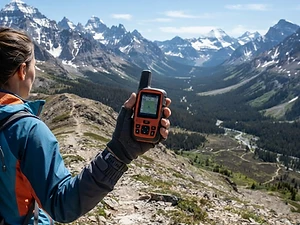
Satellite Messenger
Premium pickTwo-way messaging and SOS far from cell signal.
Garmin inReach Mini 2

Trekking Poles
Our pickSaves your knees on steep descents.
Cascade Mountain Tech Carbon Fiber Trekking Poles

Rain Jacket
Our pickBreathable storm shell with pit zips for climbs.
Outdoor Research Foray II

Traction
Our pickGrip for icy or early-season snowy trail sections.
Kahtoola MICROspikes
As an Amazon Associate, Love Hiking Trails earns from qualifying purchases.
Photos

Featured in: The Best Hikes Near Cookeville, Tennessee, The Best Hikes in Tennessee, The Best Hikes Near Nashville, Tennessee
Ratings & Comments
—
No ratings yet
Sign in to rate this trail and leave a comment.
No comments yet. Share what the trail was like for you.
Nearby
Nearby bike trails
Trails nearby
 ModerateHike
Burgess Falls
Burgess Falls State Park, Tennessee
Burgess Falls is one of the biggest waterfall payoffs in Middle Tennessee for the effort. A short trail along the Falling Water River passes four waterfalls in a little over half a mile, ending at an overlook of the main falls as it plunges into a deep gorge.
Distance
1.5 mi
Difficulty
Moderate
Type
Loop
 ChallengingHike
Twin Falls
Rock Island State Park, Tennessee
Rock Island is where three rivers (the Caney Fork, Collins, and Rocky) meet at the head of Center Hill Lake, cutting a slick limestone gorge full of waterfalls. The star is Twin Falls, the park's tallest waterfall, which pours out of the bluffs in dozens of ribbons.
Distance
1.55 mi
Difficulty
Challenging
Type
Out-and-back
 ExpertHike
Virgin Falls
Virgin Falls State Natural Area, Tennessee
A creek rushes out of a cave, falls about 110 feet over sculpted rock, and then disappears into another cave below. That's Virgin Falls, and there's nothing else quite like it in Tennessee.
Distance
8.6 mi
Difficulty
Expert
Type
Out-and-back (optional short loop near the falls via Sheep Cave Trail)
More trails to explore
More hikes nearby
Frequently asked questions
Do I need a permit for Cummins Falls?
Only to enter the gorge or reach the base of the falls. The overlook and other park trails are permit-free, and the park is free to enter.
How much is the Cummins Falls permit?
Recent third-party reports put it at $7 per person. Check the official booking page for the current price.
How long is the hike to the bottom of Cummins Falls?
The park says it's a little over a mile from the parking lot to the falls, so plan on about 2–2.5 miles round trip.
Is the Cummins Falls hike hard?
Yes. The park calls it very strenuous: steep descents, river wading, rock climbing, and slippery rocks, then a steep climb out.
Can kids go?
The park recommends that children 5 and under not go to the falls. Children 12 and under must wear a life jacket at the falls and be accompanied by an adult.
Are dogs allowed at Cummins Falls?
Yes, on a leash and under control. Clean up after them.
What happens if it rains?
The gorge can close without warning because of flash-flood risk. Permits aren't refundable, but if the gorge closes while you're at the park with a permit, you'll get a rain check.
How difficult is Cummins Falls?
We rate it Expert (5 out of 5) for Cummins Falls State Park. That reflects its distance and terrain.
When is the best time to hike Cummins Falls?
The best window is Late May–September for swimming; spring and fall for cooler hiking. Only on fair-weather days.. Always check current conditions and weather before you go.