

At a glance
Distance
Elevation gain
Difficulty
Route type
Time
Permit required
Fees
Dogs
Best season
Official park info: Virgin Falls State Natural Area
A creek rushes out of a cave, falls about 110 feet over sculpted rock, and then disappears into another cave below. That's Virgin Falls, and there's nothing else quite like it in Tennessee.
Overview
It's about a two-hour drive from Nashville, and well worth a full day.
Virgin Falls sits in Scott's Gulf Wilderness State Park, a 9,566-acre wilderness on the edge of the Cumberland Plateau near Sparta. Older guides call it the "Virgin Falls Pocket Wilderness" or "Virgin Falls State Natural Area." Bowater set it aside as a pocket wilderness in 1973, and the State of Tennessee bought it in 2012. Today Tennessee State Parks manages it as part of Scott's Gulf.
The hike starts on the plateau in oak-hickory forest and drops into the gorge, where the forest turns to hemlock and rich mixed hardwoods: tulip poplar, buckeye, basswood, yellow birch, and sycamore. Mountain laurel and wild blueberries crowd the trail. You'll pass Big Branch Falls and Big Laurel Falls on the way in, with optional side trips to Sheep Cave Falls and the Caney Fork River.
Plan your visit
Getting there
Park at the Virgin Falls Trailhead, 2080 Scott's Gulf Road, Sparta. The park office and Dog Cove Trailhead are at 6747 Lost Creek Road (931-739-6747). The park also runs occasional guided Virgin Falls Shuttle events; check the events calendar if you'd like a one-way through-hike.
Plan your start time. Park management advises not starting longer hikes after 2:00 p.m. and recommends carrying a headlamp.
Parking
Free; no hiking permit. Trailhead at 2080 Scott's Gulf Rd, Sparta, TN 38583. Backcountry campsites require a reservation and fee.
When to go
Late fall through spring for flow and cooler temps; avoid days after very heavy rain (cable crossing)
Good to know
Leashed pets are generally allowed in Tennessee State Parks; call the park to confirm for this trail
Trailhead map
Trailhead at 35.8541, -85.2822. Confirm current trail conditions before you go.
Where to stay near Virgin Falls
Find hotels and rentals near Virgin Falls
We may earn a commission if you book a stay through these links, at no extra cost to you. Prices and availability come from booking partners and can change. We never rank trails by commission.
Route, step by step
The park's official mileposts make this one easy to follow:
0.15 mi: Upland Trail junction. Stay left on the Virgin Falls Trail. (The Upland Trail on the right is part of an optional loop; see below.)
Show full route
1.05 mi: Hemlock Springs Trail junction. Stay right on the Virgin Falls Trail. Remember this junction: Hemlock Springs is your high-water bypass around the cable crossing.
1.35 mi: Big Branch Falls. Your first waterfall, a pretty spot for a quick break.
1.6 mi: The Cable Crossing over Big Laurel Creek. You'll ford the creek with a cable for balance. After heavy rain this crossing can be high and dangerous. If it looks fast or deep, go back and take the Hemlock Springs Trail, which rejoins the main trail farther on. Backcountry campsites sit across the creek here.
1.8 mi: Upland Trail junction (other end). Stay left.
2.4 mi: Big Laurel Falls. This is the last water source on the trail until Virgin Falls, so top off and treat it here. Big Laurel Falls pours over a wide overhang and is one of the best stops of the day.
2.5 mi: Hemlock Springs Trail rejoins from the left. Continue right on the Virgin Falls Trail.
3.6 mi: Start of the loop. Sheep Cave Trail goes right; the Virgin Falls Trail goes left. Take either. The 0.85-mile Sheep Cave Trail visits a karst feature where a waterfall drops into a large sinkhole, and it rejoins near Virgin Falls.
4.0 mi: Caney Fork campsites on the left. Continue on the Virgin Falls Trail.
4.3 mi: Virgin Falls. Watch the creek come out of the cliff, fall, and vanish into the ground. Rest, eat, and refuel. Then remember: the hard part is still ahead. The climb out regains everything you lost.
Return the way you came, or close the Sheep Cave loop first.
Optional variations
- Upland Trail loop (about 5 miles): Combine the Upland Trail with the main trail for a shorter loop to Martha's Pretty Point, an overlook with the Caney Fork River about 900 feet below. Note that this loop does not reach Virgin Falls.
- Rylander Cascades approach: The Rylander Cascades Trail reaches Virgin Falls in 3.8 miles from the Rylander parking area. With a shuttle, you can link it with the Virgin Falls Trail for an 8.5-mile through-hike.
Tips
- Start early. 5–8 hours is realistic. Late starters get caught climbing out at dusk.
- Carry enough water, or a filter for Big Laurel Falls (the last reliable source). Treat all water.
- Check recent rainfall. High water affects the cable crossing and the Caney Fork campsites.
- Hunting seasons: Parts of nearby trails on TWRA land (like the Polly Branch Trail) close during big game hunts. Wear some bright color in fall.
- Camping: Virgin Falls and Caney Fork campsites are primitive (no water or electricity). Reserve through Tennessee State Parks, and don't camp above Virgin Falls.
- Leave No Trace. This is a protected natural area. Pack out all trash.
Tips
- Free; no hiking permit. Trailhead at 2080 Scott's Gulf Rd, Sparta, TN 38583. Backcountry campsites require a reservation and fee.
What to bring & gear
- Sturdy hiking boots with ankle support: mid-height hiking boots
- Trekking poles (a big help on the climb out): aluminum trekking poles
- 3 liters of water capacity: 3L hydration bladder
- Water filter or purification tablets: gravity water filter / water purification tablets
- Headlamp (recommended by the park): rechargeable headlamp
- Water shoes or quick-dry socks for the cable crossing: hiking sandals
- Lunch and high-calorie snacks: energy bars variety pack
- Printed trail map (signal is poor in the gorge): waterproof map case
- First-aid and blister kit: blister care kit
- For an overnight: 2-person backpacking tent, bear-resistant food bag
- Sun protection: hat, sunscreen, sunglasses
- Emergency layers and a small first-aid kit
- Rain shell
- Insect repellent
Picks sized for a 8.6-mile, 5–8 hours (the park's guidance) hike.
Our gear picks
Our picks for this hike. Compare current prices at Amazon.

Hiking Boots
Our pickBurly support for heavy loads and long climbs.
Salomon Quest 4 GTX

Water Filter
Budget pickReliable squeeze filter with a long service life.
Sawyer Squeeze Water Filter
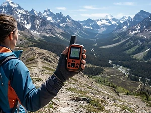
Satellite Messenger
Premium pickTwo-way messaging and SOS far from cell signal.
Garmin inReach Mini 2

Trekking Poles
Our pickSaves your knees on steep descents.
Cascade Mountain Tech Carbon Fiber Trekking Poles

Rain Jacket
Our pickBreathable storm shell with pit zips for climbs.
Outdoor Research Foray II

Traction
Our pickGrip for icy or early-season snowy trail sections.
Kahtoola MICROspikes
As an Amazon Associate, Love Hiking Trails earns from qualifying purchases.
Photos

Featured in: The Best Hikes Near Cookeville, Tennessee, The Best Hikes in Tennessee, The Best Hikes Near Nashville, Tennessee
Ratings & Comments
—
No ratings yet
Sign in to rate this trail and leave a comment.
No comments yet. Share what the trail was like for you.
Nearby
Nearby bike trails
Nearby off-road
Trails nearby
 StrenuousHike
Fall Creek Falls
Fall Creek Falls State Park, Tennessee
At 256 feet, Fall Creek Falls is the highest waterfall in Tennessee and one of the tallest in the eastern United States. Standing at its base, watching the water fall in a long white ribbon into a huge rock amphitheater, is one of the great short hikes in the Southeast.
Distance
2.6 mi
Difficulty
Strenuous
Type
Out-and-back
 ChallengingHike
Twin Falls
Rock Island State Park, Tennessee
Rock Island is where three rivers (the Caney Fork, Collins, and Rocky) meet at the head of Center Hill Lake, cutting a slick limestone gorge full of waterfalls. The star is Twin Falls, the park's tallest waterfall, which pours out of the bluffs in dozens of ribbons.
Distance
1.55 mi
Difficulty
Challenging
Type
Out-and-back
 ModerateHike
Burgess Falls
Burgess Falls State Park, Tennessee
Burgess Falls is one of the biggest waterfall payoffs in Middle Tennessee for the effort. A short trail along the Falling Water River passes four waterfalls in a little over half a mile, ending at an overlook of the main falls as it plunges into a deep gorge.
Distance
1.5 mi
Difficulty
Moderate
Type
Loop
More trails to explore
More hikes nearby
Frequently asked questions
How long is the Virgin Falls hike?
4.3 miles one way, 8.6 miles round trip, per Tennessee State Parks.
How hard is the Virgin Falls Trail?
Strenuous. You descend more than 1,000 feet into the gorge and regain it on the way out. Plan 5–8 hours.
Is there an entrance fee or permit?
No. Tennessee State Parks are free to enter, and day hiking doesn't require a permit. Overnight campsites must be reserved.
What is the cable crossing?
A ford of Big Laurel Creek at mile 1.6 with a cable for balance. In high water, use the Hemlock Springs Trail to bypass it.
Can I camp at Virgin Falls?
Yes, at designated primitive sites (Virgin Falls Campground and Caney Fork campsites) by reservation. Camping above Virgin Falls is not allowed.
Can I bring my dog?
Tennessee State Parks generally allow leashed pets, but rules vary by park and trail. Call Scott's Gulf at 931-739-6747 to confirm.
What's the best time of year?
Late fall through spring, when the creek flows strongly and temperatures are cooler. Avoid the day after heavy storms.
How difficult is Virgin Falls?
We rate it Expert (5 out of 5) for Virgin Falls State Natural Area. That reflects its distance, 1,000 ft of climbing, and terrain.
When is the best time to hike Virgin Falls?
The best window is Late fall through spring for flow and cooler temps; avoid days after very heavy rain (cable crossing). Always check current conditions and weather before you go.
Do I need a permit or reservation for Virgin Falls?
Yes — access is managed. Free; no hiking permit. Trailhead at 2080 Scott's Gulf Rd, Sparta, TN 38583. Backcountry campsites require a reservation and fee.. Check the official Virgin Falls State Natural Area page before you go.
Are dogs allowed on the Virgin Falls trail?
Leashed pets are generally allowed in Tennessee State Parks; call the park to confirm for this trail. Bring water for your dog and follow the area's pet rules.