

Current Alert
Current alert: As of Sept 14, 2026 (NPS): Bright Angel Trail is open from the trailhead to River Resthouse, and Plateau Point is open. Water is turned off at 1.5-Mile Resthouse, 3-Mile Resthouse and Havasupai Gardens, so carry all you need. Phantom Ranch, the Silver and Black bridges, the River Trail and the entire North Kaibab Trail are closed after August flash flooding, with no reopening date.
At a glance
Distance
Elevation gain
Difficulty
Route type
Time
Permit required
Fees
Dogs
Best season
Official park info: Grand Canyon National Park
The Grand Canyon's most popular trail, a long switchbacking descent below the South Rim where every mile down is a mile you must climb back out.
Bright Angel is the trail most Grand Canyon visitors picture: a broad, well-graded path that leaves the South Rim right beside the historic village and folds down the canyon wall in tight switchbacks. Because it starts in the middle of Grand Canyon Village, it's also the easiest canyon trail to reach, which is why the National Park Service calls it the park's most popular hike.
The catch is the reverse-mountain shape. The walk down feels easy, and the climb back up comes at the end of the day, in the heat, at altitude (the trailhead sits at 6,860 ft). Love Hiking Trails recommends picking a turnaround point before you start and treating it as fixed. The NPS rule of thumb is to plan on the hike out taking twice as long as the hike down.
Overview
Mule trips share the trail. When you meet a mule train, step to the uphill side, stay quiet, follow the wrangler's directions and wait until the last mule is about 50 ft past you. NPS also asks hikers not to try a rim-to-river-and-back day hike, especially from May to September. The park handles more than 300 rescues a year.
Plan your visit
Getting there
The trailhead is just west of Bright Angel Lodge on the South Rim. From the park's south entrance, follow signs to Grand Canyon Village.
Parking
NPS suggests Lot D near Maswik Lodge and the Backcountry Information Center, about a 0.4-mile walk to the trailhead. You can also ride the free Village (Blue) shuttle to the Hermit Road Interchange stop, which is close to the trailhead.
Permits & fees
No permit is needed for a non-commercial day hike. Camping anywhere below the rim requires a backcountry permit. The park entrance fee is $35 per private vehicle (good for 7 days), $30 per motorcycle or $20 per person on foot or bike. Starting in 2026, non-US residents aged 16 and older pay an extra $100 per person unless they hold an annual pass. Entry is cashless, and there's no reservation or timed-entry system.
When to go
Spring (March–May) and fall (September–November) are the comfortable windows. In summer, temperatures inside the canyon often top 100°F in the shade, so NPS advises staying off the trail from 10 am to 4 pm. Monsoon storms bring lightning from July to September. In winter the upper switchbacks are often icy, and NPS strongly recommends traction devices. The busiest periods are spring break (March–April), Memorial Day to Labor Day and holidays. Enter the park before 10 am or after 2 pm to avoid the longest lines.
Trailhead map
Trailhead at 36.0579, -112.1439. Confirm current trail conditions before you go.
Where to stay near Bright Angel Trail
Find hotels and rentals near Bright Angel Trail
We may earn a commission if you book a stay through these links, at no extra cost to you. Prices and availability come from booking partners and can change. We never rank trails by commission.
Route, step by step
1. Trailhead to the tunnels. You pass through the First Tunnel almost at once (0.1 mi). The Second Tunnel is 1.8 mi round trip with 590 ft of descent, which makes it a good short sampler.
2. 1.5-Mile Resthouse: 3 mi round trip, 1,120 ft, 2–4 hours. This is the best first-timer turnaround. The water here is currently off.
Show full route
3. 3-Mile Resthouse: 6 mi round trip, 2,120 ft, 4–6 hours. A longer turnaround with deeper canyon views.
4. Havasupai Gardens: 9 mi round trip, 3,040 ft, 6–9 hours. It's a shady oasis, but check with a ranger before planning this far in warm weather.
5. Plateau Point: 12 mi round trip, 3,080 ft, 9–12 hours. The flat spur from Havasupai Gardens ends at a lookout above the Colorado River.
Tips
- Carry all your water and salty snacks while the resthouse taps are off.
- Set a turnaround time, not just a destination.
- Hike down Bright Angel and back up the same way. Rim-to-river trips aren't possible right now because the bridges and Phantom Ranch are closed.
Nearby trails we recommend
- South Kaibab Trail, the steeper ridgeline trail 3 miles east
- Havasu Falls Trail, on Havasupai land west of the park (overnight reservations only)
- The Wave, a permit-lottery classic north of the canyon
Tips
- Avoid in summer heat. Start before dawn, rest in shade midday, and never try to reach the river and back in one day in summer.
What to bring & gear
- Sturdy hiking shoes or boots
- 2–3 liters of water per person
- Sun protection: hat, sunscreen, sunglasses
- Trail snacks or a packed lunch
- Trekking poles for the steep sections
- Headlamp and extra batteries
- Electrolyte tablets
Picks sized for a 12-mile, 8–12 hour hike.
Our gear picks
Our picks for this hike. Compare current prices at Amazon.

Hiking Boots
Our pickLightweight waterproof support for technical trails.
Salomon X Ultra 4 Mid GTX

Daypack
Our pickVentilated back panel and suspension for long days.
Osprey Stratos 24

Water Filter
Our pickFast-flow filter with a collapsible flask.
Katadyn BeFree 1L Filter Bottle

Trekking Poles
Our pickSaves your knees on steep descents.
Cascade Mountain Tech Carbon Fiber Trekking Poles

Rain Jacket
Our pickBreathable storm shell with pit zips for climbs.
Outdoor Research Foray II
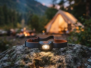
Headlamp
Our pickBright, weatherproof light with a red night mode.
Black Diamond Spot 450 Headlamp
As an Amazon Associate, Love Hiking Trails earns from qualifying purchases.
Photos


Featured in: The Best Hikes in Arizona
Ratings & Comments
—
No ratings yet
Sign in to rate this trail and leave a comment.
No comments yet. Share what the trail was like for you.
Nearby
Trails nearby
 StrenuousHike
South Kaibab Trail
Grand Canyon National Park, Arizona
A steep, open ridgeline trail with the widest views of any South Rim route, plus no water and almost no shade.
Distance
6 mi
Difficulty
Strenuous
Type
Out and back
 StrenuousHike
Havasu Falls Trail
Havasupai Indian Reservation, Arizona
An overnight-only trek into Havasu Canyon on Havasupai tribal land, to the turquoise waterfalls below the village of Supai. You'll need a paid reservation from the Havasupai Tribe.
Distance
20 mi
Difficulty
Strenuous
Type
Out and back (overnight)
 ChallengingHike
The Wave
Paria Canyon–Vermilion Cliffs Wilderness, Arizona
Swirled Navajo sandstone in BLM's Coyote Buttes North, reached by a cross-country route. Only 64 people a day get in, all through a lottery.
Distance
6.4 mi
Difficulty
Challenging
Type
Out and back (cross-country, no marked trail)
More trails to explore
More hikes nearby
Frequently asked questions
Do I need a permit to hike Bright Angel Trail?
Not for a day hike. You only need a backcountry permit to camp below the rim.
Is there water on the Bright Angel Trail?
Not right now. As of September 2026, NPS has turned off the water at 1.5-Mile Resthouse, 3-Mile Resthouse and Havasupai Gardens. Carry everything you'll drink.
Can you hike Bright Angel to the river and back in a day?
NPS strongly advises against it, especially from May to September. Rim to river is 7.8 mi one way with a 4,460 ft elevation change.
Where do I park for Bright Angel Trail?
Park in Lot D near Maswik Lodge and walk about 0.4 mi, or take the Village (Blue) shuttle.
What's a good turnaround for beginners?
1.5-Mile Resthouse, 3 mi round trip with 1,120 ft of climbing back out.