

Current alert
Open (checked Oct 21, 2026). Echo Canyon reopened Dec 14, 2025, after storm-damage repairs, and safety cables are replacing the old guide rope. During an NWS Extreme Heat Warning, the trail is restricted 8 a.m.–5 p.m.
At a glance
Distance
Elevation gain
Difficulty
Route type
Time
Permit required
Fees
Dogs
Best season
Official park info: Camelback Mountain
Phoenix's steepest classic: 1,400 feet of scrambling to a 2,704-foot summit.
Camelback Mountain is the skyline landmark of Phoenix, and the Echo Canyon Trail is the most direct way to the top. The City of Phoenix rates it extremely difficult. It's incredibly steep, very rocky and fully exposed, and it gains 1,400 feet in just over a mile to a summit that sits 2,704 feet above sea level. Come in the cool months, start early, and turn around if you're running low on water.
Overview
- Sweeping summit views across the Valley
- Steep rock scrambling, with guide rope (now being replaced by safety cables) on the steepest pitches
- Sonoran Desert plants such as saguaro, cholla and ocotillo
- The short Bobby's Rock loop (0.2 mi, 200 ft) near the trailhead
The city warns that rescues are common here, even of capable hikers. Heat and summer monsoon storms raise the risk. The trailhead has restrooms, benches, drinking water and a small shade canopy.
Plan your visit
Getting there
The trail starts at the Echo Canyon Trailhead, 4925 E. McDonald Dr, Phoenix, AZ 85018.
Parking
Small lot; open sunrise to sunset. In winter and spring it's typically full from late morning on weekdays and all day on weekends, and the gate closes when it's full. No idling or waiting on McDonald Dr or Tatum Blvd (ticketed/towed).
Permits & fees
No permit is needed. The City of Phoenix doesn't state a fee.
When to go
November–March. Avoid summer heat. During an NWS Extreme Heat Warning, the trail is restricted 8 a.m.–5 p.m.
Trailhead map
Trailhead at 33.5233, -111.9746. Confirm current trail conditions before you go.
Where to stay near Camelback Mountain via Echo Canyon Trail
Find hotels and rentals near Camelback Mountain via Echo Canyon Trail
We may earn a commission if you book a stay through these links, at no extra cost to you. Prices and availability come from booking partners and can change. We never rank trails by commission.
Route, step by step
1. The trailhead. From the Echo Canyon Trailhead, start up the Echo Canyon Trail. The Bobby's Rock spur and a helipad are on the right.
2. The scrambling sections. Climb the steep, rocky trail to the scrambling sections, where the guide rope or new safety cables help on bare rock.
Show full route
3. To the summit. Keep climbing over loose rock and boulders. The route is exposed, with no shade, all the way to the summit.
4. The summit and descent. Take a break at the top, then come down slowly the same way. Most slips happen on the descent.
Tips
- Carry more water than you think you need, even in winter.
- Dogs are prohibited on all Camelback trails.
- If the lot is full, don't wait on nearby roads. Come back another time.
- Check the city's heat-safety alerts before summer hikes.
Tips
- Carry more water than you think you need, even in winter. Dogs are prohibited on all Camelback trails. If the lot is full, don't wait on nearby roads. Come back another time. Check the city's heat-safety alerts before summer hikes.
What to bring & gear
- Sturdy hiking shoes or boots
- 2–3 liters of water per person
- Sun protection: hat, sunscreen, sunglasses
- Trail snacks or a packed lunch
- Trekking poles for the steep sections
- Headlamp and extra batteries
- Electrolyte tablets
Picks sized for a 2.3-mile, 2–3 hours (our estimate) hike.
Our gear picks
Our picks for this hike. Compare current prices at Amazon.

Hiking Boots
Our pickSupport and grip for rocky, rooty miles.
Merrell Moab 3 Mid Waterproof

Daypack
Our pickCarries water, layers, and snacks comfortably.
Osprey Talon 22

Hydration Reservoir
Our pickWide-opening reservoir that's easy to fill and clean.
Platypus Big Zip EVO 3L Reservoir

Trekking Poles
Our pickSaves your knees on steep descents.
Cascade Mountain Tech Carbon Fiber Trekking Poles

Rain Jacket
Our pickBlocks sudden mountain storms and wind.
Columbia Watertight II Rain Jacket
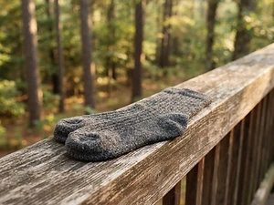
Hiking Socks
Budget pickPrevents blisters over long miles.
Darn Tough Hiker Micro Crew Cushion
As an Amazon Associate, Love Hiking Trails earns from qualifying purchases.
Photos

Featured in: The Best Hikes in Arizona
Places to eat nearby
The Henry
Phoenix, AZ1.2 mi awayWebsite
LGO (La Grande Orange Grocery)
Phoenix, AZ1.9 mi away
Ratings & Comments
—
No ratings yet
Sign in to rate this trail and leave a comment.
No comments yet. Share what the trail was like for you.
Nearby
Nearby bike trails
Nearby off-road
Trails nearby
 ChallengingHike
Cathedral Rock
Coconino National Forest, Arizona
Sedona's most photographed spires, reached by a short, steep scramble that the Forest Service calls "more of a rock climb than a hike."
Distance
1.1 mi
Difficulty
Challenging
Type
Out and back
 ModerateHike
Soldier Pass Trail No. 66
Coconino National Forest (Red Rock Ranger District), Arizona
A sinkhole, stair-step pools and a hidden arch on one red-rock trail.
Distance
4 mi
Difficulty
Moderate
Type
Out and back
 ModerateHike
Devil's Bridge
Coconino National Forest, Arizona
Sedona's largest natural sandstone arch — a short, iconic red-rock walk.
Distance
4.2 mi
Difficulty
Moderate
Type
Out and back
More trails to explore
More trails in Arizona
More hikes nearby
Frequently asked questions
How long is the Echo Canyon Trail on Camelback?
The City of Phoenix lists 1.14 miles with 1,400 feet of elevation change. The out-and-back hike is about 2.3 miles.
Can I bring my dog on Camelback Mountain?
No. Dogs are prohibited on all Camelback trails year-round.
When is Echo Canyon closed for heat?
During a National Weather Service Extreme Heat Warning, Echo Canyon and Cholla are restricted from 8 a.m. to 5 p.m.