

At a glance
Distance
Elevation gain
Difficulty
Route type
Time
Permit required
Fees
Dogs
Best season
Official park info: Coconino National Forest
Sedona's largest natural sandstone arch — a short, iconic red-rock walk.
Devil's Bridge is the biggest natural arch in the Sedona area. The trail climbs slickrock and loose gravel to a broad sandstone span framed by red-rock buttes. The final approach narrows and the arch itself has a dramatic drop on the far side — the classic photo sits hikers on its crest.
Overview
Devil's Bridge is the largest natural sandstone arch in the Sedona area, and that photo of someone standing on top of it is one of Arizona's most-shared images. The hike itself is short. The hard part is logistics: the official trailhead is up a rough jeep road, so most people start somewhere else or ride the free Sedona Shuttle. Here's how to choose.
Status check (Oct 12, 2026): The Coconino National Forest alerts page lists no closure for Devil's Bridge or its access trails. Active alerts nearby include the West Fork (Oak Creek) closure after the Pocket Fire and West Sedona camping and campfire restrictions. Check alerts before you go.
Yes, for almost anyone with basic fitness. The rock staircase at the end needs hands now and then. If heights bother you, the view from the bench beside the bridge and the base trail are just as rewarding.
Plan your visit
Getting there
1. Sedona Shuttle (Easiest, Thursday–Sunday)
- Free. No reservation needed for the trailhead routes.
- Board at the West SR 89A Park & Ride (905 Upper Red Rock Loop Rd), which has 91 spaces.
- The shuttle serves Dry Creek Vista (with Devil's Bridge access) and Mescal trailheads.
- It runs Thursday–Sunday, 7:00 a.m.–5:30 p.m. MST (8:00 a.m.–6:30 p.m. CT; Arizona doesn't observe daylight time).
- Upcoming extra service days include Nov 19–29, 2026 (except Thanksgiving Day), Dec 17–31, and spring break Feb 25–Apr 25, 2027.
Parking
Red Rock Pass or America the Beautiful pass for trailhead parking
When to go
- Weekday mornings in fall, winter, and spring are best.
- Expect a photo line to walk onto the bridge on busy mornings, sometimes a long one.
- Summer: Temperatures are high and shade is limited. The shuttle has cut back Mescal and Dry Creek service in past summers because of heat.
- Monsoon (summer): Afternoon storms bring lightning and slick rock.
Good to know
- Mescal Trailhead: From Dry Creek Road, continue to the stop sign at Long Canyon Road, turn right, and go 0.2 mi. Then follow the signed Mescal–Chuckwagon connection to Devil's Bridge. It's 4.0 mi round trip.
- Dry Creek Vista Trailhead: This is at the end of the paved section of Dry Creek Road. Take the Chuckwagon Trail, which adds 2.1 mi each way of rolling, scenic trail. It's 5.8 mi round trip. Don't walk the jeep road; the USFS doesn't recommend it for pedestrians.
3. High-Clearance Vehicle
From West Sedona, turn onto Dry Creek Road (FR 152). After 2 miles, take the right fork onto unpaved FR 152. The road is rough and not recommended in wet weather. Go about 1.3 miles, then turn right to the Devil's Bridge Trailhead.
Trailhead map
Trailhead at 34.8956, -111.8106. Confirm current trail conditions before you go.
Where to stay near Devil's Bridge
Find hotels and rentals near Devil's Bridge
We may earn a commission if you book a stay through these links, at no extra cost to you. Prices and availability come from booking partners and can change. We never rank trails by commission.
Route, step by step
1. The old jeep track. The first stretch is smooth and wide. It was originally built for jeeps and winds through washes with juniper and prickly pear.
2. Gradual climb. The grade slowly steepens, with red-rock views opening up.
Show full route
3. The fork (about 0.75 mi). Left goes to the base of the bridge. Stand under the 50-foot-high arch and look up.
4. The topside route. Right/up is a steep natural rock staircase to an open bench with big views, then one more level to the bridge itself.
5. On the bridge. You can walk across the top. The USFS says it isn't hard once you're on it, but "it's a long way down." Use common sense, stay off when it's wet or windy, and don't goof around for photos.
Tips
- Red Rock Pass: You need it to park at a designated fee site (not just driving through or a stop of 15 minutes or less). Buy it at Recreation.gov (it's tied to your plate, so register your rental's plate) or at card-only trailhead kiosks. An America the Beautiful pass works too.
- Don't park on road shoulders.
- Carry 2–3 liters of water. Even the short route is exposed.
- Sedona Shuttle Connect ($2 on-demand rides) can get you from your hotel to a Park & Ride. It runs 30 minutes before and after trailhead-route hours.
Tips
- High-clearance vehicles shorten the hike via the dirt road; otherwise add 2 miles each way. Avoid midday heat.
What to bring & gear
- Hydration pack: hydration pack
- Sun hat: sun hat
- Grippy trail shoes: trail running shoes
- Sunscreen: sunscreen
- Phone mount/tripod for the bridge shot: travel tripod
- Electrolyte tablets
Picks sized for a 4.2-mile, 2–3 hour hike.
Our gear picks
Our picks for this hike. Compare current prices at Amazon.

Hiking Boots
Our pickSupport and grip for rocky, rooty miles.
Merrell Moab 3 Mid Waterproof

Daypack
Our pickCarries water, layers, and snacks comfortably.
Osprey Talon 22

Hydration Reservoir
Our pickWide-opening reservoir that's easy to fill and clean.
Platypus Big Zip EVO 3L Reservoir

Trekking Poles
Our pickSaves your knees on steep descents.
Cascade Mountain Tech Carbon Fiber Trekking Poles

Rain Jacket
Our pickBlocks sudden mountain storms and wind.
Columbia Watertight II Rain Jacket
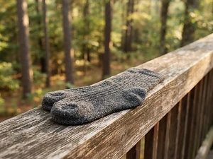
Hiking Socks
Budget pickPrevents blisters over long miles.
Darn Tough Hiker Micro Crew Cushion
As an Amazon Associate, Love Hiking Trails earns from qualifying purchases.
Photos

Featured in: The Best Hikes in Arizona
Ratings & Comments
—
No ratings yet
Sign in to rate this trail and leave a comment.
No comments yet. Share what the trail was like for you.
Nearby
Nearby bike trails
Nearby off-road
Trails nearby
 ModerateHike
Soldier Pass Trail No. 66
Coconino National Forest (Red Rock Ranger District), Arizona
A sinkhole, stair-step pools and a hidden arch on one red-rock trail.
Distance
4 mi
Difficulty
Moderate
Type
Out and back
 ChallengingHike
Cathedral Rock
Coconino National Forest, Arizona
Sedona's most photographed spires, reached by a short, steep scramble that the Forest Service calls "more of a rock climb than a hike."
Distance
1.1 mi
Difficulty
Challenging
Type
Out and back
 StrenuousHike
South Kaibab Trail
Grand Canyon National Park, Arizona
A steep, open ridgeline trail with the widest views of any South Rim route, plus no water and almost no shade.
Distance
6 mi
Difficulty
Strenuous
Type
Out and back
More trails to explore
More trails in Arizona
More hikes nearby
Frequently asked questions
How long is the Devil's Bridge hike?
1.6 mi round trip from the high-clearance trailhead, 4.0 mi from Mescal, or 5.8 mi from Dry Creek Vista.
Can I drive a regular car to Devil's Bridge?
Not to the official trailhead. Park at Mescal or Dry Creek Vista, or take the free shuttle.
Is the Sedona Shuttle free?
Yes. Both the trailhead routes and the Park & Ride parking are free, and riders don't need a Red Rock Pass.
Is it safe to walk on Devil's Bridge?
It's wide enough, but there are big drops. Stay off in wind, rain, or ice.
What days does the shuttle run?
Thursday–Sunday, 7:00 a.m.–5:30 p.m., with extra days during holidays and spring break.
How difficult is Devil's Bridge?
We rate it Moderate (2 out of 5) for Coconino National Forest. That reflects its distance, 600 ft of climbing, and terrain.
When is the best time to hike Devil's Bridge?
The best window is Mar–May, Sep–Nov. Always check current conditions and weather before you go.
Do I need a permit or reservation for Devil's Bridge?
No special trail permit is required. Red Rock Pass or America the Beautiful pass for trailhead parking.
Are dogs allowed on the Devil's Bridge trail?
Allowed on leash. Bring water for your dog and follow the area's pet rules.