

At a glance
Distance
Elevation gain
Difficulty
Route type
Time
Permit required
Fees
Dogs
Best season
Official park info: Congaree National Park
A 2.6-mile, wheelchair-accessible boardwalk from the Harry Hampton Visitor Center into old-growth bottomland forest, among bald cypress and tupelo trees.
The Boardwalk Trail is the easiest way into Congaree National Park, and NPS rates it Easy. It starts on a bluff at the Harry Hampton Visitor Center, where an elevated section leads down into old-growth bottomland hardwood forest. NPS lists it at 2.6 miles round trip. Bald cypress and tupelo grow in the lowest spots, with loblolly pines, oaks, maples and holly elsewhere. The park protects stands of old-growth trees that are part of the tallest deciduous forest in the United States. There are benches along the way, and the boardwalk is wheelchair and stroller accessible.
Plan your visit
Getting there
NPS warns that some GPS apps send drivers to the wrong place for "Congaree National Park," so use 100 National Park Road, Hopkins, SC 29061. From I-77, take Exit 5 onto SC 48 East (Bluff Road). Drive about 8 miles, bear slightly right onto Old Bluff Road, and follow it 4.5 miles to the park sign. The visitor center is 1 mile farther. Rideshare services may not pick up at the park, so arrange a ride back before you go.
Parking
The lots are on the right at the Harry Hampton Visitor Center. NPS says they increasingly fill early on busy days. About half the stalls in the third lot are set aside for oversized vehicles. Sleeping in vehicles isn't allowed anywhere in the park.
Permits & fees
Entry to Congaree is free, and no entrance pass is required. No permit is needed for a day hike. The park doesn't sell America the Beautiful passes.
When to go
The boardwalk is open year-round, but each season has its trade-offs. Mosquitoes are out from mid-spring to mid-fall. Summer highs generally reach the low to mid 90s, and the humidity can make it feel like more than 100 degrees, so NPS recommends at least 2 liters of water per person in summer. In late spring, synchronous fireflies put on a light show along the nearby Firefly Trail.
Good to know
About 80% of the park lies in the Congaree River floodplain, which floods about ten times a year. The elevated part of the boardwalk isn't subject to flooding, but floods can make other parts of the boardwalk inaccessible. NPS posts an alert whenever there's a flood, so check alerts or call the visitor center at (803) 776-4396 before you go. Water moccasins are common along trails and waterways. Cell reception is unreliable. Park water is high in tannin, so carry your own. Leashed pets are welcome, but large sections of the boardwalk are elevated and confined, with no quick way off. If your dog is uneasy around people or other pets, NPS suggests another trail.
Trailhead map
Trailhead at 33.8297, -80.8234. Confirm current trail conditions before you go.
Where to stay near Boardwalk Loop
Find hotels and rentals near Boardwalk Loop
We may earn a commission if you book a stay through these links, at no extra cost to you. Prices and availability come from booking partners and can change. We never rank trails by commission.
Route, step by step
1. Harry Hampton Visitor Center. Pick up the Self-guided Boardwalk Tour brochure inside before you start.
2. The bluff. The boardwalk begins on a bluff, and the elevated section descends into the floodplain forest. The Bluff Trail connects to this stretch.
Show full route
3. Into the bottomland. Look for bald cypress and tupelo in the lowest areas, plus loblolly pines, oaks, maples and holly. The Sims Trail, an old gravel road, crosses the boardwalk twice.
4. Back to the visitor center. Benches along the way make it easy to stop. The full walk is 2.6 miles.
Tips
- Bring insect repellent from spring through fall, and check yourself and your pets for ticks afterward.
- Carry water for everyone, pets included.
- Check the flood alerts and river gauges before driving out.
Nearby trails we recommend
- Table Rock Trail, a summit hike in South Carolina's Upstate
- Rainbow Falls Trail, in Jones Gap State Park
- Yellow Branch Falls, in Sumter National Forest
- Lower Whitewater Falls Trail, near the North Carolina line
Tips
- Bring insect repellent from spring through fall, and check yourself and your pets for ticks afterward. Carry water for everyone, pets included. Check the flood alerts and river gauges before driving out.
What to bring & gear
- Sturdy hiking shoes or boots
- 2–3 liters of water per person
- Sun protection: hat, sunscreen, sunglasses
- Trail snacks or a packed lunch
- Rain shell
- Insect repellent
Picks sized for a 2.6-mile, 1–1.5 hour hike.
Our gear picks
Our picks for this hike. Compare current prices at Amazon.

Trail Runners
Our pickClassic out-of-the-box comfort for easy miles.
Merrell Moab 3

Daypack
Our pickCompact, well-built daypack that packs down small.
Osprey Daylite Plus
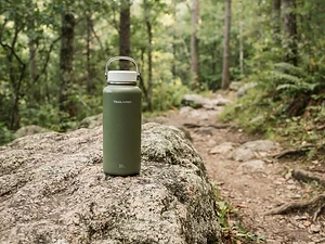
Water Bottle
Budget pickSimple, tough bottle for casual day hikes.
Nalgene 32 oz Wide Mouth Bottle
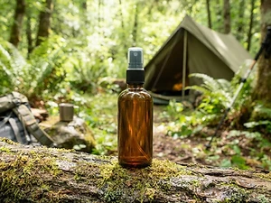
Insect Repellent
Budget pickLong-lasting protection without the DEET smell.
Sawyer 20% Picaridin Insect Repellent Spray
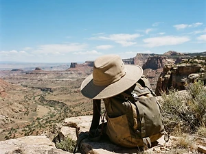
Sun Hat
Our pickFull coverage with a long neck cape.
Sunday Afternoons Adventure Hat

Trail Snacks
Budget pickDense energy bars for sustained effort.
CLIF Bar Variety Pack
As an Amazon Associate, Love Hiking Trails earns from qualifying purchases.
Photos

Featured in: The Best Hikes in South Carolina
Places to eat nearby
Big T Bar-B-Q
Gadsden, SC3.8 mi away
J D's Place
Gadsden, SC3.4 mi away
Ratings & Comments
—
No ratings yet
Sign in to rate this trail and leave a comment.
No comments yet. Share what the trail was like for you.
Nearby
More in South Carolina
Trails nearby
 StrenuousHike
Crowders Mountain via Backside Trail
Crowders Mountain State Park, North Carolina
A short, steep climb up 336 wooden steps to one of the Piedmont's best-known summits.
Distance
1.6 mi
Difficulty
Strenuous
Type
Out and back
 StrenuousHike
Rainbow Falls Trail
Jones Gap State Park, South Carolina
A steep climb to a 100-foot waterfall.
Distance
4.4 mi
Difficulty
Strenuous
Type
Out & Back
 ExpertHike
Table Rock Trail
Table Rock State Park, South Carolina
A steep climb to the summit of Table Rock.
Distance
7.2 mi
Difficulty
Expert
Type
Out & Back
More trails to explore
More trails in South Carolina
More hikes nearby
Frequently asked questions
How long is the Congaree Boardwalk Trail?
NPS lists it at 2.6 miles round trip.
Is the Congaree boardwalk wheelchair accessible?
Yes. NPS says it's wheelchair and stroller accessible, with benches along the way.
Does Congaree National Park charge an entrance fee?
No. Entry is free, and no entrance pass is required.
Can I bring my dog on the boardwalk?
Yes. Pets are allowed on all Congaree trails, including the boardwalk, on a leash.
Does the boardwalk flood?
The elevated portion isn't subject to flooding, but floods can make other parts of the boardwalk inaccessible. NPS posts an alert when there's a flood.
What trees will I see?
Bald cypress and tupelo in the lowest areas, plus loblolly pines, oaks, maples and holly.
When are the mosquitoes worst?
NPS says to expect mosquitoes from mid-spring until mid-fall.
Sources (checked October 22, 2026)
- https://www.nps.gov/cong/planyourvisit/Trail-Information.htm
- https://www.nps.gov/cong/planyourvisit/hiking.htm
- https://www.nps.gov/cong/planyourvisit/conditions.htm
- https://www.nps.gov/cong/planyourvisit/fees.htm
- https://www.nps.gov/cong/planyourvisit/directions.htm
- https://www.nps.gov/cong/planyourvisit/pets.htm
- https://www.nps.gov/cong/planyourvisit/Hiking-Safety.htm
- https://www.nps.gov/cong/planyourvisit/basicinfo.htm