
At a glance
Distance
Elevation gain
Difficulty
Route type
Time
Permit required
Fees
Dogs
Best season
Official park info: Francis Marion and Sumter National Forests
A forest trail to a cascade over layered rock.
Yellow Branch Falls tumbles about 50 feet over layered rock in Sumter National Forest near Walhalla. The cascades spread across a wide rock face, creating a lace-like effect.
Overview
The falls sit on Yellow Branch, a small stream that tumbles off the Blue Ridge Escarpment through a forest of hardwoods, hemlocks and rhododendron. What makes them distinctive is the thin, stair-stepped rock layers that spread the water into dozens of tiny cascades across a broad face, so even modest flows look lacy and photogenic. The hike is moderate and well suited to families with older children.
- Wide, lacy cascades
- Rhododendron and hardwood forest
- Picnic area at the trailhead
The trail is good year-round. Spring has the best flow.
Plan your visit
Getting there
The Yellow Branch Picnic Area is on SC Highway 28 northwest of Walhalla, in the Andrew Pickens Ranger District of Sumter National Forest. The falls drop over thin layers of rock that make the water spread out. Nearby Issaqueena Falls and Stumphouse Tunnel make good add-ons.
Trailhead map
Trailhead at 34.8058, -83.1287. Confirm current trail conditions before you go.
Where to stay near Yellow Branch Falls
Find hotels and rentals near Yellow Branch Falls
We may earn a commission if you book a stay through these links, at no extra cost to you. Prices and availability come from booking partners and can change. We never rank trails by commission.
Route, step by step
From the Yellow Branch Picnic Area, the trail winds through forest, crossing small streams. It descends to the base of the falls. The round trip is about 3.2 miles. The trail is about 1.5 miles one way, with gentle ups and downs through rhododendron and hardwood forest. Near the end, it descends to the base of the falls, where the water spreads across a wide rock face.
Tips
Show full route
- The trail can be muddy.
- Some stream crossings require care.
- Check the Forest Service alerts page before you go.
- There is no fee.
Tips
- The trail can be muddy.
What to bring & gear
- Sturdy hiking shoes or boots
- 2–3 liters of water per person
- Sun protection: hat, sunscreen, sunglasses
- Trail snacks or a packed lunch
- Rain shell
- Insect repellent
Picks sized to this trail's difficulty rating.
Our gear picks
Our picks for this hike. Compare current prices at Amazon.

Trail Runners
Our pickClassic out-of-the-box comfort for easy miles.
Merrell Moab 3

Daypack
Our pickCompact, well-built daypack that packs down small.
Osprey Daylite Plus
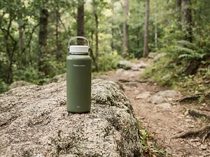
Water Bottle
Budget pickSimple, tough bottle for casual day hikes.
Nalgene 32 oz Wide Mouth Bottle

Insect Repellent
Budget pickLong-lasting protection without the DEET smell.
Sawyer 20% Picaridin Insect Repellent Spray
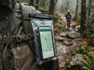
Phone Case
Budget pickKeeps your phone dry and usable in a wet pack or on the water.
Waterproof Phone Pouch

Trail Snacks
Budget pickDense energy bars for sustained effort.
CLIF Bar Variety Pack
As an Amazon Associate, Love Hiking Trails earns from qualifying purchases.
Photos

Featured in: The Best Hikes Near Greenville, South Carolina, The Best Hikes in South Carolina
Ratings & Comments
—
No ratings yet
Sign in to rate this trail and leave a comment.
No comments yet. Share what the trail was like for you.
Nearby
More in South Carolina
Nearby bike trails
Trails nearby
 ChallengingHike
Hurricane Falls Loop
Tallulah Gorge State Park, Georgia
Metal stairs, a swaying suspension bridge and a waterfall deep in a 1,000-foot gorge.
Distance
2 mi
Difficulty
Challenging
Type
Loop
 ChallengingHike
Lower Whitewater Falls Trail
Duke Energy Bad Creek, South Carolina
A trail to an overlook of a towering waterfall in the Jocassee Gorges.
Distance
3.8 mi
Difficulty
Challenging
Type
Out & Back
 ExpertHike
Table Rock Trail
Table Rock State Park, South Carolina
A steep climb to the summit of Table Rock.
Distance
7.2 mi
Difficulty
Expert
Type
Out & Back
More trails to explore
More trails in South Carolina
More hikes nearby
Frequently asked questions
How long is the Yellow Branch Falls trail?
It is about 3.2 miles round trip.
Is there a fee?
No, there is no fee.
Are dogs allowed?
Yes, leashed dogs are allowed.
How tall is Yellow Branch Falls?
About 50 feet.
How long is the Yellow Branch Falls hike?
Yellow Branch Falls is 3.2 miles. Most hikers complete it in Varies.
How difficult is Yellow Branch Falls?
We rate it Moderate (2 out of 5) for Sumter National Forest. That reflects its distance and terrain.
When is the best time to hike Yellow Branch Falls?
The best window is Year-round. Always check current conditions and weather before you go.
Do I need a permit or reservation for Yellow Branch Falls?
No special trail permit is required. Free.