

At a glance
Distance
Elevation gain
Difficulty
Route type
Time
Permit required
Fees
Dogs
Best season
Official park info: Jones Gap State Park
A steep climb to a 100-foot waterfall.
Rainbow Falls drops about 100 feet over a granite cliff in Jones Gap State Park, part of the Mountain Bridge Wilderness Area in the Blue Ridge of upstate South Carolina. The trail is one of the steepest and most rewarding hikes in the area.
Overview
- 100-foot Rainbow Falls
- Middle Saluda River
- Rhododendron and hemlock forest
The trail is good year-round. Spring has the best water flow. Fall color is beautiful.
Plan your visit
Getting there
Jones Gap State Park is about 30 miles north of Greenville, near Marietta. The park is part of the 11,000-acre Mountain Bridge Wilderness Area, along with Caesars Head State Park. The Jones Gap Trail follows the Middle Saluda River, South Carolina's first designated scenic river.
Trailhead map
Trailhead at 35.1250, -82.5736. Confirm current trail conditions before you go.
Where to stay near Rainbow Falls Trail
Find hotels and rentals near Rainbow Falls Trail
We may earn a commission if you book a stay through these links, at no extra cost to you. Prices and availability come from booking partners and can change. We never rank trails by commission.
Route, step by step
From the Jones Gap parking area, follow the Jones Gap Trail along the Middle Saluda River, then turn onto the Rainbow Falls Trail. It climbs steeply along Cox Camp Creek, with rocky footing and stone steps, to the base of the falls. The trail is about 2.2 miles one way. Return the same way. The climb gains roughly 1,000 feet, much of it in the final mile. The trail crosses Cox Camp Creek and climbs rocky steps through rhododendron. At the falls, water drops over a granite cliff into a rocky pool, and the spray often creates a rainbow on sunny afternoons, giving the falls its name.
Tips
Show full route
- Register at the trailhead.
- The climb is steep and rocky; allow 2.5 to 3 hours round trip.
- Park capacity is limited; arrive early.
- The park charges an admission fee.
Tips
- Register at the trailhead.
What to bring & gear
- Sturdy hiking shoes or boots
- 2–3 liters of water per person
- Sun protection: hat, sunscreen, sunglasses
- Trail snacks or a packed lunch
- Trekking poles for the steep sections
- Headlamp and extra batteries
- Rain shell
- Insect repellent
Picks sized to this trail's difficulty rating.
Our gear picks
Our picks for this hike. Compare current prices at Amazon.

Hiking Boots
Our pickLightweight waterproof support for technical trails.
Salomon X Ultra 4 Mid GTX

Daypack
Our pickVentilated back panel and suspension for long days.
Osprey Stratos 24

Water Filter
Our pickFast-flow filter with a collapsible flask.
Katadyn BeFree 1L Filter Bottle

Trekking Poles
Our pickSaves your knees on steep descents.
Cascade Mountain Tech Carbon Fiber Trekking Poles

Rain Jacket
Our pickBreathable storm shell with pit zips for climbs.
Outdoor Research Foray II
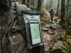
Phone Case
Budget pickKeeps your phone dry and usable in a wet pack or on the water.
Waterproof Phone Pouch
As an Amazon Associate, Love Hiking Trails earns from qualifying purchases.
Photos

Featured in: The Best Hikes Near Asheville, North Carolina, The Best Hikes Near Greenville, South Carolina, The Best Hikes Near Johnson City, Tennessee, The Best Hikes in South Carolina
Ratings & Comments
—
No ratings yet
Sign in to rate this trail and leave a comment.
No comments yet. Share what the trail was like for you.
Nearby
More in South Carolina
Trails nearby
 ExpertHike
Table Rock Trail
Table Rock State Park, South Carolina
A steep climb to the summit of Table Rock.
Distance
7.2 mi
Difficulty
Expert
Type
Out & Back
 ChallengingHike
Looking Glass Rock
Pisgah National Forest, North Carolina
Driving US-276 through Pisgah National Forest, it's hard to miss Looking Glass Rock: a massive granite dome whose wet rock faces shine like a mirror after rain. The trail to the top is a steady, switchbacking climb through changing forest to open rock with sweeping views north toward the Blue Ridge Parkway.
Distance
3.1 mi
Difficulty
Challenging
Type
Out-and-back
 ChallengingHike
Lower Whitewater Falls Trail
Duke Energy Bad Creek, South Carolina
A trail to an overlook of a towering waterfall in the Jocassee Gorges.
Distance
3.8 mi
Difficulty
Challenging
Type
Out & Back
More trails to explore
More trails in South Carolina
More hikes nearby
Frequently asked questions
How long is the Rainbow Falls Trail?
It is about 2.2 miles one way, roughly 4.4 miles round trip.
Is the trail open after Hurricane Helene?
Yes, South Carolina State Parks lists all official Mountain Bridge Wilderness trails as open.
Is there a fee?
Yes, Jones Gap State Park charges an admission fee.
Are dogs allowed?
Yes, leashed dogs are allowed.
How difficult is Rainbow Falls Trail?
We rate it Strenuous (4 out of 5) for Jones Gap State Park. That reflects its distance, 100 ft of climbing, and terrain.
When is the best time to hike Rainbow Falls Trail?
The best window is Year-round. Always check current conditions and weather before you go.
Do I need a permit or reservation for Rainbow Falls Trail?
No special trail permit is required. Park admission fee.