

At a glance
Distance
Elevation gain
Difficulty
Route type
Time
Permit required
Fees
Dogs
Best season
Official park info: Great Smoky Mountains National Park
Perched on a rocky knob at the eastern end of the Smokies, the Mount Cammerer fire tower is one of the most distinctive structures in the park. It's a squat, stone-and-timber "western-style" lookout built by the Civilian Conservation Corps in the 1930s, with a wraparound deck and a 360-degree view over the Pigeon River Gorge and the eastern Smokies.
Overview
Mount Cammerer (about 4,928 feet) is named for Arno B. Cammerer, a former director of the National Park Service. The tower sits on a rocky outcrop on the state line, just off the Appalachian Trail. Unlike many fire towers, it's short and wide, built right onto the rock. Inside and on the deck you can see the craftsmanship of the CCC crews who built it.
From the top, the views sweep east over the Pigeon River Gorge and I-40, north into the Tennessee valley, and west along the crest of the Smokies.
2026 conditions: The eastern end of the park took the brunt of Hurricane Helene (2024), particularly the Big Creek area just east of Cammerer. As of October 2026, NPS lists Big Creek Trail closed beyond its first two miles, along with the Swallow Fork and Gunter Fork trails. Low Gap Trail (the Cosby route) is not listed as closed. Cosby Knob Shelter, on the AT south of the Low Gap junction, is closed due to bear activity. Check the closures page before you go.
Mount Cammerer is for hikers who are comfortable with a long, steep climb and a full day on the trail. If you've done Alum Cave Bluffs or Rainbow Falls and felt good, you're ready. If you're newer to mountain hiking, try Hen Wallow Falls from the same Cosby trailhead area first. It gives you a feel for the terrain in a fraction of the distance.
Plan your visit
Getting there
Drive to the Cosby area off TN 32, east of Gatlinburg. Hiker parking is at Cosby Picnic Area near the campground entrance. The Low Gap Trailhead is at the back of Cosby Campground. Follow the signs from the hiker parking area.
Parking
No day-hike permit. Parking tag required ($5 daily, $15 weekly, $40 annual). Tag machine at Cosby Picnic Area.
When to go
April–June and September–October; the summit is exposed in storms and winter wind
Spring brings wildflowers in the Cosby valley and mild temperatures. Summer is hot and humid low down, with afternoon storms up high, so be off the exposed summit before they hit. Fall offers the clearest air and best colors. Winter is quiet but icy, with severe wind on top.
Trailhead map
Trailhead at 35.7559, -83.2078. Confirm current trail conditions before you go.
Where to stay near Mount Cammerer Fire Tower
Find hotels and rentals near Mount Cammerer Fire Tower
We may earn a commission if you book a stay through these links, at no extra cost to you. Prices and availability come from booking partners and can change. We never rank trails by commission.
Route, step by step
1. Low Gap Trail: the warm-up (0–1 mi). The trail starts gently through mature hardwood forest along Cosby Creek, crossing a footbridge.
2. Low Gap Trail: the climb (1–2.9 mi). The grade gets steep, with long switchbacks up the Cosby Creek valley. This is the hardest part of the day. Top off water before the top; sources are scarce beyond.
Show full route
3. Appalachian Trail at Low Gap (2.9 mi). At the AT junction, turn left (north/east). The AT climbs more gently along the ridge, with glimpses down into the Cosby valley.
4. Along the ridge (2.9–5 mi). Follow the AT about 2 miles to the signed Mount Cammerer spur trail.
5. Summit spur (5–5.6 mi). Turn left onto the spur, which is mostly level at first and then gets rocky with some light scrambling just below the tower.
6. Mount Cammerer tower (about 5.6 mi). Climb onto the deck and enjoy the 360° view. Be careful on the rocks around the tower, especially in wind or ice.
7. Return the way you came. The descent of Low Gap is steep and long on tired legs, so poles help.
Tips
- Start early. This is a full day.
- Carry 3 liters and a filter; water is limited above the Low Gap Trail.
- Respect the tower. It's a historic structure. Don't carve or leave anything.
- Turnaround time: Pick one. Darkness comes early in fall.
- Backpackers: AT shelters require a permit and reservation, and check bear-related shelter closures.
Tips
- No day-hike permit. Parking tag required ($5 daily, $15 weekly, $40 annual). Tag machine at Cosby Picnic Area.
What to bring & gear
- Hiking boots: hiking boots
- Trekking poles: carbon trekking poles
- 3 L water + filter: hydration reservoir / water filter
- Warm layer + shell: fleece jacket / rain jacket
- Headlamp: headlamp
- Lunch: trail lunch kit
- Microspikes (winter): microspikes
- Sun protection: hat, sunscreen, sunglasses
- Map or offline GPS route
- Insect repellent
Picks sized for a 11.2-mile, 6–8 hour hike.
Our gear picks
Our picks for this hike. Compare current prices at Amazon.

Hiking Boots
Our pickBurly support for heavy loads and long climbs.
Salomon Quest 4 GTX

Water Filter
Budget pickReliable squeeze filter with a long service life.
Sawyer Squeeze Water Filter
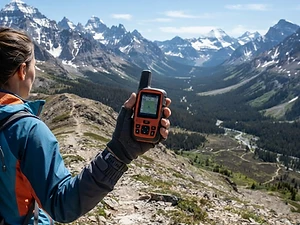
Satellite Messenger
Premium pickTwo-way messaging and SOS far from cell signal.
Garmin inReach Mini 2

Trekking Poles
Our pickSaves your knees on steep descents.
Cascade Mountain Tech Carbon Fiber Trekking Poles

Traction
Our pickGrip for icy or early-season snowy trail sections.
Kahtoola MICROspikes
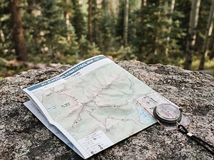
Map
Budget pickWaterproof topographic map of the park's trails.
Nat Geo Trails Illustrated Great Smoky Mountains Map #229
As an Amazon Associate, Love Hiking Trails earns from qualifying purchases.
Photos

Featured in: The Best Hikes Near Johnson City, Tennessee
Ratings & Comments
—
No ratings yet
Sign in to rate this trail and leave a comment.
No comments yet. Share what the trail was like for you.
Nearby
Trails nearby
 ChallengingHike
Hen Wallow Falls
Great Smoky Mountains National Park, Tennessee
Hen Wallow Falls has a classic Smokies mix: a moderate forest walk, a tall waterfall, and far fewer people than the famous falls near Gatlinburg. The creek is only about two feet wide at the top of the falls, then splits and fans out to roughly 30 feet across as it slides 90 feet down a rock face.
Distance
4.3 mi
Difficulty
Challenging
Type
Out-and-back
 ExpertHike
Ramsey Cascades
Great Smoky Mountains National Park, Tennessee
At 105 feet, Ramsey Cascades is the tallest waterfall in Great Smoky Mountains National Park. You don't get to see it easily.
Distance
8 mi
Difficulty
Expert
Type
Out-and-back
 ModerateHike
Porters Creek Trail to Fern Branch Falls
Great Smoky Mountains National Park, Tennessee
A quiet Greenbrier valley walk past a historic barn to a 40-foot waterfall.
Distance
4 mi
Difficulty
Moderate
Type
Out and back
More trails to explore
More in Great Smoky Mountains National Park
More trails in Tennessee
More hikes nearby
Frequently asked questions
How long is the hike to Mount Cammerer?
About 11 miles round trip from Cosby via Low Gap Trail and the AT.
How hard is the Mount Cammerer hike?
Strenuous. Expect about 3,000 feet of climbing, mostly on the steep Low Gap Trail.
Who built the Mount Cammerer tower?
The Civilian Conservation Corps, in the 1930s.
Is the trail open after Hurricane Helene?
As of October 2026, Low Gap Trail isn't on the NPS closure list, but nearby Big Creek, Swallow Fork, and Gunter Fork trails have closures. Check before you go.
Where do I park?
At the hiker parking area at Cosby Picnic Area.
Are dogs allowed?
No.
How difficult is Mount Cammerer Fire Tower?
We rate it Expert (5 out of 5) for Great Smoky Mountains National Park. That reflects its distance, 3,000 ft of climbing, and terrain.
When is the best time to hike Mount Cammerer Fire Tower?
The best window is April–June and September–October; the summit is exposed in storms and winter wind. Always check current conditions and weather before you go.
Do I need a permit or reservation for Mount Cammerer Fire Tower?
Yes — access is managed. No day-hike permit. Parking tag required ($5 daily, $15 weekly, $40 annual). Tag machine at Cosby Picnic Area.. Check the official Great Smoky Mountains National Park page before you go.