

At a glance
Distance
Elevation gain
Difficulty
Route type
Time
Permit required
Fees
Dogs
Best season
Official park info: Great Smoky Mountains National Park
Just minutes from downtown Gatlinburg, the Rainbow Falls Trail climbs steadily through old-growth forest beside LeConte Creek to a tall, delicate waterfall. Its name comes from the misty rainbow that often appears at its base on sunny afternoons.
Overview
Here's how to beat the parking crunch, handle the rocky climb, and time your visit for the rainbow.
Rainbow Falls is one of the Smokies' "big four" waterfall hikes, along with Abrams, Grotto, and Laurel. NPS says those four together see more than 200,000 visitors a year. The trail is well built and well maintained, but it climbs almost the whole way. You'll see some impressive old-growth trees, plus scars from the 2016 wildfire that swept this side of the mountain.
The falls themselves are a tall, airy plunge over a rock ledge. Height estimates are commonly given as about 80 feet. On a sunny afternoon, the spray catches the light and throws the rainbow the falls are named for. After heavy rain they roar; in a dry late summer they thin to a veil. In a deep freeze they can build impressive ice formations.
The trail doesn't end at the falls. It continues to the summit of Mount LeConte (6,593 ft), 6.7 miles from the trailhead, making a strenuous 13-mile round trip for strong hikers.
Plan your visit
Parking
No entrance fee or hiking permit. Parking tag required if you park more than 15 minutes ($5 daily, $15 weekly, $40 annual). The trailhead has just 48 parking spaces.
The trailhead is on Cherokee Orchard Road on the edge of Gatlinburg, with upper and lower parking lots. Both work. Cherokee Orchard Road isn't on the park's seasonal-closure list, but any park road can close for snow or ice. (Don't confuse it with the Roaring Fork Motor Nature Trail, which begins just beyond and is closed in winter; it was open 4/17–11/29 in 2026.)
Parking is the hardest part of this hike. With only 48 spaces, the lots often fill early, and a parking tag doesn't guarantee a spot. Your options:
- Arrive early. On weekends, summer days, and October color weekends, plan to park soon after sunrise.
- Take a shuttle. NPS lists authorized shuttle companies, and several serve Rainbow Falls. Most run March through October. Book directly with the company, and confirm your return pickup before you start, because cell service is limited.
- Choose a quiet day. Winter weekdays (with traction devices) are the calmest.
Buy your parking tag ahead of time on Recreation.gov and print it, or buy one in person at Sugarlands Visitor Center or the Gatlinburg Welcome Center. Most trailheads, including this one, don't have tag machines.
When to go
Spring (strong flow, wildflowers) and October (fall color). Winter is beautiful but often icy.
Trailhead map
Trailhead at 35.6758, -83.4854. Confirm current trail conditions before you go.
Where to stay near Rainbow Falls
Find hotels and rentals near Rainbow Falls
We may earn a commission if you book a stay through these links, at no extra cost to you. Prices and availability come from booking partners and can change. We never rank trails by commission.
Route, step by step
1. Trailhead and the first climb (0–1 mi). From the parking area, the trail heads uphill through mixed hardwood forest above LeConte Creek. The grade is steady right away, so start slower than you think you need to. The tread is a mix of packed dirt, rock, and roots.
2. Along LeConte Creek (1–2 mi). The trail works its way up the drainage, sometimes near the water, sometimes on the hillside. Look for big old-growth trees and blackened stumps from the 2016 fire. The trail crosses the creek on footbridges in this stretch.
Show full route
3. The rocky final push (2–2.8 mi). The last section is the steepest and roughest: stone steps, uneven rock, and spots that stay wet. Take your time, especially on the way back down, when most slips happen.
4. At the falls (about 2.8 mi). A final footbridge puts you at the base. Enjoy it from the trail and the open rocks near the creek. Don't climb on the rocks around or above the falls; NPS warns that waterfalls are among the most dangerous places in the park. In winter, watch for falling icicles.
5. Return, or keep going. Most hikers head back the way they came. If you're continuing to Mount LeConte, the trail keeps climbing past the falls and meets the Bullhead, Alum Cave, and Trillium Gap trails near the summit. Note that the Bullhead Trail is closed Monday through Thursday (except federal holidays) through Nov. 19, 2026 for rehabilitation, so don't plan a Bullhead loop on those days.
Tips
- For the rainbow: Aim to reach the falls on a sunny afternoon. That's when NPS says the mist rainbow usually appears.
- Use poles on the descent. The rocky upper section is much harder going down than up.
- Winter = microspikes. NPS warns the trail is often icy in cold weather. Carry traction and expect slick footbridges.
- High water? If you're headed to LeConte after heavy rain, NPS recommends the Bullhead Trail instead (when it's open).
- Bring more water than you think. That 1,500-foot climb makes you sweat even on cool days.
- Bear-aware hiking: This side of Gatlinburg has plenty of black bears. Keep your distance and never leave food unattended.
Tips
- No entrance fee or hiking permit. Parking tag required if you park more than 15 minutes ($5 daily, $15 weekly, $40 annual). The trailhead has just 48 parking spaces.
What to bring & gear
- Hiking boots or shoes with grippy, lugged soles: waterproof hiking boots
- Trekking poles: carbon trekking poles
- 2–3 liters of water: hydration pack 2L
- Water filter (backup): compact water filter
- Winter traction, November–March: microspikes traction cleats
- Warm layer (it's cooler at the falls): lightweight fleece jacket
- Rain shell: packable rain jacket
- Headlamp, in case you're out late or continuing to LeConte: rechargeable headlamp
- Lens cloth and a phone or camera rain cover for the mist: waterproof phone pouch
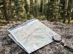
- Trail map: National Geographic Great Smoky Mountains map
- Sun protection: hat, sunscreen, sunglasses
- Insect repellent
Picks sized for a 5.6-mile, 3.5–5 hours round trip hike.
Our gear picks
Our picks for this hike. Compare current prices at Amazon.

Hiking Boots
Our pickSupport and grip for rocky, rooty miles.
Merrell Moab 3 Mid Waterproof

Daypack
Our pickCarries water, layers, and snacks comfortably.
Osprey Talon 22

Hydration Reservoir
Our pickWide-opening reservoir that's easy to fill and clean.
Platypus Big Zip EVO 3L Reservoir

Trekking Poles
Our pickSaves your knees on steep descents.
Cascade Mountain Tech Carbon Fiber Trekking Poles

Traction
Our pickGrip for icy or early-season snowy trail sections.
Kahtoola MICROspikes
Map
Budget pickWaterproof topographic map of the park's trails.
Nat Geo Trails Illustrated Great Smoky Mountains Map #229
As an Amazon Associate, Love Hiking Trails earns from qualifying purchases.
Photos

Featured in: The Best Hikes Near Knoxville, Tennessee, The Best Hikes Near Gatlinburg, Tennessee, The Best Hikes in Tennessee
Ratings & Comments
—
No ratings yet
Sign in to rate this trail and leave a comment.
No comments yet. Share what the trail was like for you.
Nearby
Nearby bike trails
Nearby off-road
Trails nearby
 ChallengingHike
Mount LeConte (Alum Cave)
Great Smoky Mountains National Park, Tennessee
The Smokies' highest lodge, reached by the dramatic Alum Cave trail past Arch Rock.
Distance
11 mi
Difficulty
Challenging
Type
Out and back
 ModerateHike
Grotto Falls
Great Smoky Mountains National Park, Tennessee
Most waterfalls ask you to admire them from the front. Grotto Falls lets you step behind the curtain.
Distance
2.6 mi
Difficulty
Moderate
Type
Out-and-back
 ExpertHike
Chimney Tops
Great Smoky Mountains National Park, Tennessee
The Chimney Tops are twin rocky pinnacles rising above Newfound Gap Road, and the trail toward them is one of the Smokies' great short workouts. It climbs about 1,400 feet in under two miles of stairs and switchbacks.
Distance
3.5 mi
Difficulty
Expert
Type
Out-and-back
More trails to explore
More in Great Smoky Mountains National Park
More trails in Tennessee
More hikes nearby
Frequently asked questions
How long is the Rainbow Falls hike?
NPS lists it as 5.6 miles (9 km) round trip. Most people take 3.5–5 hours, depending on pace and time at the falls.
How hard is Rainbow Falls Trail?
It's one of the more demanding waterfall hikes in the park: about 1,500 feet of gain to the falls, with steep, rocky sections. NPS describes the trail as "very steep and rocky."
Where do I park for Rainbow Falls?
At the Rainbow Falls Trailhead on Cherokee Orchard Road (upper or lower lot), which has 48 spaces. Arrive early or use an authorized shuttle, and display a printed parking tag.
When will I see the rainbow?
On sunny afternoons, when light hits the mist at the base.
Can I hike Rainbow Falls in winter?
Yes, but expect ice on the trail and possible falling icicles near the falls. Microspikes are strongly recommended.
Are dogs allowed?
No. Only the Gatlinburg Trail and Oconaluftee River Trail allow leashed pets in the park.
Can I hike from Rainbow Falls to Mount LeConte?
Yes. The summit is 6.7 miles from the trailhead (13 miles round trip). It's a strenuous full-day hike.
How difficult is Rainbow Falls?
We rate it Strenuous (4 out of 5) for Great Smoky Mountains National Park. That reflects its distance, 1,500 ft of climbing, and terrain.
When is the best time to hike Rainbow Falls?
The best window is Spring (strong flow, wildflowers) and October (fall color). Winter is beautiful but often icy.. Always check current conditions and weather before you go.
Do I need a permit or reservation for Rainbow Falls?
Yes — access is managed. No entrance fee or hiking permit. Parking tag required if you park more than 15 minutes ($5 daily, $15 weekly, $40 annual). The trailhead has just 48 parking spaces.. Check the official Great Smoky Mountains National Park page before you go.