

10 of the trails we cover are within about 2 hr 25 min of downtown Huntsville, from Walls of Jericho Trail (about 1 hr 15 min) to Outcroppings Trail (about 2 hr 25 min). They're spread across the Walls of Jericho tract, Short Springs State Natural Area, Sipsey Wilderness (Bankhead National Forest) and Little River Canyon National Preserve and more, in Alabama, Tennessee, Georgia and Mississippi.
Drive times are approximate, from downtown, and the list runs from closest to farthest. Each entry links to our full trail guide with the route, parking, gear and FAQ.
The Best Hikes Near Huntsville

Photo: Fredlyfish4, CC BY-SA 4.0, via Wikimedia Commons. Walls of Jericho, Alabama
Drive
About 1 hr 15 min (52 mi)
Distance
6.6 mi, out and back
Elevation gain
1,200 ft
Difficulty
Strenuous
Best season
Spring and fall
The Walls of Jericho is a sheer limestone bowl where Hurricane Creek and the headwaters of the Paint Rock River have carved a canyon deep into the Cumberland Plateau, just south of the Tennessee line near Skyline. Locals call it the Grand Canyon of the South, and after rain, water pours off the rim and vanishes into sinks and springs at the base of the amphitheater. It's in the Walls of Jericho tract.

Photo: Earino, CC BY-SA 3.0, via Wikimedia Commons. Short Springs State Natural Area, Tennessee
Drive
About 1 hr 30 min (62 mi)
Distance
2 mi, out-and-back or loop
Elevation gain
300 ft
Difficulty
Challenging
Best season
Late March-April for wildflowers; winter and spring for flow
Permits & fees
Free
Machine Falls is one of Middle Tennessee's prettiest surprises: a wide, stair-stepped cascade that drops more than 60 feet and is nearly as wide as it is tall, hidden in a ravine just outside Tullahoma. In spring, Short Springs is also one of the best wildflower hikes in the state. It's in Short Springs State Natural Area.

Photo: Forest Service Photography, Public domain, via Wikimedia Commons. Sipsey Wilderness (Bankhead National Forest), Alabama
Drive
About 1 hr 35 min (63 mi)
Difficulty
Challenging
Best season
Spring and fall
The Sipsey River Trail follows the Sipsey Fork of the Black Warrior River, Alabama's only National Wild and Scenic River, into the heart of the Sipsey Wilderness in Bankhead National Forest. This is a landscape of sandstone bluffs, hemlock-shaded side canyons and waterfalls, and the Sipsey is often called the Land of a Thousand Waterfalls. It's in Sipsey Wilderness (Bankhead National Forest).

Photo: Thomson200, CC0, via Wikimedia Commons. Little River Canyon National Preserve, Alabama
Drive
About 1 hr 40 min (77 mi)
Difficulty
Easy
Best season
Year-round
Little River Falls marks the beginning of Little River Canyon, one of the deepest canyons east of the Mississippi, cut into Lookout Mountain in northeast Alabama. The Little River is unusual because it flows for most of its length on top of the mountain, and here it drops over a broad sandstone ledge into the canyon. It's in Little River Canyon National Preserve.

Photo: J. Michael Scarborough, CC BY-SA 3.0, via Wikimedia Commons. South Cumberland State Park, Tennessee
Drive
About 1 hr 40 min (69 mi)
Distance
12.8 mi, point-to-point (shuttle) or out-and-back sections
Elevation gain
1,500 ft
Difficulty
Expert
Best season
Spring (waterfalls), fall (color), summer (swimming holes)
Permits & fees
Free day use
The Fiery Gizzard is the trail Tennessee backpackers brag about: a boulder-choked gorge with swimming holes, waterfalls, and rim overlooks, and a reputation for being harder than its mileage suggests. It runs 12.8 miles from the North Trailhead in Tracy City to the South Trailhead at Foster Falls. It's in South Cumberland State Park.

Photo: John J. Hammer, Public domain, via Wikimedia Commons. Chickamauga & Chattanooga National Military Park, Tennessee
Drive
About 2 hr 5 min (102 mi)
Distance
0.2 mi, out-and-back; can be extended on the Bluff Trail
Difficulty
Easy
Best season
Year-round; fall color and clear winter evenings are spectacular
Permits & fees
Free
Sunset Rock is a sandstone ledge on the western brow of Lookout Mountain, high above Lookout Valley, with views that stretch toward the Tennessee River and the ridges beyond. It's part of Chickamauga and Chattanooga National Military Park, so you get Civil War history with your sunset. It's in Chickamauga & Chattanooga National Military Park.

Photo: Jsfouche, CC BY-SA 3.0, via Wikimedia Commons. Cloudland Canyon State Park, Georgia
Drive
About 2 hr 5 min (96 mi)
Distance
2 mi, out-and-back
Elevation gain
500 ft
Difficulty
Expert
Best season
Winter and early spring for the strongest flow; fall for color
Permits & fees
$10 daily ParkPass per vehicle (or $70 annual)
The Waterfalls Trail at Cloudland Canyon State Park is short, only 2 miles round trip, but the park rates it strenuous for a reason: 600 metal stair steps drop you into a canyon on the western edge of Lookout Mountain to two beautiful waterfalls, Cherokee Falls and Hemlock Falls. Going down is a joy.
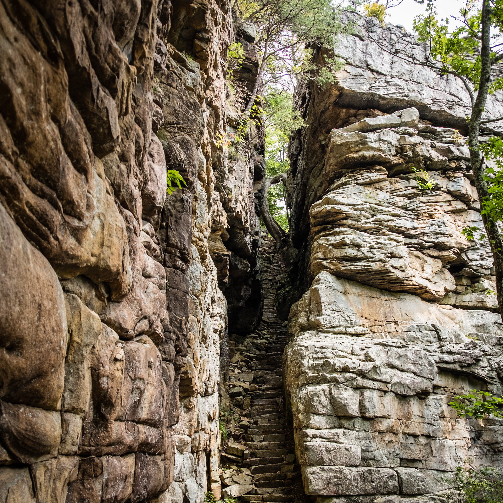
Photo: Sharon Mollerus, CC BY 2.0, via Flickr. Savage Gulf State Park, Tennessee
Drive
About 2 hr 5 min (87 mi)
Distance
0.9 mi, out-and-back
Difficulty
Easy
Best season
Fall color (late Oct), spring wildflowers; sunsets year-round
Permits & fees
Free
Stand at the Stone Door overlook and the Cumberland Plateau simply ends. Hundreds of feet below, Big Creek Gulf stretches off in a sea of hardwood forest. It's in Savage Gulf State Park.

Photo: Kaldari, CC0, via Wikimedia Commons. Radnor Lake State Park, Tennessee
Drive
About 2 hr 10 min (105 mi)
Distance
3 mi, loops and connectors
Elevation gain
200 ft
Difficulty
Moderate
Best season
Year-round; spring migration and wildflowers, fall color, winter waterfowl
Permits & fees
Free
Ten minutes from Green Hills, Radnor Lake State Park feels like another world: an 85-acre lake ringed by forested ridges, herons stalking the shallows, turtles sunning on logs, and owls calling at dusk. It's protected as a Class II Natural Area, so the trails are for hiking and wildlife watching only.

Photo: Waynersnitzel, CC BY-SA 3.0, via Wikimedia Commons. Tishomingo State Park, Mississippi
Drive
About 2 hr 25 min (108 mi)
Difficulty
Moderate
Best season
Year-round
Tishomingo State Park in northeast Mississippi sits in the foothills of the Appalachian Mountains, an unusual landscape in the state with sandstone outcrops, rock gardens and fern-filled ravines. The Outcroppings Trail explores the park's distinctive rock formations, and nearby is the famous swinging bridge over Bear Creek, built by the Civilian Conservation Corps.

Photo: Sharon Mollerus, CC BY 2.0, via Wikimedia Commons. Savage Gulf State Park, Tennessee
Drive
About 1 hr 55 min (approximate)
Distance
0.8 mi loop (park trail map)
Difficulty
Moderate
Best for
Three waterfalls in under a mile
Three waterfalls, a blue swimming hole and a spiral staircase at the Savage Gulf West Trailhead in Altamont, Tennessee.
Quick Tips for Hiking Near Huntsville
- Start early on the long days: Fiery Gizzard Trail (12.8 mi).
- Confirm before you go: trail status, fees and road access change, so check the managing park or forest on the day.
Frequently asked questions
What's the closest hike to Huntsville?
Walls of Jericho Trail, about 1 hr 15 min from downtown (52 mi). It's rated Strenuous on our trail page.
What's the easiest hike near Huntsville?
Of the trails on this page, Sunset Rock has the gentlest rating on our trail page (Easy; 0.2 mi out-and-back; can be extended on the Bluff Trail).
What's the hardest hike near Huntsville?
Fiery Gizzard Trail is rated Expert on our trail page: 12.8 mi point-to-point (shuttle) or out-and-back sections, 1,500 ft of climbing.
Do I need a permit for these hikes?
None of these trails needs a hiking permit, according to our trail pages. Some charge an entrance or parking fee, shown on each card.
Can I bring my dog?
Leashed dogs are allowed on Walls of Jericho Trail, Machine Falls, Sipsey River Trail, Little River Falls Trail, Fiery Gizzard Trail, Sunset Rock, Cloudland Canyon Waterfalls Trail, Stone Door, Radnor Lake Trails and Outcroppings Trail.
Gear for Hiking Near Huntsville
Osprey Daylite Plus daypack
Osprey Daylite Plus
Check price on AmazonBlack Diamond Spot headlamp
Black Diamond Spot 450 Headlamp
Check price on AmazonDarn Tough hiking socks
Darn Tough Hiker Micro Crew Cushion
Check price on AmazonCascade Mountain Tech trekking poles
Cascade Mountain Tech Carbon Fiber Trekking Poles
Check price on Amazon
As an Amazon Associate, Love Hiking Trails earns from qualifying purchases.
Sources
Trail facts come from our own trail guides, linked above, as published in October 2026. Conditions change, so check the managing park or forest before you go.
Drive times are approximate routing estimates from downtown (OSRM, using OpenStreetMap data), rounded to 5 minutes, and don't include traffic.
- lovehikingtrails.com/trails/walls-of-jericho
- lovehikingtrails.com/trails/machine-falls
- lovehikingtrails.com/trails/sipsey-river-trail
- lovehikingtrails.com/trails/little-river-falls
- lovehikingtrails.com/trails/fiery-gizzard
- lovehikingtrails.com/trails/sunset-rock
- lovehikingtrails.com/trails/cloudland-canyon-waterfalls
- lovehikingtrails.com/trails/stone-door
- lovehikingtrails.com/trails/radnor-lake
- lovehikingtrails.com/trails/tishomingo-outcroppings
- project-osrm.org (OpenStreetMap routing)