

At a glance
Elevation gain
Difficulty
Route type
Time
Permit required
Fees
Dogs
Best season
Official park info: Little River Canyon National Preserve
A short boardwalk to Little River Falls at the head of one of the deepest canyons in the Southeast.
Little River Falls marks the beginning of Little River Canyon, one of the deepest canyons east of the Mississippi, cut into Lookout Mountain in northeast Alabama. The Little River is unusual because it flows for most of its length on top of the mountain, and here it drops over a broad sandstone ledge into the canyon. The falls are in Little River Canyon National Preserve, managed by the National Park Service.
Overview
- Broad curtain of water spanning the river
- Easy boardwalk access
- Starting point for the scenic Canyon Rim Parkway
Winter and spring, when the river is high, give the most impressive flow. Summer brings swimmers, and the falls can be a thin trickle by late summer. Fall color lines the canyon in late October.
Plan your visit
Trailhead map
Trailhead at 34.3916, -85.6250. Confirm current trail conditions before you go.
Where to stay near Little River Falls Trail
Find hotels and rentals near Little River Falls Trail
We may earn a commission if you book a stay through these links, at no extra cost to you. Prices and availability come from booking partners and can change. We never rank trails by commission.
Route, step by step
From the Little River Falls parking area on Alabama Highway 35, a short boardwalk leads to an overlook of the falls. It is a very easy walk suitable for most visitors. For a closer look, a short, rougher path continues down to the rocks above the falls. Many visitors combine the falls with a drive along the Canyon Rim Parkway, which has more overlooks.
Tips
Show full route
- Swimming above the falls is dangerous; strong currents have caused drownings here.
- Rocks near the water are slippery even when dry.
- The Little River Canyon Center a few miles north has exhibits and restrooms.
- Weekends in summer are crowded; arrive early.
Tips
- Swimming above the falls is dangerous; strong currents have caused drownings here.
What to bring & gear
- Sturdy hiking shoes or boots
- 2–3 liters of water per person
- Sun protection: hat, sunscreen, sunglasses
- Trail snacks or a packed lunch
- Rain shell
- Insect repellent
Picks sized to this trail's difficulty rating.
Our gear picks
Our picks for this hike. Compare current prices at Amazon.

Trail Runners
Our pickClassic out-of-the-box comfort for easy miles.
Merrell Moab 3

Daypack
Our pickCompact, well-built daypack that packs down small.
Osprey Daylite Plus
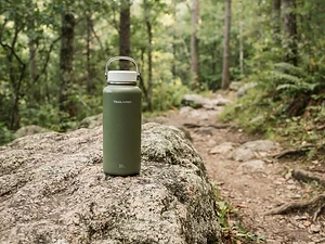
Water Bottle
Budget pickSimple, tough bottle for casual day hikes.
Nalgene 32 oz Wide Mouth Bottle

Insect Repellent
Budget pickLong-lasting protection without the DEET smell.
Sawyer 20% Picaridin Insect Repellent Spray
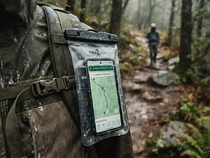
Phone Case
Budget pickKeeps your phone dry and usable in a wet pack or on the water.
Waterproof Phone Pouch

Trail Snacks
Budget pickDense energy bars for sustained effort.
CLIF Bar Variety Pack
As an Amazon Associate, Love Hiking Trails earns from qualifying purchases.
Photos

Featured in: The Best Hikes Near Huntsville, Alabama
Ratings & Comments
—
No ratings yet
Sign in to rate this trail and leave a comment.
No comments yet. Share what the trail was like for you.
Nearby
More in Alabama
Nearby bike trails
Trails nearby
 ExpertHike
Cloudland Canyon Waterfalls Trail
Cloudland Canyon State Park, Georgia
The Waterfalls Trail at Cloudland Canyon State Park is short, only 2 miles round trip, but the park rates it strenuous for a reason: 600 metal stair steps drop you into a canyon on the western edge of Lookout Mountain to two beautiful waterfalls, Cherokee Falls and Hemlock Falls. Going down is a joy.
Distance
2 mi
Difficulty
Expert
Type
Out-and-back
 EasyHike
Sunset Rock
Chickamauga & Chattanooga National Military Park, Tennessee
Sunset Rock is a sandstone ledge on the western brow of Lookout Mountain, high above Lookout Valley, with views that stretch toward the Tennessee River and the ridges beyond. It's part of Chickamauga and Chattanooga National Military Park, so you get Civil War history with your sunset.
Distance
0.2 mi
Difficulty
Easy
Type
Out-and-back; can be extended on the Bluff Trail
 StrenuousHike
Walls of Jericho Trail
Walls of Jericho, Alabama
A descent into a limestone amphitheater on the Paint Rock River headwaters, called the Grand Canyon of the South.
Distance
6.6 mi
Difficulty
Strenuous
Type
Out & Back
More trails to explore
More trails in Alabama
More hikes nearby
Frequently asked questions
How long is the walk to Little River Falls?
It is a very short boardwalk walk from the parking area, just a few minutes each way.
Is there a fee?
No, there is no fee at the Little River Falls parking area.
Are dogs allowed?
Yes, leashed dogs are allowed.
Can you swim at Little River Falls?
Swimming happens here, but currents near the lip of the falls are dangerous, especially in high water.
How long is the Little River Falls Trail hike?
Most hikers complete Little River Falls Trail in 30 minutes, though pace varies with conditions.
How difficult is Little River Falls Trail?
We rate it Easy (1 out of 5) for Little River Canyon National Preserve. That reflects its distance and terrain.
When is the best time to hike Little River Falls Trail?
The best window is Year-round. Always check current conditions and weather before you go.
Do I need a permit or reservation for Little River Falls Trail?
No special trail permit is required. Free.