

At a glance
Distance
Elevation gain
Difficulty
Route type
Time
Permit required
Fees
Dogs
Best season
Official park info: Walls of Jericho
A descent into a limestone amphitheater on the Paint Rock River headwaters, called the Grand Canyon of the South.
The Walls of Jericho is a sheer limestone bowl where Hurricane Creek and the headwaters of the Paint Rock River have carved a canyon deep into the Cumberland Plateau, just south of the Tennessee line near Skyline. Locals call it the Grand Canyon of the South, and after rain, water pours off the rim and vanishes into sinks and springs at the base of the amphitheater. The land is part of the Walls of Jericho Forever Wild tract, managed by the state as a wildlife management area.
Overview
- The amphitheater itself, ringed by cliffs and fern-draped ledges
- Seasonal waterfalls and blue-green pools along Hurricane Creek
- Caves, sinks and springs typical of limestone karst country
- Spring wildflowers on the lower slopes
Spring is best: the creek runs strong, the falls are flowing and the forest is in bloom. Fall brings color and cooler air for the climb out. Summer is hot and humid, and the falls can dry to a trickle in late summer and early autumn.
Plan your visit
Trailhead map
Trailhead at 34.9768, -86.0803. Confirm current trail conditions before you go.
Where to stay near Walls of Jericho Trail
Find hotels and rentals near Walls of Jericho Trail
We may earn a commission if you book a stay through these links, at no extra cost to you. Prices and availability come from booking partners and can change. We never rank trails by commission.
Route, step by step
The hike starts at the trailhead parking area on Alabama Highway 79. The first stretch rolls gently along the plateau before the trail drops steadily through hardwood forest toward Hurricane Creek. Lower down you cross the creek and follow it upstream along its rocky bed to the mouth of the bowl, where the walls close in and a small waterfall spills into a pool. Everything you lose on the way in has to be climbed on the way out, and the ascent back to the highway is long and sustained.
Tips
Show full route
- Save energy for the return, which is a steady climb of roughly 1,200 feet.
- Creek crossings can be impassable after heavy rain; turn back if the water is fast or above your knees.
- The area is a wildlife management area, so wear blaze orange during hunting seasons.
- Cell service is poor; download a map before you leave.
Tips
- Save energy for the return, which is a steady climb of roughly 1,200 feet.
What to bring & gear
- Sturdy hiking shoes or boots
- 2–3 liters of water per person
- Sun protection: hat, sunscreen, sunglasses
- Trail snacks or a packed lunch
- Trekking poles for the steep sections
- Headlamp and extra batteries
- Rain shell
- Insect repellent
Picks sized for a 6.6-mile, 4–5 hour hike.
Our gear picks
Our picks for this hike. Compare current prices at Amazon.

Hiking Boots
Our pickSupport and grip for rocky, rooty miles.
Merrell Moab 3 Mid Waterproof

Daypack
Our pickCarries water, layers, and snacks comfortably.
Osprey Talon 22

Hydration Reservoir
Our pickWide-opening reservoir that's easy to fill and clean.
Platypus Big Zip EVO 3L Reservoir

Trekking Poles
Our pickSaves your knees on steep descents.
Cascade Mountain Tech Carbon Fiber Trekking Poles

Rain Jacket
Our pickBlocks sudden mountain storms and wind.
Columbia Watertight II Rain Jacket
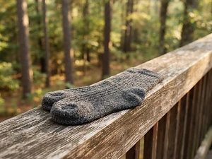
Hiking Socks
Budget pickPrevents blisters over long miles.
Darn Tough Hiker Micro Crew Cushion
As an Amazon Associate, Love Hiking Trails earns from qualifying purchases.
Photos

Featured in: The Best Hikes Near Huntsville, Alabama
Ratings & Comments
—
No ratings yet
Sign in to rate this trail and leave a comment.
No comments yet. Share what the trail was like for you.
Nearby
More in Alabama
Nearby bike trails
Trails nearby
 ExpertHike
Fiery Gizzard Trail
South Cumberland State Park, Tennessee
The Fiery Gizzard is the trail Tennessee backpackers brag about: a boulder-choked gorge with swimming holes, waterfalls, and rim overlooks, and a reputation for being harder than its mileage suggests. It runs 12.8 miles from the North Trailhead in Tracy City to the South Trailhead at Foster Falls.
Distance
12.8 mi
Difficulty
Expert
Type
Point-to-point (shuttle) or out-and-back sections
 ChallengingHike
Machine Falls
Short Springs State Natural Area, Tennessee
Machine Falls is one of Middle Tennessee's prettiest surprises: a wide, stair-stepped cascade that drops more than 60 feet and is nearly as wide as it is tall, hidden in a ravine just outside Tullahoma. In spring, Short Springs is also one of the best wildflower hikes in the state.
Distance
2 mi
Difficulty
Challenging
Type
Out-and-back or loop
 ExpertHike
Cloudland Canyon Waterfalls Trail
Cloudland Canyon State Park, Georgia
The Waterfalls Trail at Cloudland Canyon State Park is short, only 2 miles round trip, but the park rates it strenuous for a reason: 600 metal stair steps drop you into a canyon on the western edge of Lookout Mountain to two beautiful waterfalls, Cherokee Falls and Hemlock Falls. Going down is a joy.
Distance
2 mi
Difficulty
Expert
Type
Out-and-back
More trails to explore
More trails in Alabama
More hikes nearby
Frequently asked questions
How long is the Walls of Jericho hike?
Plan on about 6.6 miles round trip with roughly 1,200 feet of elevation gain, which most hikers finish in 4 to 5 hours.
Is it hard?
The walk in is easy but the climb back to the trailhead is steep and sustained, so it rates as strenuous for most people.
Can I bring my dog?
Yes, leashed dogs are allowed. Carry water for them, as the climb out can be hot.
Is there a fee?
No, there is no fee to park or hike at the Highway 79 trailhead.
How difficult is Walls of Jericho Trail?
We rate it Strenuous (4 out of 5) for Walls of Jericho. That reflects its distance, 1,200 ft of climbing, and terrain.
When is the best time to hike Walls of Jericho Trail?
The best window is Spring and fall. Always check current conditions and weather before you go.
Do I need a permit or reservation for Walls of Jericho Trail?
No special trail permit is required. Free.
Are dogs allowed on the Walls of Jericho Trail?
Allowed on leash. Bring water for your dog and follow the area's pet rules.