

At a glance
Distance
Elevation gain
Difficulty
Route type
Time
Permit required
Fees
Dogs
Best season
Official park info: Short Springs State Natural Area
Machine Falls is one of Middle Tennessee's prettiest surprises: a wide, stair-stepped cascade that drops more than 60 feet and is nearly as wide as it is tall, hidden in a ravine just outside Tullahoma. In spring, Short Springs is also one of the best wildflower hikes in the state.
Overview
Short Springs State Natural Area is a 420-acre Class I Scenic-Recreational State Natural Area in Coffee County, about 3.5 miles northeast of Tullahoma. It was designated in 1994 and is owned by the State of Tennessee, TVA, and the City of Tullahoma. It once supplied Tullahoma's water before Normandy Dam was built.
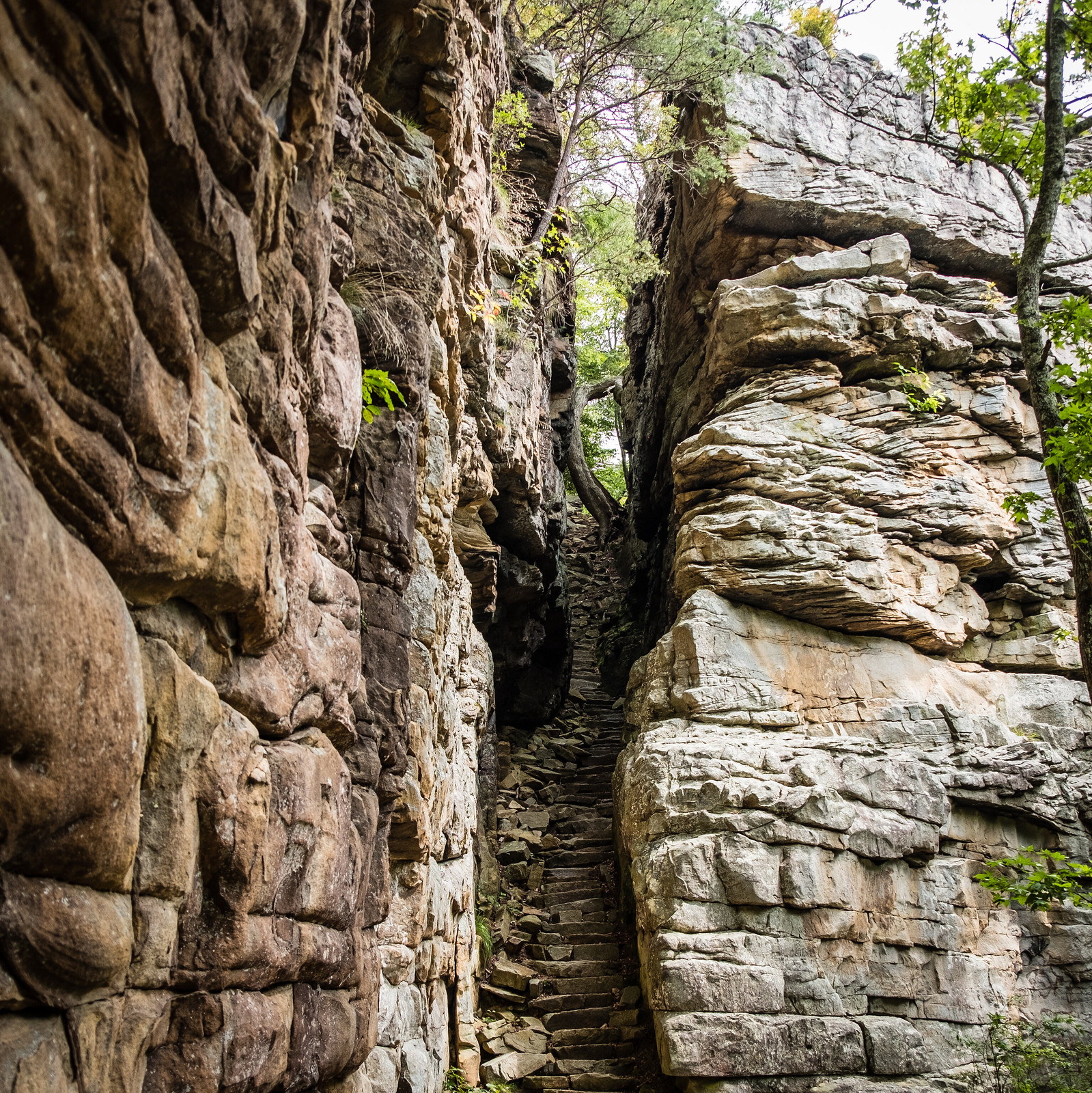
Geologically, it sits right on the boundary between the Highland Rim and the Central Basin. As you descend the Machine Falls trail, you'll pass exposed black Chattanooga shale at mid-slope, the formation that separates the two. Mountain laurel and oak-hickory forest cover the upper slopes; sycamore, buckeye, magnolia, beech, and tulip poplar tower along Bobo Creek below.
TDEC calls Short Springs "one of the very best spring wildflower locations in the state." Look for trout lilies, Virginia bluebells, jack-in-the-pulpit, larkspur, and Dutchman's breeches, plus uncommon Middle Tennessee species like large-flowered trillium, southern red trillium, and barren strawberry. Two state-endangered plants grow here as well (nestronia and broad-leaved bunchflower), so stay on the trail.
Most reasonably active hikers, including kids, can manage the trip to Machine Falls. The climb out is short but steep. If wildflowers are your thing, it belongs on your spring list.
The wide, layered ledges make Machine Falls a great subject for photos. The best light comes on overcast days, or early and late, when the ravine is in even shade. Bright sun creates harsh contrast. A small tripod and a slow shutter (1/4 to 1 second) will give you that silky-water look. A polarizing filter cuts the glare off the wet rock and brings out the green moss. In spring, get low and use the wildflowers on the slopes as foreground. Please don't trample the plants to get the shot.
Plan your visit
Getting there
From downtown Tullahoma, head north on Jackson St. (US-41A). Turn right on Hogan St. (4 blocks), then left on Country Club Dr. (5 blocks). Country Club becomes Short Springs Rd. Follow it several miles to the Short Springs water tower on the right. The natural area is on the left.
Parking: It's extremely limited. If the spaces are full, TDEC says the area has met its maximum capacity, and you may not park in non-designated areas. Plan for weekdays or early mornings.
Parking
Free. Parking is extremely limited, and when it's full, the area is at capacity.
When to go
Late March–April for wildflowers; winter and spring for flow
Late March through April is prime time for wildflowers and strong flow. Winter brings the "particularly impressive" wet-weather seeps on the escarpment. Summer and fall can reduce Machine Falls to a gentle trickle after dry spells.
Trailhead map
Trailhead at 35.4072, -86.1744. Confirm current trail conditions before you go.
Where to stay near Machine Falls
Find hotels and rentals near Machine Falls
We may earn a commission if you book a stay through these links, at no extra cost to you. Prices and availability come from booking partners and can change. We never rank trails by commission.
Route, step by step
1. Trailhead (0 mi). From the parking area across from the water tower, follow the main trail into the forest along the rim.
2. The descent (about 0.3–0.7 mi). The trail drops off the Highland Rim into the ravine. Watch for the dark Chattanooga shale exposures at mid-slope. This is the steepest section, so take it slowly when it's wet.
Show full route
3. Machine Falls (about 0.75–1 mi). At the bottom, Machine Falls fans out over a wide series of ledges. You can view it from the base area; don't climb the falls.
4. Optional loop to Busby Falls. Continue on the Bobo Creek trail to overlooks of Upper and Lower Busby Falls, two prominent cascades on Bobo Creek. Loop back to the trailhead (total roughly 3 mi, unofficial).
5. Return. Climb back out the way you came, or finish the loop.
Tips
- Arrive early or come midweek. There's no overflow parking.
- Stay on trail to protect the rare plants.
- No hunting, fishing, or camping.
- Bring trekking poles for the climb back up.
Tips
- Free. Parking is extremely limited, and when it's full, the area is at capacity.
What to bring & gear
- Hiking shoes: hiking shoes
- Trekking poles: trekking poles
- Wildflower field guide: Tennessee wildflowers field guide
- Macro lens or clip-on: phone macro lens
- Water bottle: water bottle
- Dog leash: hands-free dog leash
- Sun protection: hat, sunscreen, sunglasses
- Trail snacks or a packed lunch
- Rain shell
- Insect repellent
Picks sized for a 2-mile, 1–2 hour hike.
Our gear picks
Our picks for this hike. Compare current prices at Amazon.

Trail Runners
Our pickClassic out-of-the-box comfort for easy miles.
Merrell Moab 3

Daypack
Our pickCompact, well-built daypack that packs down small.
Osprey Daylite Plus

Insulation
Our pickWarmth that compresses into its own pocket.
Packable Puffer Jacket

Insect Repellent
Budget pickLong-lasting protection without the DEET smell.
Sawyer 20% Picaridin Insect Repellent Spray

Trekking Poles
Our pickSaves your knees on steep descents.
Cascade Mountain Tech Carbon Fiber Trekking Poles

Traction
Our pickGrip for icy or early-season snowy trail sections.
Kahtoola MICROspikes
As an Amazon Associate, Love Hiking Trails earns from qualifying purchases.
Photos

Featured in: The Best Hikes Near Huntsville, Alabama, The Best Hikes Near Nashville, Tennessee
Ratings & Comments
—
No ratings yet
Sign in to rate this trail and leave a comment.
No comments yet. Share what the trail was like for you.
Nearby
Nearby bike trails
Trails nearby
 ExpertHike
Fiery Gizzard Trail
South Cumberland State Park, Tennessee
The Fiery Gizzard is the trail Tennessee backpackers brag about: a boulder-choked gorge with swimming holes, waterfalls, and rim overlooks, and a reputation for being harder than its mileage suggests. It runs 12.8 miles from the North Trailhead in Tracy City to the South Trailhead at Foster Falls.
Distance
12.8 mi
Difficulty
Expert
Type
Point-to-point (shuttle) or out-and-back sections
 ModerateHike
Greeter Falls Loop
Savage Gulf State Park, Tennessee
Three waterfalls, a blue swimming hole and a famous spiral staircase in under a mile.
Distance
0.8 mi
Difficulty
Moderate
Type
Loop with short spurs
 EasyHike
Stone Door
Savage Gulf State Park, Tennessee
Stand at the Stone Door overlook and the Cumberland Plateau simply ends. Hundreds of feet below, Big Creek Gulf stretches off in a sea of hardwood forest.
Distance
0.9 mi
Difficulty
Easy
Type
Out-and-back
More trails to explore
More hikes nearby
Frequently asked questions
How tall is Machine Falls?
More than 60 feet, and nearly as wide, according to TDEC.
Where is Machine Falls?
In Short Springs State Natural Area, about 3.5 miles northeast of Tullahoma, off Short Springs Rd. near the water tower.
Are dogs allowed?
Yes, on a leash.
Is there a fee?
No.
Why can't I park?
Parking is extremely limited. When it's full, the area is at capacity, and roadside parking isn't allowed.
How long is the Machine Falls hike?
Machine Falls is 2 miles with 300 feet of elevation gain. Most hikers complete it in 1–2 hours.
How difficult is Machine Falls?
We rate it Challenging (3 out of 5) for Short Springs State Natural Area. That reflects its distance, 300 ft of climbing, and terrain.
When is the best time to hike Machine Falls?
The best window is Late March–April for wildflowers; winter and spring for flow. Always check current conditions and weather before you go.
Do I need a permit or reservation for Machine Falls?
No special trail permit is required. Free. Parking is extremely limited, and when it's full, the area is at capacity..