

At a glance
Distance
Elevation gain
Difficulty
Route type
Time
Permit required
Fees
Dogs
Best season
Official park info: Great Smoky Mountains National Park
The Chimney Tops are twin rocky pinnacles rising above Newfound Gap Road, and the trail toward them is one of the Smokies' great short workouts. It climbs about 1,400 feet in under two miles of stairs and switchbacks.
Overview
The Chimney Tops Trail starts beside the West Prong of the Little Pigeon River and climbs relentlessly to a picturesque view of the pinnacles and the surrounding mountains. The lower trail crosses a few bridges; higher up you'll climb stone and timber stairs.
In November 2016, the Chimney Tops 2 fire started near the summit and burned through this area and on into Gatlinburg. The fire changed the landscape and left the upper slopes vulnerable to erosion and other hazards. The park rebuilt the trail to an overlook, but the final section to the pinnacles stays closed. NPS is direct about it: read the closed sign and don't go past the gate. Some of the scorched forest is still visible, and the regrowth is fascinating to see.
Chimney Tops packs a lot of climbing into a short distance. If you're comfortable on long staircases and steep grades, it's a fantastic half-day hike with a real summit-style feel. If you have knee issues, consider the gentler West Prong Trail or the Cove Hardwood Nature Trail instead. Families with older kids who like a challenge usually love it; little ones may struggle with the stairs.
People often ask when the pinnacles will reopen. The 2016 fire burned away vegetation that held soil and rock in place on the steep upper slopes. Without it, erosion and rockfall make that last stretch unsafe, and building a sustainable trail there isn't possible right now. The overlook gives you the classic view of the pinnacles without the risk.
Plan your visit
Getting there
The trailhead is on Newfound Gap Road (US 441), about 7 miles south of Sugarlands Visitor Center and 22 miles from Oconaluftee Visitor Center. With just 34 spaces, the lot fills early. NPS recommends considering an authorized shuttle. Several shuttle companies serve the Chimney Tops Trailhead, mostly March through October.
Parking
No permit. Parking tag required ($5 daily, $15 weekly, $40 annual). The trailhead lot has only 34 spaces.
When to go
April–November; October for fall color. Winter brings ice on stairs.
Spring brings wildflowers along the lower trail and cool temperatures for the climb. Summer mornings are best; by midday the lot is full and the stairs are hot and humid. October is peak season for color, and also for crowds, so take a shuttle or go on a weekday. Winter can be beautiful and quiet, but the stairs and rock steps ice up, so bring traction and check road conditions on Newfound Gap Road, which can close for snow and ice.
Trailhead map
Trailhead at 35.6354, -83.4698. Confirm current trail conditions before you go.
Where to stay near Chimney Tops
Find hotels and rentals near Chimney Tops
We may earn a commission if you book a stay through these links, at no extra cost to you. Prices and availability come from booking partners and can change. We never rank trails by commission.
Route, step by step
1. Bridges along the river (0–0.9 mi). From the parking area, the trail drops to cross the West Prong on a footbridge, then crosses Road Prong. The grade is moderate, and the creek scenery is lovely. You'll pass a junction with the Road Prong Trail; stay on the Chimney Tops Trail.
2. The big climb (0.9–1.6 mi). This is where the trail earns its reputation. It climbs steeply on stone steps and timber stairs, with few breaks. Rest when you need to; there's no prize for speed.
Show full route
3. Burn zone and ridge (1.6–1.75 mi). The forest opens up, with lingering signs of the 2016 fire. Views get bigger as you approach the end.
4. The overlook (about 1.75 mi). The trail ends at a viewing area with a clear look at the rocky Chimney Tops and the surrounding ridges. Stop here. The closed area beyond the gate is unstable and off-limits.
5. Return the way you came. The stairs are hard on knees going down, so poles help.
Tips
- Arrive early or take a shuttle. Thirty-four spaces won't stretch far on a fall Saturday.
- Pace yourself on the stairs. This hike feels harder than its mileage.
- Respect the closure. Going past the gate is illegal and dangerous.
- Winter: The stairs ice up. Microspikes are a good idea November through March.
- Pair it with the easy 0.75-mile Cove Hardwood Nature Trail or the West Prong Trail for a fuller day (NPS alternates).
Tips
- No permit. Parking tag required ($5 daily, $15 weekly, $40 annual). The trailhead lot has only 34 spaces.
What to bring & gear
- Supportive hiking shoes: hiking shoes with ankle support
- Trekking poles (big help on the descent): collapsible trekking poles
- Water: insulated water bottle
- Light layers: quarter-zip hiking top
- Rain jacket: packable rain jacket
- Microspikes in winter: traction cleats
- Snacks: trail mix
- Sun protection: hat, sunscreen, sunglasses
- Headlamp and extra batteries
- Map or offline GPS route
- Insect repellent
Picks sized for a 3.5-mile, 2.5–3.5 hour hike.
Our gear picks
Our picks for this hike. Compare current prices at Amazon.

Hiking Boots
Our pickBurly support for heavy loads and long climbs.
Salomon Quest 4 GTX

Water Filter
Budget pickReliable squeeze filter with a long service life.
Sawyer Squeeze Water Filter
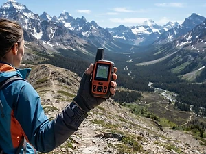
Satellite Messenger
Premium pickTwo-way messaging and SOS far from cell signal.
Garmin inReach Mini 2

Trekking Poles
Our pickSaves your knees on steep descents.
Cascade Mountain Tech Carbon Fiber Trekking Poles

Traction
Our pickGrip for icy or early-season snowy trail sections.
Kahtoola MICROspikes
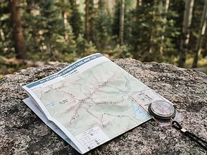
Map
Budget pickWaterproof topographic map of the park's trails.
Nat Geo Trails Illustrated Great Smoky Mountains Map #229
As an Amazon Associate, Love Hiking Trails earns from qualifying purchases.
Photos


Featured in: The Best Hikes Near Knoxville, Tennessee, The Best Hikes Near Gatlinburg, Tennessee
Ratings & Comments
—
No ratings yet
Sign in to rate this trail and leave a comment.
No comments yet. Share what the trail was like for you.
Nearby
Nearby bike trails
Nearby off-road
Trails nearby
 ChallengingHike
Mount LeConte (Alum Cave)
Great Smoky Mountains National Park, Tennessee
The Smokies' highest lodge, reached by the dramatic Alum Cave trail past Arch Rock.
Distance
11 mi
Difficulty
Challenging
Type
Out and back
 StrenuousHike
Rainbow Falls
Great Smoky Mountains National Park, Tennessee
Just minutes from downtown Gatlinburg, the Rainbow Falls Trail climbs steadily through old-growth forest beside LeConte Creek to a tall, delicate waterfall. Its name comes from the misty rainbow that often appears at its base on sunny afternoons.
Distance
5.6 mi
Difficulty
Strenuous
Type
Out-and-back
 ModerateHike
Grotto Falls
Great Smoky Mountains National Park, Tennessee
Most waterfalls ask you to admire them from the front. Grotto Falls lets you step behind the curtain.
Distance
2.6 mi
Difficulty
Moderate
Type
Out-and-back
More trails to explore
More in Great Smoky Mountains National Park
More trails in Tennessee
More hikes nearby
Frequently asked questions
Can you still climb to the top of the Chimney Tops?
No. Since the 2016 fire, the trail ends at an overlook. The summit area is closed for safety and habitat protection.
How long is the Chimney Tops Trail?
3.5 miles (5.6 km) round trip to the overlook.
How hard is the Chimney Tops hike?
Short but steep. NPS calls it "popular but challenging," with steep inclines and stone stairs.
Where do I park?
At the Chimney Tops Trailhead on Newfound Gap Road, which has 34 spaces. A shuttle is a good alternative.
Are dogs allowed?
No. Pets are allowed only on the Gatlinburg Trail and Oconaluftee River Trail.
How long is the Chimney Tops hike?
Chimney Tops is 3.5 miles with 1,400 feet of elevation gain. Most hikers complete it in 2.5–3.5 hours.
How difficult is Chimney Tops?
We rate it Expert (5 out of 5) for Great Smoky Mountains National Park. That reflects its distance, 1,400 ft of climbing, and terrain.
When is the best time to hike Chimney Tops?
The best window is April–November; October for fall color. Winter brings ice on stairs.. Always check current conditions and weather before you go.
Do I need a permit or reservation for Chimney Tops?
Yes — access is managed. No permit. Parking tag required ($5 daily, $15 weekly, $40 annual). The trailhead lot has only 34 spaces.. Check the official Great Smoky Mountains National Park page before you go.