

At a glance
Distance
Elevation gain
Difficulty
Route type
Time
Permit required
Fees
Dogs
Best season
Official park info: Great Smoky Mountains National Park
If you want a big-water payoff with very little effort, Lynn Camp Prong Cascades is hard to beat. A wide, nearly flat old railroad grade follows the rushing Middle Prong of Little River through rhododendron and past mossy rock outcrops to a dramatic, multi-tiered cascade, all in just 1.4 miles round trip.
Overview
The Middle Prong Trail follows an old logging railroad bed, a reminder that this valley was heavily logged in the early 1900s before the park was created. Today the forest has grown back, and the trail is a gentle, shady ramble beside one of the most beautiful streams in the park. NPS describes it as "mostly wide and flat," gently ascending through rhododendron and some cliff-like rock outcroppings. It narrows in a few spots where washouts have occurred.
The first 1.3 miles of the Middle Prong Trail have been formally assessed for accessibility, and GRIT Freedom Chairs (all-terrain wheelchairs) are available for free checkout on a first-come, first-served basis for this section. That makes it one of the most accessible waterfall experiences in the Smokies.
The trail you're walking was once a logging railroad. In the early 1900s, lumber companies ran rail lines up the Little River watershed to haul timber out of these mountains, and much of the forest here was cut before the national park was established in the 1930s. The wide, steady grade of the Middle Prong Trail is a direct legacy of those rail beds, which is why it's so easy to walk. Look for occasional old rail-era remnants along the way, and leave everything where you find it. Removing artifacts is prohibited in the park.
Almost certainly. If you can walk a mile and a half on a gravel path, you can do this hike. It's ideal for young kids, grandparents, rainy-day plans, and anyone who wants a classic Smokies stream scene without a big climb.
Plan your visit
Getting there
From Townsend, enter the park and turn onto Tremont Road (just inside the park, near the Townsend Wye). Pass the Great Smoky Mountains Institute at Tremont, where you can also buy parking tags at the store. Continue on Upper Tremont Road, which is unpaved but well-maintained, to the Middle Prong Trailhead at the end of the road. The road is open year-round but may close for snow, ice, or muddy conditions.
Parking
No permit. Parking tag required ($5 daily, $15 weekly, $40 annual). Middle Prong Trailhead at the end of Upper Tremont Road.
When to go
Year-round; Upper Tremont Road is open all year but can close for snow, ice, or mud
Spring brings peak flow and wildflowers. Summer is shady and cool by the water, a great midday escape. Fall color reflects beautifully in the pools. Winter is quiet and lovely, but check whether Upper Tremont Road is closed for weather.
Trailhead map
Trailhead at 35.6181, -83.6697. Confirm current trail conditions before you go.
Where to stay near Lynn Camp Prong Cascades
Find hotels and rentals near Lynn Camp Prong Cascades
We may earn a commission if you book a stay through these links, at no extra cost to you. Prices and availability come from booking partners and can change. We never rank trails by commission.
Route, step by step
1. Middle Prong Trailhead (0 mi). Cross the bridge from the parking area and start up the wide railroad grade.
2. Along the Middle Prong (0–0.5 mi). The trail stays close to the river, which tumbles over boulders and through deep green pools. Mossy rock walls and rhododendron line the path.
Show full route
3. Approaching the cascades (0.5–0.7 mi). The sound grows as you near Lynn Camp Prong, where it pours down a long series of ledges into the Middle Prong.
4. Lynn Camp Prong Cascades (0.7 mi). Enjoy the cascade from the trail. Several spots give good views. Stay off the slick boulders.
5. Return the way you came. Want more? The Middle Prong Trail continues upstream toward Indian Flats Falls for a longer day; bring a map.
Tips
- Perfect for kids and for a short leg-stretcher between drives.
- Swimming isn't recommended. NPS warns that drowning is one of the leading causes of death in the park.
- Restroom stop: Use the Great Smokies Welcome Center in Townsend before driving up.
- Combine with a drive through Cades Cove or a picnic in Townsend.
- GRIT chairs: Check the NPS trail accessibility page for the checkout process.
Tips
- No permit. Parking tag required ($5 daily, $15 weekly, $40 annual). Middle Prong Trailhead at the end of Upper Tremont Road.
What to bring & gear
- Comfortable walking or trail shoes: kids' trail shoes / walking shoes
- Water bottle: water bottle
- Light rain jacket: packable rain jacket
- Camera: compact travel camera
- Picnic gear: packable picnic set
- Small first-aid kit: compact first aid kit
- Sun protection: hat, sunscreen, sunglasses
- Insect repellent
Picks sized for a 1.4-mile, 45 minutes–1.5 hour hike.
Our gear picks
Our picks for this hike. Compare current prices at Amazon.

Trail Runners
Our pickClassic out-of-the-box comfort for easy miles.
Merrell Moab 3

Daypack
Our pickCompact, well-built daypack that packs down small.
Osprey Daylite Plus
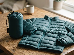
Insulation
Our pickWarmth that compresses into its own pocket.
Packable Puffer Jacket
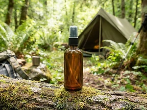
Insect Repellent
Budget pickLong-lasting protection without the DEET smell.
Sawyer 20% Picaridin Insect Repellent Spray
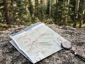
Map
Budget pickWaterproof topographic map of the park's trails.
Nat Geo Trails Illustrated Great Smoky Mountains Map #229

Traction
Our pickGrip for icy or early-season snowy trail sections.
Kahtoola MICROspikes
As an Amazon Associate, Love Hiking Trails earns from qualifying purchases.
Photos


Featured in: The Best Hikes Near Knoxville, Tennessee
Ratings & Comments
—
No ratings yet
Sign in to rate this trail and leave a comment.
No comments yet. Share what the trail was like for you.
Nearby
Nearby bike trails
Nearby off-road
Trails nearby
 ModerateHike
Little River, Cucumber Gap & Jakes Creek Loop
Great Smoky Mountains National Park, Tennessee
If you're looking for a classic Smokies forest walk (river views, history, wildflowers, and no big climb), this Elkmont loop is it. NPS lists it first among alternatives to the closed Laurel Falls Trail.
Distance
5.4 mi
Difficulty
Moderate
Type
Loop (includes a short section of one-way road)
 ChallengingHike
Mount LeConte (Alum Cave)
Great Smoky Mountains National Park, Tennessee
The Smokies' highest lodge, reached by the dramatic Alum Cave trail past Arch Rock.
Distance
11 mi
Difficulty
Challenging
Type
Out and back
 ChallengingHike
Abrams Falls
Great Smoky Mountains National Park, Tennessee
Abrams Falls isn't the tallest waterfall in the Great Smoky Mountains. It's only 25 feet high.
Distance
5 mi
Difficulty
Challenging
Type
Out-and-back
More trails to explore
More in Great Smoky Mountains National Park
More trails in Tennessee
More hikes nearby
Frequently asked questions
How long is the Lynn Camp Prong Cascades hike?
1.4 miles (2.3 km) round trip on the Middle Prong Trail.
Is Lynn Camp Prong good for kids?
Yes. It's wide, mostly flat, and short, with a big waterfall payoff.
Is the trail wheelchair accessible?
It isn't paved, but the first 1.3 miles have been assessed, and NPS offers GRIT Freedom Chairs for this section on a first-come basis.
Where is the trailhead?
At the end of Upper Tremont Road (unpaved), off Tremont Road near Townsend.
Are dogs allowed?
No. Only the Gatlinburg Trail and Oconaluftee River Trail allow pets.
Do I need a parking tag?
Yes, for any stop longer than 15 minutes.
How difficult is Lynn Camp Prong Cascades?
We rate it Easy (1 out of 5) for Great Smoky Mountains National Park. That reflects its distance, 200 ft of climbing, and terrain.
When is the best time to hike Lynn Camp Prong Cascades?
The best window is Year-round; Upper Tremont Road is open all year but can close for snow, ice, or mud. Always check current conditions and weather before you go.
Do I need a permit or reservation for Lynn Camp Prong Cascades?
Yes — access is managed. No permit. Parking tag required ($5 daily, $15 weekly, $40 annual). Middle Prong Trailhead at the end of Upper Tremont Road.. Check the official Great Smoky Mountains National Park page before you go.