

Current alert
Open. NPS Current Conditions (checked Oct 21, 2026) lists no closure for Porters Creek or Greenbrier. Nearby, Laurel Falls Trail stays closed into 2027 and Bullhead Trail closes Mon–Thu through Nov 19.
At a glance
Distance
Elevation gain
Difficulty
Route type
Time
Permit required
Fees
Dogs
Best season
Official park info: Great Smoky Mountains National Park
A quiet Greenbrier valley walk past a historic barn to a 40-foot waterfall.
Porters Creek is the Smokies hike for people who want history, a footlog crossing and a waterfall without the crowds of Laurel Falls or Alum Cave. The trail follows an old roadbed up the Greenbrier valley, passes the sites of former farms, then narrows to a rooty forest path that ends at a mossy cascade called Fern Branch Falls.
Overview
- Old stone walls and homesites from the families who farmed Greenbrier before the park
- A short spur to the 1875 John Messer barn and the Smoky Mountains Hiking Club cabin
- A long footlog bridge over Porters Creek
- Fern Branch Falls, a 40-foot cascade about 2 miles in
- Spring wildflowers along the creek, including trillium and phlox
The park calls this a moderate trail that is usually less crowded than other Smokies hikes. Most people turn around at the falls. The path keeps climbing for about another mile to backcountry Campsite #31, and you need a permit to camp there.
Plan your visit
Parking
Gravel lot for about 20 vehicles at the end of Greenbrier Road; fills in peak season
Permits & fees
No permit is needed for the day hike. A backcountry permit is needed only to camp at Campsite #31. Parking tag: $5 daily, $15 weekly, $40 annual.
Trailhead map
Trailhead at 35.6968, -83.3882. Confirm current trail conditions before you go.
Where to stay near Porters Creek Trail to Fern Branch Falls
Find hotels and rentals near Porters Creek Trail to Fern Branch Falls
We may earn a commission if you book a stay through these links, at no extra cost to you. Prices and availability come from booking partners and can change. We never rank trails by commission.
Route, step by step
1. Greenbrier Road to the junction (0–1 mi). From the gravel lot, the wide roadbed climbs gently beside the creek past old stone walls and a small cemetery.
2. Messer Barn detour (about 1 mi). At a big trail intersection, a side path of roughly 350 yards on the far right leads to the barn and the hiking club cabin. It adds about 0.4 mi round trip.
Show full route
3. Footlog and climb (1.6 mi). Cross the long footlog bridge. After it, the trail turns rockier and climbs.
4. Fern Branch Falls (about 2 mi). Look left where a little side stream crosses the path; that's the falls. Turn around here for a 4-mile day, or keep climbing to Campsite #31 (about 3 mi in).
Tips
- Buy a parking tag before you go (Recreation.gov or on site). You need one to park for more than 15 minutes.
- Pets aren't allowed on this trail. Leave dogs at home.
- Roots, rocks, stream crossings and a high footlog can make the footing tricky, especially when wet.
- Flow at the falls can be weak in dry spells. Spring and the days after rain are best.
Tips
- Buy a parking tag before you go (Recreation.gov or on site). You need one to park for more than 15 minutes. Pets aren't allowed on this trail. Leave dogs at home.
What to bring & gear
- Sturdy hiking shoes or boots
- 2–3 liters of water per person
- Sun protection: hat, sunscreen, sunglasses
- Trail snacks or a packed lunch
- Rain shell
- Insect repellent
Picks sized for a 4-mile, 1–3 hour hike.
Our gear picks
Our picks for this hike. Compare current prices at Amazon.

Hiking Boots
Our pickSupport and grip for rocky, rooty miles.
Merrell Moab 3 Mid Waterproof

Daypack
Our pickCarries water, layers, and snacks comfortably.
Osprey Talon 22

Hydration Reservoir
Our pickWide-opening reservoir that's easy to fill and clean.
Platypus Big Zip EVO 3L Reservoir

Trekking Poles
Our pickSaves your knees on steep descents.
Cascade Mountain Tech Carbon Fiber Trekking Poles

Traction
Our pickGrip for icy or early-season snowy trail sections.
Kahtoola MICROspikes
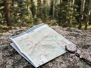
Map
Budget pickWaterproof topographic map of the park's trails.
Nat Geo Trails Illustrated Great Smoky Mountains Map #229
As an Amazon Associate, Love Hiking Trails earns from qualifying purchases.
Photos


Featured in: The Best Hikes Near Knoxville, Tennessee, The Best Hikes Near Gatlinburg, Tennessee, The Best Hikes Near Asheville, North Carolina, The Best Hikes in Tennessee
Places to eat nearby
The Greenbrier
Gatlinburg, TN5.7 mi awayWebsite
Ratings & Comments
—
No ratings yet
Sign in to rate this trail and leave a comment.
No comments yet. Share what the trail was like for you.
Nearby
Nearby bike trails
Nearby off-road
Trails nearby
 ExpertHike
Ramsey Cascades
Great Smoky Mountains National Park, Tennessee
At 105 feet, Ramsey Cascades is the tallest waterfall in Great Smoky Mountains National Park. You don't get to see it easily.
Distance
8 mi
Difficulty
Expert
Type
Out-and-back
 ModerateHike
Grotto Falls
Great Smoky Mountains National Park, Tennessee
Most waterfalls ask you to admire them from the front. Grotto Falls lets you step behind the curtain.
Distance
2.6 mi
Difficulty
Moderate
Type
Out-and-back
 StrenuousHike
Rainbow Falls
Great Smoky Mountains National Park, Tennessee
Just minutes from downtown Gatlinburg, the Rainbow Falls Trail climbs steadily through old-growth forest beside LeConte Creek to a tall, delicate waterfall. Its name comes from the misty rainbow that often appears at its base on sunny afternoons.
Distance
5.6 mi
Difficulty
Strenuous
Type
Out-and-back
More trails to explore
More in Great Smoky Mountains National Park
More trails in Tennessee
More hikes nearby
Frequently asked questions
How long is the hike to Fern Branch Falls?
About 4 miles round trip. The NPS times the trail at 1–3 hours depending on how far you go.
Do I need a parking tag at Porters Creek?
Yes. Any vehicle parked for more than 15 minutes needs a Smokies parking tag: $5 daily, $15 weekly or $40 a year.
Are dogs allowed on Porters Creek Trail?
No. Pets aren't permitted on this trail.