

At a glance
Distance
Elevation gain
Difficulty
Route type
Time
Permit required
Fees
Dogs
Best season
Official park info: Great Smoky Mountains National Park
At 105 feet, Ramsey Cascades is the tallest waterfall in Great Smoky Mountains National Park. You don't get to see it easily.
Overview
The Ramsey Cascades Trail starts in the Greenbrier section of the park east of Gatlinburg. The first part follows an old roadbed through cove hardwood forest. Then the trail narrows and gets rockier as it follows Ramsey Prong up the mountain, crossing several streams and footlog bridges. The upper section passes huge old-growth trees, some of the biggest you'll see anywhere in the East.
The trail was rehabilitated through the park's Trails Forever program, so the tread is in better shape than it was a decade ago. It's still a serious climb, though. NPS flags it for extreme crowding and limited parking, so start early.
Safety first: NPS specifically warns visitors not to climb to the top of the falls. The rock is muddy and slippery, and people have died here. Admire the cascade from the base.
If you've done Rainbow Falls or Alum Cave Bluffs comfortably and want a step up, Ramsey Cascades is the natural next challenge. If you're new to mountain hiking or hiking with young kids, start with a shorter waterfall like Hen Wallow Falls or Lynn Camp Prong and work up to this one. Either way, give yourself a full day and don't rush the descent.
Plan your visit
Getting there
From Gatlinburg, drive east on US 321 to the Greenbrier entrance, then follow the road into Greenbrier toward the Ramsey Cascades Trailhead on Ramsey Prong Road. Parking is limited. Arrive early or use an authorized shuttle. Buy your parking tag in advance, or use the machine at Greenbrier Ranger Station or the store at Greenbrier Grocery just outside the park.
Parking
No permit. Parking tag required ($5 daily, $15 weekly, $40 annual). There's a parking tag machine at Greenbrier Ranger Station.
When to go
Late spring through fall; winter brings ice and short days
Spring (April–May) brings strong flow and wildflowers along the lower trail, and comfortable temperatures for the big climb. Summer is shady and lush, but it's humid, afternoon storms are common, and the parking lot fills fast, so start at dawn. Fall (October) is beautiful in Greenbrier's hardwood forest, though the cascade can run thinner after a dry late summer. Winter is quiet but serious: the upper rocks ice over, and daylight is short.
Trailhead map
Trailhead at 35.7027, -83.3578. Confirm current trail conditions before you go.
Where to stay near Ramsey Cascades
Find hotels and rentals near Ramsey Cascades
We may earn a commission if you book a stay through these links, at no extra cost to you. Prices and availability come from booking partners and can change. We never rank trails by commission.
Route, step by step
1. The old roadbed (0–1.5 mi). From the trailhead, the trail follows a wide, gentle old road along the Middle Prong of Little Pigeon River. You'll cross a long footbridge early on. This part feels deceptively easy.
2. End of the road (about 1.5 mi). The old roadbed ends at a turnaround, and the real trail begins: narrower, rockier, and steeper.
Show full route
3. Old-growth forest (1.5–3 mi). The trail climbs alongside Ramsey Prong through rhododendron and towering old-growth hardwoods: tulip trees, hemlocks, and silverbells. There are several footlog crossings and rock-hopping spots. Take your time, especially in wet weather.
4. The final climb (3–4 mi). The last mile is the steepest and roughest, with rock steps, roots, and wet rock. The sound of falling water tells you you're close.
5. Ramsey Cascades (4 mi). The 105-foot cascade fans down a series of ledges into a small pool. Find a safe perch at the base, refuel, and enjoy it. Don't climb the cascade.
6. Return the way you came. Save energy for the descent. Most slips happen going down on tired legs.
Tips
- Start before 9 a.m. to get a parking spot and enough daylight.
- Pack plenty of water and a filter, and treat all stream water.
- Trekking poles help with the footlogs, the rock-hopping, and the long descent.
- After heavy rain, streams run higher and rock gets slicker. Consider a different day.
- Winter: Expect ice on the upper trail and early darkness. Carry microspikes and a headlamp.
- Bears live here. Store food properly and keep your distance.
Tips
- No permit. Parking tag required ($5 daily, $15 weekly, $40 annual). There's a parking tag machine at Greenbrier Ranger Station.
What to bring & gear
- Sturdy, lugged hiking boots: mid hiking boots
- Trekking poles: carbon trekking poles
- 2–3 L of water capacity: 3L hydration reservoir
- Water filter: squeeze water filter
- Headlamp: rechargeable headlamp
- Rain shell and warm layer: packable rain jacket / fleece jacket
- Lunch and snacks: energy bars
- First-aid kit: hiking first aid kit
- Winter traction: microspikes
- Sun protection: hat, sunscreen, sunglasses
- Map or offline GPS route
- Insect repellent
Picks sized for a 8-mile, 5–7 hour hike.
Our gear picks
Our picks for this hike. Compare current prices at Amazon.

Hiking Boots
Our pickBurly support for heavy loads and long climbs.
Salomon Quest 4 GTX

Water Filter
Budget pickReliable squeeze filter with a long service life.
Sawyer Squeeze Water Filter
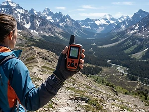
Satellite Messenger
Premium pickTwo-way messaging and SOS far from cell signal.
Garmin inReach Mini 2

Trekking Poles
Our pickSaves your knees on steep descents.
Cascade Mountain Tech Carbon Fiber Trekking Poles

Traction
Our pickGrip for icy or early-season snowy trail sections.
Kahtoola MICROspikes
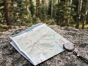
Map
Budget pickWaterproof topographic map of the park's trails.
Nat Geo Trails Illustrated Great Smoky Mountains Map #229
As an Amazon Associate, Love Hiking Trails earns from qualifying purchases.
Photos


Featured in: The Best Hikes Near Knoxville, Tennessee, The Best Hikes Near Gatlinburg, Tennessee, The Best Hikes in Tennessee, The Best Hikes Near Johnson City, Tennessee
Ratings & Comments
—
No ratings yet
Sign in to rate this trail and leave a comment.
No comments yet. Share what the trail was like for you.
Nearby
Nearby bike trails
Nearby off-road
Trails nearby
 ModerateHike
Porters Creek Trail to Fern Branch Falls
Great Smoky Mountains National Park, Tennessee
A quiet Greenbrier valley walk past a historic barn to a 40-foot waterfall.
Distance
4 mi
Difficulty
Moderate
Type
Out and back
 ModerateHike
Grotto Falls
Great Smoky Mountains National Park, Tennessee
Most waterfalls ask you to admire them from the front. Grotto Falls lets you step behind the curtain.
Distance
2.6 mi
Difficulty
Moderate
Type
Out-and-back
 ChallengingHike
Charlies Bunion
Great Smoky Mountains National Park, Tennessee
A rocky knuckle of the Appalachian Trail with a dizzying view over the Smokies.
Distance
8 mi
Difficulty
Challenging
Type
Out and back
More trails to explore
More in Great Smoky Mountains National Park
More trails in Tennessee
More hikes nearby
Frequently asked questions
How tall is Ramsey Cascades?
105 feet (32 m). It's the tallest waterfall in Great Smoky Mountains National Park.
How long and hard is the hike?
It's 8 miles round trip with more than 2,000 feet of elevation gain. It's strenuous and gets rockier and steeper as you climb.
Can I climb to the top of Ramsey Cascades?
No. NPS warns against climbing the falls because the rock is muddy and slippery.
Where is the trailhead?
On Ramsey Prong Road in the Greenbrier area, east of Gatlinburg off US 321.
Are dogs allowed?
No. Pets are allowed only on the Gatlinburg Trail and Oconaluftee River Trail.
What's an easier alternative?
NPS suggests Hen Wallow Falls (4.3 miles round trip) or Lynn Camp Prong Cascades (1.4 miles round trip).
How long is the Ramsey Cascades hike?
Ramsey Cascades is 8 miles with 2,100 feet of elevation gain. Most hikers complete it in 5–7 hours.
How difficult is Ramsey Cascades?
We rate it Expert (5 out of 5) for Great Smoky Mountains National Park. That reflects its distance, 2,100 ft of climbing, and terrain.
When is the best time to hike Ramsey Cascades?
The best window is Late spring through fall; winter brings ice and short days. Always check current conditions and weather before you go.
Do I need a permit or reservation for Ramsey Cascades?
Yes — access is managed. No permit. Parking tag required ($5 daily, $15 weekly, $40 annual). There's a parking tag machine at Greenbrier Ranger Station.. Check the official Great Smoky Mountains National Park page before you go.